Robot for detecting underwater topography and water quality index in reservoir area

A technology of underwater terrain and robots, which is applied in the direction of instruments, non-electric variable control, position/direction control, etc., can solve problems that do not conform to sustainable development, consume manpower, material resources and resources, and achieve light weight, convenient transportation and low cost. low effect

Active Publication Date: 2013-12-11
BEIJING NORMAL UNIVERSITY
View PDF3 Cites 27 Cited by
  • Summary
  • Abstract
  • Description
  • Claims
  • Application Information

AI Technical Summary

Problems solved by technology

[0005] Although miniature GPS and ADCP instruments have appeared at this stage, most of the underwater terrain mapping work is still done by ships equipped with GPS and ADCP instruments
This method consumes manpower, material resources and resources, and does not meet the requirements of sustainable development

Method used


Image

  • Robot for detecting underwater topography and water quality index in reservoir area
  • Robot for detecting underwater topography and water quality index in reservoir area
  • Robot for detecting underwater topography and water quality index in reservoir area

Examples


Embodiment Construction

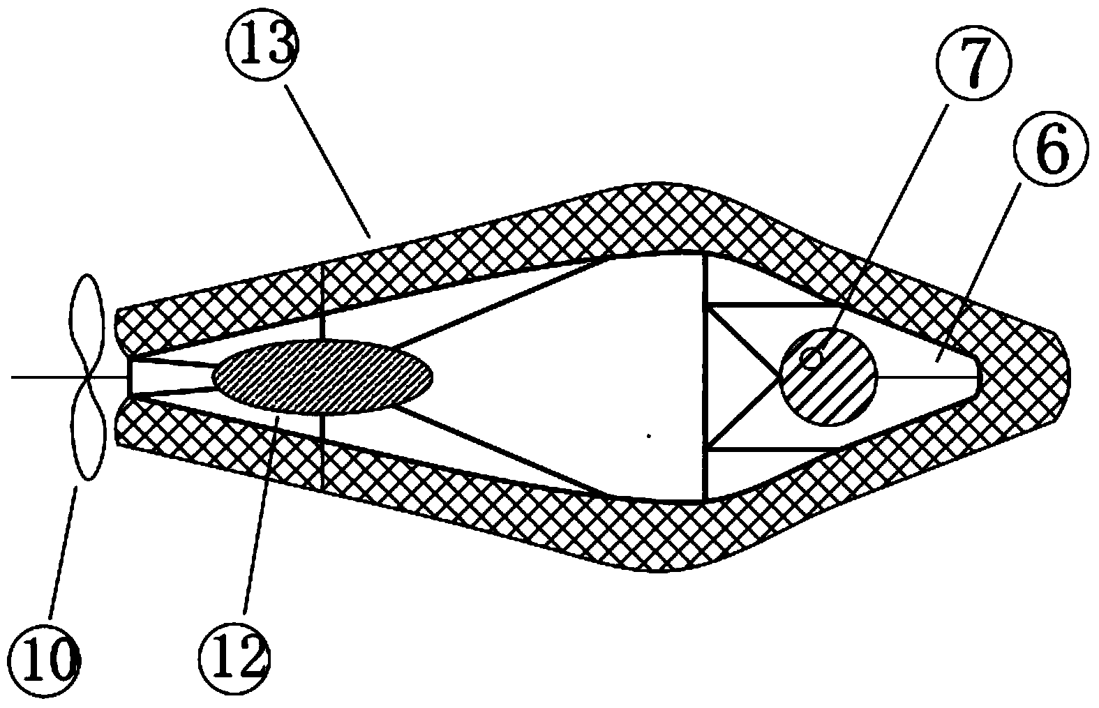
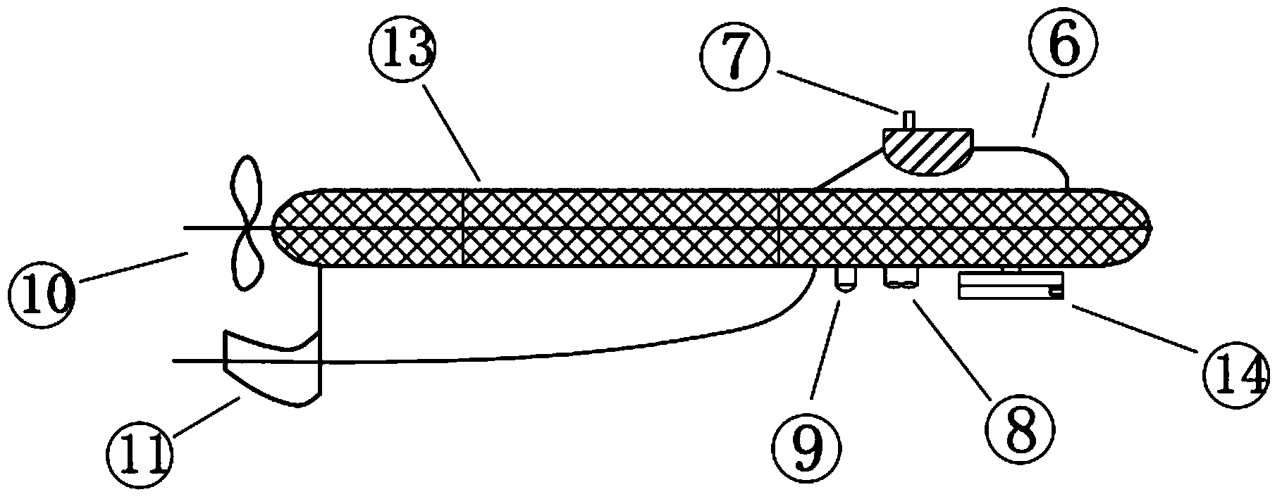
[0042] The invention relates to an underwater terrain and water quality index detection robot in a reservoir area, which includes a ground base station system and a robot system. The relationship between the two is: the ground base station system is on the shore, the robot system is in the water, the ground base station system and the robot system are connected by cables, and the ground base station system is used to control the robot system to work; the working status of the robot system is divided into Above-water state and underwater state. When it is necessary to draw an underwater topographic map, the working state of the robot system is the above-water state. When it is necessary to measure underwater water quality indicators and obtain underwater images, the working state of the robot system is the underwater state.

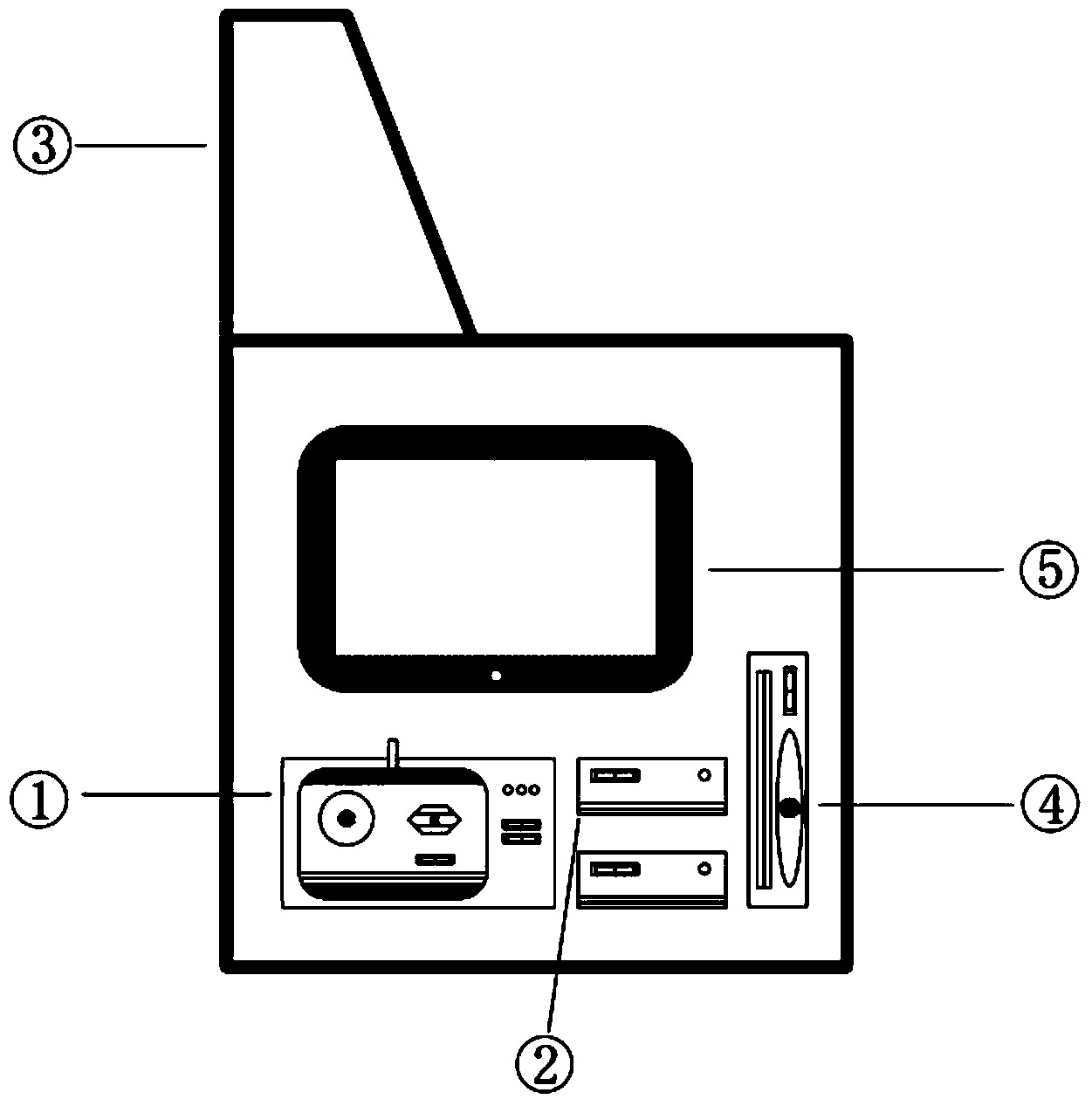
[0043] The ground base station system includes a metal shell main body and 6 modules. The 6 modules include: robot control module ①, GPS reference station...


PUM


Abstract

The invention discloses a robot for detecting underwater topography and a water quality index in a reservoir area. The robot comprises a ground base station system and a robot system. The ground base station system is arranged on shore, the robot system is arranged in water, the ground base station system is connected with the robot system through a cable, and the robot system is controlled to work through the ground base station system; the work states of the robot system comprise the on-water state and the underwater state and when an underwater topographic map needs to be drawn, the work state of the robot system is the on-water state; when the underwater water quality index needs to be detected and underwater images need to be obtained, the work state of the robot system is the underwater state. The GPS technology and the ADCP technology are combined by the multifunctional robot and the robot is small in size, light in weight, low in cost, convenient to transport, and capable of achieving operation of the robot system by only one person. Through change of the work states of the robot system, the underwater topography is detected, the underground topographic map is drawn, different kinds of water quality data are obtained, and a good platform is brought to development of a scientific research activity.

Description

technical field [0001] The invention relates to a robot for detecting underwater topography and water quality indicators in a reservoir area. It is a multifunctional underwater robot used in the construction of water conservancy projects such as reservoirs. It integrates GPS (Global Positioning System) and ADCP (Acoustic Doppler Current Profilers) ) function, which mainly focuses on the surveying and mapping of the underwater terrain of the water body, and also has the functions of measuring the flow velocity of different layers of the water body, the flow rate of the water body, and the conventional water quality indicators, and belongs to the field of robot technology. Background technique [0002] With the country's increasing efforts in the development and utilization of water resources and the adjustment of the spatial distribution of water resources, various water conservancy construction projects emerge in endlessly. Before the construction and implementation of water...

Claims


Application Information

Patent Timeline
Patent Type & Authority Applications(China)
IPC IPC(8): G05D1/00
Inventor 顾洪宾欧阳威高统彪韩升徐璐刘冰
Owner BEIJING NORMAL UNIVERSITY
Why Eureka
Try Eureka