Underwater intelligent self-adapted terrain matching method based on terrain information amount

A terrain matching and adaptive technology, applied in the direction of navigation calculation tools, etc., can solve problems such as incomplete terrain information evaluation

Inactive Publication Date: 2014-04-23
SOUTHEAST UNIV
View PDF2 Cites 19 Cited by
  • Summary
  • Abstract
  • Description
  • Claims
  • Application Information

AI Technical Summary

Problems solved by technology

In practical applications, the amount of navigation information contained in different terrains is completely different. Since the use of a single terrain navig

Method used


Image

  • Underwater intelligent self-adapted terrain matching method based on terrain information amount
  • Underwater intelligent self-adapted terrain matching method based on terrain information amount
  • Underwater intelligent self-adapted terrain matching method based on terrain information amount

Examples


Embodiment 1

[0083] Embodiment 1 An underwater intelligent adaptive terrain matching method based on terrain information.

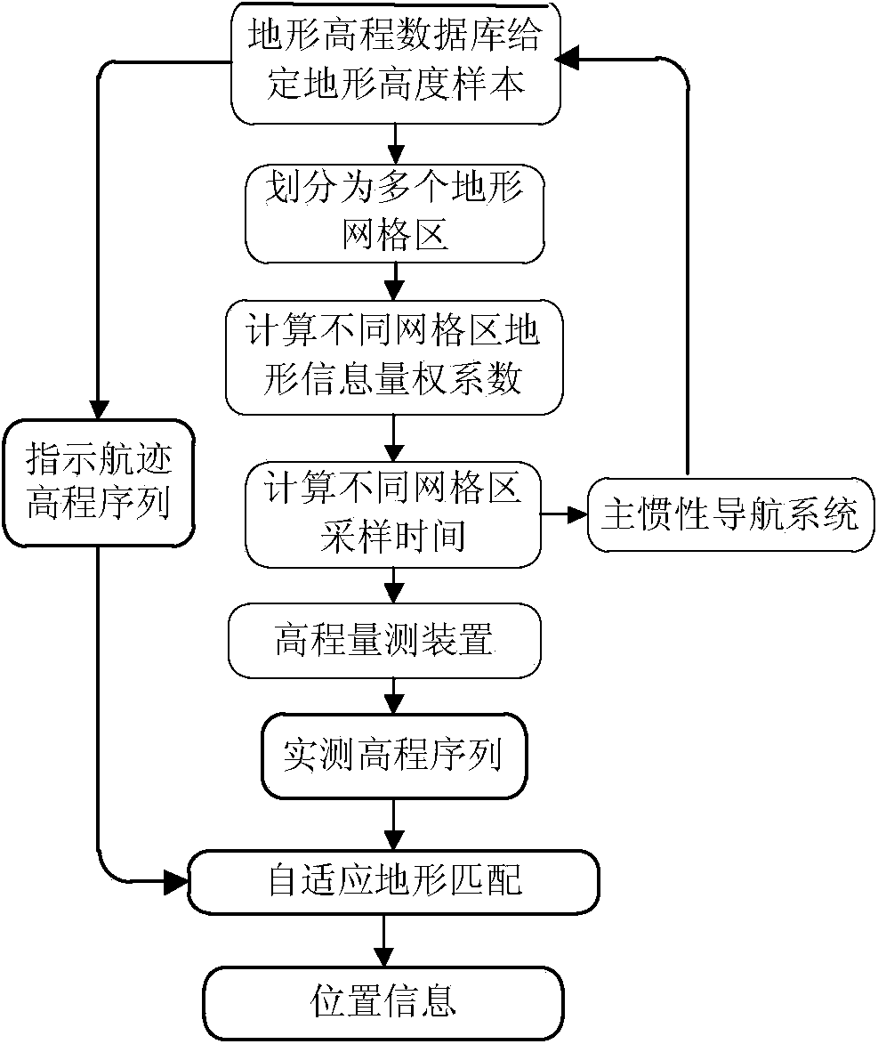
[0084] figure 1 It is a structural diagram of the intelligent adaptive terrain matching algorithm described in the present invention.

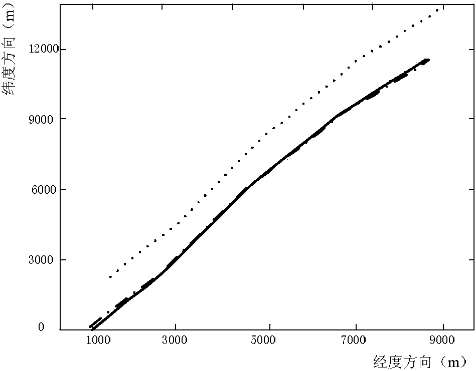
[0085] In the simulation experiment, the terrain elevation database is a rectangular area within the range of 10000m × 14000m, and the resolution of the database terrain is 100m × 100m. The area is divided into 9 grid areas, as shown in image 3As shown, the terrain information weight coefficients of the 9 grid areas are calculated. Table 1 shows the calculation results of the single terrain information values, comprehensive information weight coefficients and sampling time intervals of the 9 grid areas.

[0086] Among them, the calculation formula of terrain roughness r is:

[0087] r=(r λ + r φ ) / 2

[0088] where r λ and r φ are the roughness in the longitude direction and latitude direction respectively:

[0089] ...


PUM


Abstract

The invention discloses an underwater intelligent self-adapted terrain matching method based on terrain information amount and mainly aims to solve the problems that the terrain information amount of an underwater navigation region is not sufficient or not complete so that the error of an aided navigation system is increased and the long-time accurate navigation and positioning requirements of an underwater vehicle cannot be met. The underwater intelligent self-adapted terrain matching method mainly comprises the following steps: calculating different terrain feature parameter values in the navigation region; calculating a terrain information amount aggregative index based on an intelligent method; and carrying out sampling time calculation and a self-adapted terrain matching algorithm based on a terrain information amount aggregative index value. According to the method, the problems that the terrain information amount of the underwater navigation region is not sufficient so that the error of the aided navigation system is increased and the single terrain feature index can cause the incomplete evaluation on the terrain information amount can be effectively improved; the intelligent method is used for comprehensively considering the influence of each index; the sampling time is adjusted by the terrain information amount in a self-adapted manner, the matching range is enlarged and the matching precision is improved.

Description

technical field [0001] The invention relates to the technical field of terrain navigation, and in particular designs an underwater intelligent self-adaptive terrain matching method based on terrain information that can meet the requirements of long-term high-precision navigation. Background technique [0002] Terrain navigation technology has great application prospects in the field of navigation, mainly because it is an autonomous navigation system that is almost free from external interference. The design of matching algorithm is one of the core technologies of terrain navigation technology, and the quality of algorithm design directly affects the navigation accuracy. The amount of terrain navigation information is a statistical characteristic of terrain, based on the terrain elevation providing terrain plane position information, and an average of the ability to provide terrain plane position information for all terrain elevations in the area. In practical applications, ...

Claims


Application Information

Patent Timeline
IPC IPC(8): G01C21/20
CPCG01C21/20
Inventor 李佩娟徐晓苏张涛徐胜保吴剑飞
Owner SOUTHEAST UNIV
Why Eureka
Try Eureka