Air route planning method based on guide speed field in threat environment
A technology for guiding speed and route planning, which is applied in navigation, surveying and navigation, navigation calculation tools, etc., and can solve the problems that artificial routes cannot meet the development requirements of intelligent agents, slow convergence speed, and routes are not smooth enough
- Summary
- Abstract
- Description
- Claims
- Application Information
AI Technical Summary
Problems solved by technology
Method used
Image
Examples
Embodiment Construction
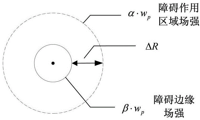
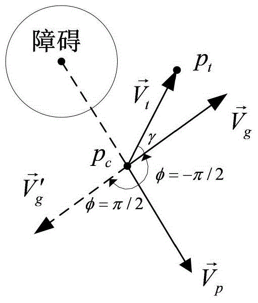
[0062] Firstly, the threat information is converted into static obstacles through preprocessing, and then the traction speed, evasion speed and guidance speed are calculated, and the superposition principle is used to sum the speeds, and finally the flight route is determined according to the simulation step size. Specifically include the following steps:
[0063] Step 1: Preprocess the threat information, and calculate the equivalent threat as a circular static obstacle of a specific height. The specific method is as follows:
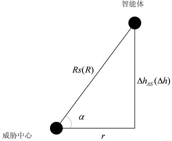
[0064] Suppose the agent moves two-dimensionally in a certain plane, and the distance between the agent and the center of the threat in this plane is r. The relationship between the maximum action radius R and α in the direction of each line-of-sight depression angle α is R=f(α), which is the envelope surface that threatens the maximum action space in space. Let the envelope height at the horizontal distance r from the missile position be Δh, then f...
PUM
 Abstract
Description
Claims
Application Information
 - R&D
- Intellectual Property
- Life Sciences
- Materials
- Tech Scout
- Unparalleled Data Quality
- Higher Quality Content
- 60% Fewer Hallucinations
Browse by: Latest US Patents, China's latest patents, Technical Efficacy Thesaurus, Application Domain, Technology Topic, Popular Technical Reports.
© 2025 PatSnap. All rights reserved.Legal|Privacy policy|Modern Slavery Act Transparency Statement|Sitemap|About US| Contact US: help@patsnap.com


