

A technical method for oblique photography of UAVs in fixed plots of forests
A fixed sample plot, oblique photography technology, applied in photogrammetry/video surveying, measuring devices, instruments, etc., can solve the problem that the forest fixed sample plot has little significance, has a great influence on image clarity, and is difficult to carry out frequently. and other problems, to achieve the effect of easy 3D modeling of forests, reduction of human workload, and easy visual interpretation.
- Summary
- Abstract
- Description
- Claims
- Application Information
AI Technical Summary
Problems solved by technology
Method used
Image

Examples
Embodiment Construction
[0026] Compared with the existing observation technology of fixed forest plots, the oblique photography technology scheme of UAV forest fixed plots has been greatly improved, specifically:
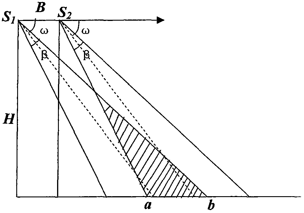
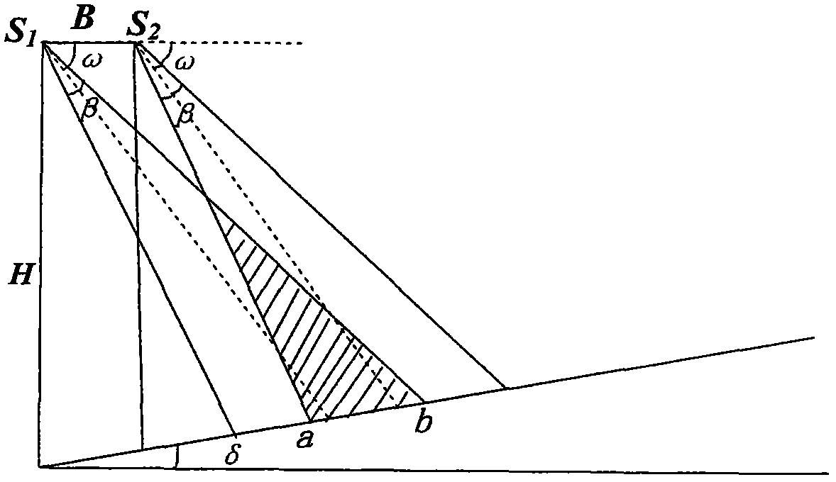
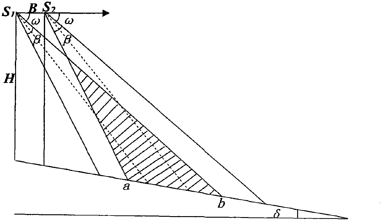
[0027] 1) Provide a technical solution for oblique photography of UAV forest fixed plots: use UAV photography technology, apply UAV oblique photography technology to the measurement of forest fixed plots, and then, according to the size of the fixed plots, reasonably Determine the drone’s oblique photography plan, and establish the drone’s flight parameters (including the baseline length B of the drone’s two photography, the drone’s flight height H, the drone’s tilted photography angle ω, and the drone’s camera field of view The geometric relationship between the angle β and the side length a) of the fixed forest plot, and then obtain the parameters of the forest plot (including diameter at breast height D, tree height H, volume V, etc.), and finally obtain the biomass and stock volume in t...
PUM
 Abstract
Description
Claims
Application Information