Road update method

A road and unified technology, applied in the field of road update, can solve the problems of low road accuracy, inaccurate GPS positioning, GPS positioning interference, etc., and achieve the effect of streamlining the method, good real-time performance, and improving accuracy

Active Publication Date: 2016-01-13
CHINA NONFERROUS METAL CHANGSHA SURVEY & DESIGN INST CO LTD
View PDF4 Cites 19 Cited by
  • Summary
  • Abstract
  • Description
  • Claims
  • Application Information

AI Technical Summary

Problems solved by technology

This method eliminates gross errors through cross-border judgment, interval data judgment, and redundant processing. However, GPS signals are easily attenuated and emitted in metal mine environments, which will adversely interfere with GPS positioning and cause positioning drift. This method cannot be compared ok fix this
At the same time, this method does not make full use of the round-trip trajectory information, and the generated road accuracy is low
[0004] Therefore, there is an urgent need for a road update method to solve the problem of inaccurate GPS positioning due to the complex and changeable mine roads and the easy deviation of GPS signals in the mine environment

Method used


Image

  • Road update method
  • Road update method
  • Road update method

Examples


Embodiment 1

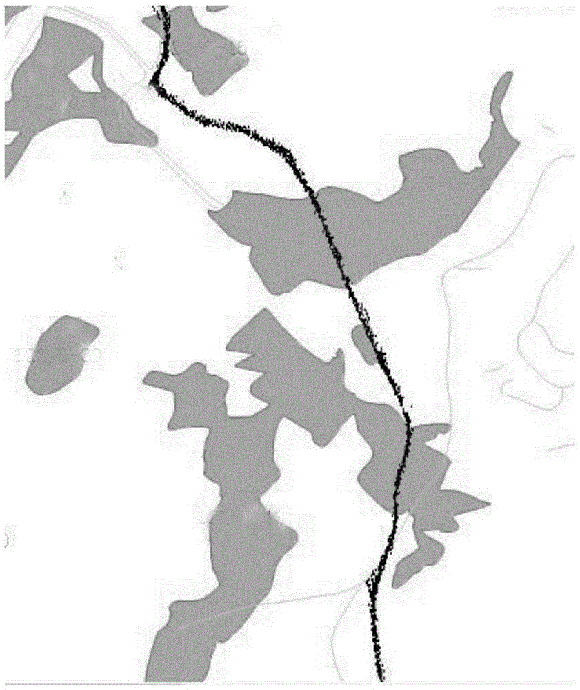
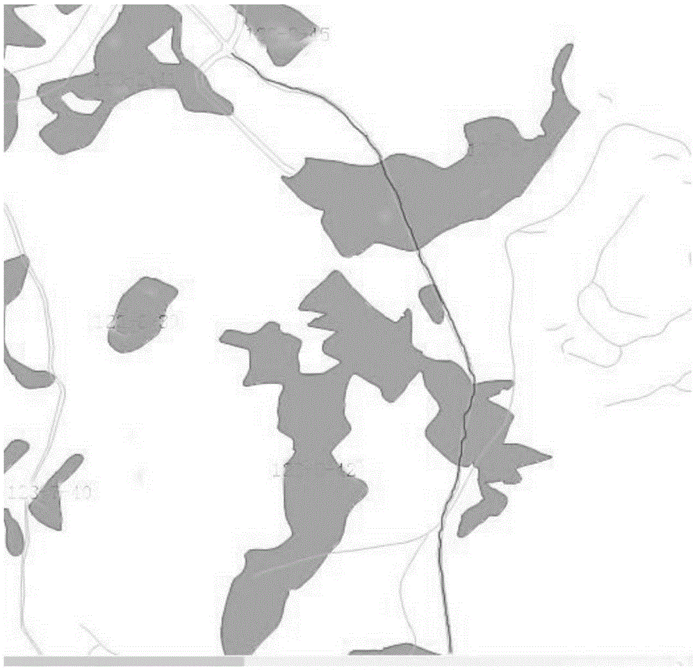
[0047] This implementation takes the automatic update of roads in Pingguo Aluminum Mine in Guangxi as an example.

[0048] Preliminary preparation: Through coverage analysis, establish 3 GPS base stations in the mining area, so that multi-base station differential settlement can be carried out in the entire mining area; collect the topographic map of the general area of ​​the mining area, specifically: A. Establish a GPS track data table, in the table Contains fields such as vehicle number, L, B, X, Y, collection time, etc., where X and Y are the information obtained by converting the L and B coordinates of the WGS track information collected on that day to the coordinates under Beijing 54 coordinates; B, establishing road elements Class, road includes fields such as road number, road generation time, road buffer radius, and road geometric information; create a buffer zone for existing roads, and the buffer radius is the width of the road.

[0049] The update steps are as foll...


PUM


Abstract

The invention provides a road update method. The method comprises the following steps that 1, information is collected; 2, data are pretreated; 3, trajectories are generated, 4, trajectories on a same road are judged and classified; 5, a track point set G2 is acquired; 6, a growth point set G4 is acquired; 7, trajectories D2 are acquired; 8, a road P2 is generated; 9, a road center line D3 of the road P2 is extracted and added to a newly added road buffer database; 10, topological operation is conducted between all road center lines D3 and the original road, and updated road data are obtained. The road update method has the advantages of being fast in update speed, high in precision, good in instantaneity, high in practicability and the like.

Description

technical field [0001] The patent of the present invention relates to the technical fields of geographic information system and mine informatization, and in particular, relates to a method for road renewal. Background technique [0002] When carrying out mining design and production in open-pit mines, it is necessary to obtain mine road information to realize mining planning and design at the initial stage of mining, real-time positioning and dynamic monitoring of trucks and electric shovels during production, statistics and analysis of loading and distribution, and Play back the historical trajectory of the vehicle, so as to achieve the purpose of effective design and improve the efficiency of production management. The mine production road network structure is undergoing rapid and dynamic changes. The traditional surface measurement system uses high-end GPS positioning equipment or total station equipment. The measurement is limited to local areas, the information acquisit...

Claims


Application Information

Patent Timeline
Patent Type & Authority Applications(China)
IPC IPC(8): G01C21/32
CPCG01C21/32
Inventor 郭琴杜年春
Owner CHINA NONFERROUS METAL CHANGSHA SURVEY & DESIGN INST CO LTD
Why Eureka
Try Eureka