Fire-fighting monitoring system based on unmanned aerial vehicle

A technology of fire monitoring and unmanned aerial vehicles, applied in image data processing, fire alarms, instruments, etc., can solve the problems of lack of further analysis of fire situation and rescue routes, and insufficient functions

Inactive Publication Date: 2016-01-13
TELEWAVE INFORMATION TECH
View PDF6 Cites 21 Cited by
  • Summary
  • Abstract
  • Description
  • Claims
  • Application Information

AI Technical Summary

Problems solved by technology

[0003] However, the existing UAV-based monitoring system is not perfect in function. It can only do some simple processing on the images taken by the UAV, and lacks further analysis of the fire situation, rescue routes, etc.

Method used


Image

  • Fire-fighting monitoring system based on unmanned aerial vehicle
  • Fire-fighting monitoring system based on unmanned aerial vehicle
  • Fire-fighting monitoring system based on unmanned aerial vehicle

Examples


Embodiment Construction

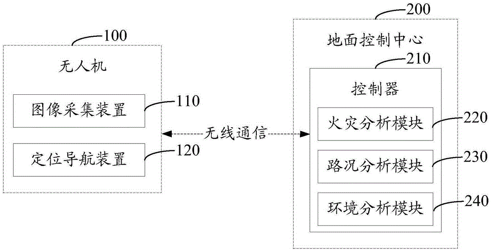
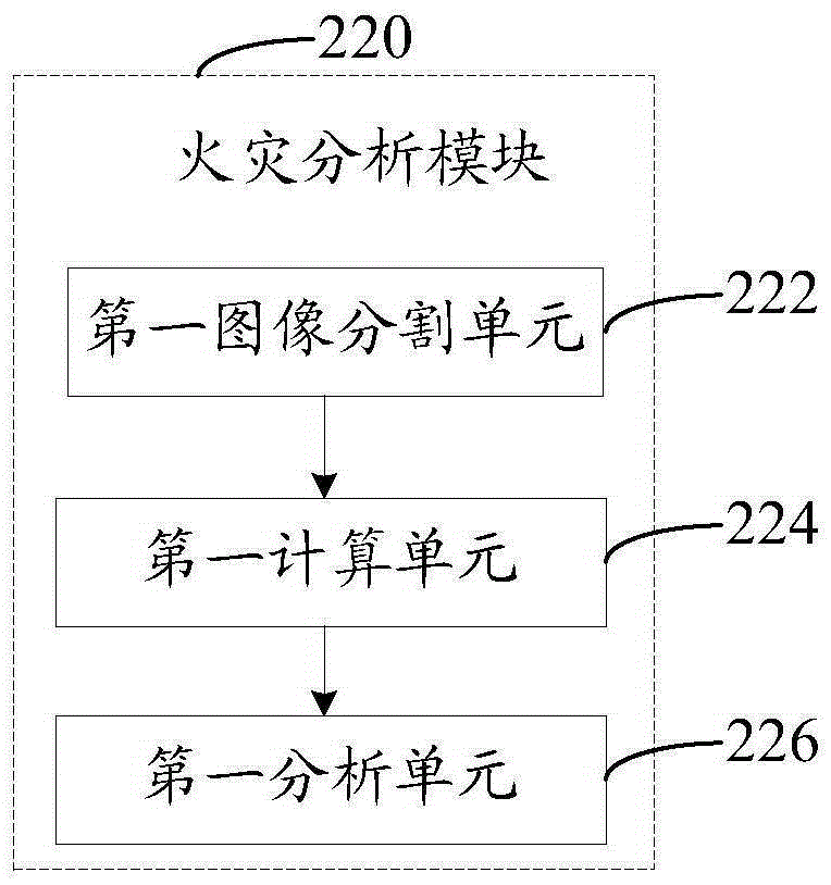
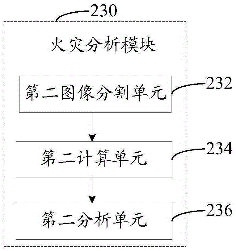
[0026] Please combine figure 1 , is a structural diagram of a fire monitoring system based on a drone in an embodiment.

[0027] The UAV-based fire monitoring system includes a UAV 100 and a ground control center 200 , the UAV 100 is equipped with an image acquisition device 110 and a positioning and navigation device 120 , and the ground control center 200 is provided with a controller 210 . Wherein, the image acquisition device 110 and the positioning and navigation device 120 are connected with the controller 210 through wireless communication.

[0028] The image acquisition device 110 is used to acquire the first image data of the monitoring area and the second image data of the relevant route, and send the first image data and the second image data to the controller 210 . Wherein, the relevant routes are all routes from the fire center closest to the monitoring area to the monitoring area.

[0029] In this embodiment, the image acquisition device 110 includes an image e...


PUM


Abstract

The invention relates to a fire-fighting monitoring system of an unmanned aerial vehicle. The fire-fighting monitoring system comprises the unmanned aerial vehicle and a ground control center. The unmanned aerial vehicle is provided with an image acquisition device and a positioning and navigation device. The ground control center is provided with a controller. The image acquisition device and the positioning and navigation device are connected with the controller via a wireless communication mode. The image acquisition device is used for acquiring first image data of a monitoring area and second image data of the related routes and transmitting the first image data and the second image data to the controller. The positioning and navigation device is used for positioning the unmanned aerial vehicle so as to acquire position data of the unmanned aerial vehicle in real time, generate the navigation data of the related routes and transmit the position data and the navigation data to the controller. The controller is used for analyzing occurrence of fire in the monitoring area and the severity of fire, analyzing the road condition of the related routes and analyzing the properties of places around the monitoring area. The fire-fighting monitoring system of the unmanned aerial vehicle is complete in function.

Description

technical field [0001] The invention relates to the field of monitoring equipment control, in particular to an unmanned aerial vehicle-based fire monitoring system. Background technique [0002] Unmanned aircraft, referred to as "drone" for short, and "UAV" for English abbreviation, is an unmanned aircraft controlled by radio remote control equipment and its own program control device. With the maturity of UAV technology and the further expansion of aerial photography technology, the application fields of civil UAV in my country are becoming more and more extensive, including: photogrammetry, emergency relief, public safety, resource exploration, environmental monitoring, natural disaster monitoring and assessment, Urban planning and municipal management, forest fire pest protection and monitoring, etc. At present, my country's firefighting forces are facing increasingly complex fire fighting and social assistance situations. For various earthquake rescue, flood fighting and...

Claims


Application Information

Patent Timeline
Patent Type & Authority Applications(China)
IPC IPC(8): G06Q50/26G06T7/00G08B17/00
Inventor 李永辉黄辉林方湖王国栋
Owner TELEWAVE INFORMATION TECH
Why Eureka
Try Eureka