Object-oriented airborne laser radar point cloud filtering method

An airborne laser radar, object-oriented technology, applied in image data processing, instrumentation, computing, etc., can solve the problems of ground points being mistaken for non-ground points, low filtering accuracy, and ground point points being mistaken for ground points, etc., to achieve Improved accuracy, wide applicability, and high filtering accuracy

Inactive Publication Date: 2016-04-13
CHINESE ACAD OF SURVEYING & MAPPING
View PDF1 Cites 30 Cited by
  • Summary
  • Abstract
  • Description
  • Claims
  • Application Information

AI Technical Summary

Problems solved by technology

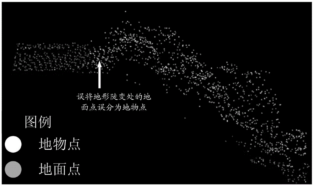
However, the triangulation network progressive encryption filtering method also has a significant weakness. For hilly and mountainous areas, it is easy to mistake ground points at steep terrain changes for non-ground points, such as figure 2 shown; for urban areas, it is easy to mistake the feature points below the vehicle for ground points
[0006] The above problems lead to the existing triangular network pr

Method used


Image

  • Object-oriented airborne laser radar point cloud filtering method
  • Object-oriented airborne laser radar point cloud filtering method
  • Object-oriented airborne laser radar point cloud filtering method

Examples


Embodiment Construction

[0087] In order to clearly illustrate the technical features of this solution, the present invention will be described in detail below through specific implementation modes and in conjunction with the accompanying drawings. The following disclosure provides many different embodiments or examples for implementing different structures of the present invention. To simplify the disclosure of the present invention, components and arrangements of specific examples are described below. Furthermore, the present invention may repeat reference numerals and / or letters in different instances. This repetition is for the purpose of simplicity and clarity and does not in itself indicate a relationship between the various embodiments and / or arrangements discussed. It should be noted that components illustrated in the figures are not necessarily drawn to scale. Descriptions of well-known components and processing techniques and processes are omitted herein to avoid unnecessarily limiting the...


PUM


Abstract

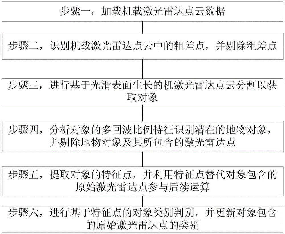
The invention discloses an object-oriented airborne laser radar point cloud filtering method. The method comprises the following steps: loading airborne laser radar point cloud data; identifying and removing a gross error point in airborne laser radar point cloud; performing smooth surface growth based airborne laser radar point cloud segmentation to obtain an object; analyzing a multi-echo ratio feature of the object to identify a potential earth object, and removing the earth object and a laser radar point contained in the earth object; extracting a feature point of the object, and performing subsequent operation by utilizing the feature point instead of an original laser radar point contained in the object; performing feature point based object type judgment, and updating the type of the original laser radar point contained in the object. According to the method, a complete object-oriented airborne laser radar point cloud filtering technical process is formed, so that the airborne laser radar point cloud filtering precision is effectively improved; and the method has wide applicability for various geomorphic types such as a mountainous area, an urban area and the like.

Description

technical field [0001] The invention relates to an airborne laser radar point cloud filtering method, in particular to an object-oriented airborne laser radar point cloud filtering method, and belongs to the technical field of laser radar point cloud data information extraction. Background technique [0002] During the operation of airborne lidar equipment, the laser scanning process is blind, that is, the laser pulse may hit the ground, or it may hit buildings, bridges, power lines, lighthouses, vehicles and other artificial features or vegetation. Therefore, the acquired airborne lidar point cloud data contains both ground points and object points. Point cloud classification is the basis for subsequent applications. In the process of engineering application, the airborne lidar point cloud data classification often adopts the idea of ​​hierarchical classification, that is, firstly, the ground points and the ground object points (non-ground points) in the point cloud data a...

Claims


Application Information

Patent Timeline
IPC IPC(8): G06T5/00
CPCG06T5/005G06T2207/10044
Inventor 林祥国段敏燕张继贤
Owner CHINESE ACAD OF SURVEYING & MAPPING
Why Eureka
Try Eureka