Meteorological radar simulation rendering method used for flight simulator

A flight simulator and weather radar technology, applied in the field of simulation, can solve the problems of lack of real-time and dynamic flight simulation, inconsistent pilots' real experience, and increased hardware costs, so as to improve authenticity, high real-time performance, and improve efficiency Effect

Active Publication Date: 2016-06-08
南京乐飞航空技术有限公司
View PDF3 Cites 14 Cited by
  • Summary
  • Abstract
  • Description
  • Claims
  • Application Information

AI Technical Summary

Problems solved by technology

[0004] 1) Simulation algorithms are mostly based on static satellite cloud images for 3D cloud reconstruction, which do not have the real-time and dynamic nature of flight simulation
[0005] 2) The imaging independence of the weather radar and the visual system cause the cloud image distribution to be inconsistent with the pilot's real experience during the simulated flight, greatly reducing the flight experience
[0006] 3) Due to the high computational intensity of existing algorithms, weather radar imaging simulation relies too much on high-performance industrial-grade computers, which greatly increases hardware costs

Method used


Image

  • Meteorological radar simulation rendering method used for flight simulator
  • Meteorological radar simulation rendering method used for flight simulator

Examples


Embodiment

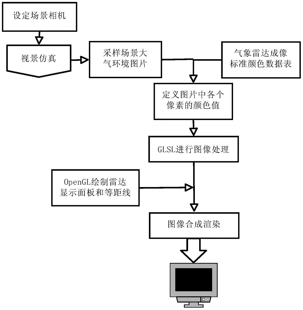
[0041] Step 1: Set the field of view and frustum of the scene camera, determine its view matrix, and use the radar position and attitude to drive the matrix update of the camera:

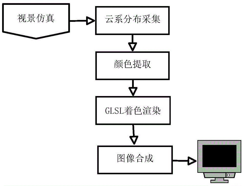
[0042] Step 2: Run the visual simulation program, use the virtual camera to sample images and scene depth values ​​within the radar reachable range near the flight position in real time, and render the images to textures.

[0043] Step 3: Access the texture in the shader, obtain the Alpha value and depth value of each pixel, look up the standard color in the table, and assign it to the original pixel.

[0044] Step 4: Perform operations such as noise and erosion on the image, and render the image to the radar display panel at the same time.

[0045] Step 5: Draw the radar display panel, obtain the processed image data, and perform image synthesis with the panel texture to form a complete weather radar imaging picture, and render it to the terminal display device.

[0046] Step 6: View the weather rad...


PUM


Abstract

The invention discloses a meteorological radar simulation rendering method used for a flight simulator. The method comprises an operation method of a meteorological radar imaging rendering system on the basis of a GLSL (OpenGL Shading Language) and an implement method for carrying out acceleration on image rendering on the basis of a GPU (Graphics Processing Unit). All meteorological data is sampled from a visual scene in a simulation process in real time, so that the meteorological data is high in imaging instantaneity and keeps consistent with the scene data of a flight process, and imaging authenticity is improved. In the whole calculation process, the meteorological radar simulation rendering method on the basis of the GLSL utilizes the parallel calculating capability and the rendering acceleration capability of the GPU, abandons traditional radar imaging simulation methods including satellite cloud picture utilization, weather bureau data query and the like at the very start, and directly collects the meteorological data in a visual simulation process of a simulation system, so that a complex calculation process of satellite cloud picture data reconstruction can be greatly simplified, imaging efficiency is improved, dependency on hardware is reduced, and equipment cost is lowered.

Description

technical field [0001] The invention relates to a simulation rendering method of weather radar, in particular to a simulation rendering method of weather radar used in flight simulators, and belongs to the technical field of simulation. Background technique [0002] With the increasing application of science and technology in the military field, the use of the latest technical equipment has had a significant impact on the troops. However, the training costs caused by the complexity of high-tech equipment have also increased rapidly, resulting in too much investment. However, the development of virtual reality simulation technology provides a technical basis for solving this contradiction. Directly using the aircraft to conduct drills to familiarize the pilots with the functions of the weather radar module may cause excessive consumption costs, low efficiency, low safety factor, and vulnerability. For practical problems such as interference from natural conditions, radar is r...

Claims


Application Information

Patent Timeline
Patent Type & Authority Applications(China)
IPC IPC(8): G06F9/455
CPCG06F9/45508
Inventor 孙传伟
Owner 南京乐飞航空技术有限公司
Why Eureka
Try Eureka