
A denoising method for airborne lidar point cloud based on 3D grid

An airborne lidar and three-dimensional grid technology, applied in image enhancement, image analysis, instruments, etc., can solve problems such as judgment failure, achieve the effects of increasing diffusion calculations, improving calculation speed, and simplifying construction rules and times

Inactive Publication Date: 2018-05-08
JILIN UNIV
View PDF5 Cites 0 Cited by
  • Summary
  • Abstract
  • Description
  • Claims
  • Application Information

AI Technical Summary

Problems solved by technology

The above-mentioned noise point elimination algorithms have their own advantages and disadvantages. Basically, they can eliminate some gross errors. Occasionally, due to some special noise points, the judgment will fail.

Method used


Image

  • A denoising method for airborne lidar point cloud based on 3D grid
  • A denoising method for airborne lidar point cloud based on 3D grid
  • A denoising method for airborne lidar point cloud based on 3D grid

Examples


Embodiment 1

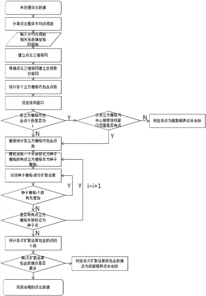
[0046] A three-dimensional grid-based airborne laser radar point cloud denoising method, comprising the following steps:

[0047] A. The present invention has adopted the reference data issued by ISPRS as experimental data, and selected 3 groups of different point cloud data for experimentation;

[0048]B has cut the selected data to meet the experimental requirements. Both sample 1 and sample 2 selected forest point clouds with undulating terrain. meters), the sample 3 selects the point cloud data of villages and towns with flat terrain, the number and density of point cloud points are: 179451 (15.385 per square meter), and each point cloud contains different numbers of discrete noise points and cluster noise point.

[0049] C determines the grid spacing according to the average point spacing of point cloud data points and related parameters;

[0050] D segment the x, y, and z directions of the circumscribed cuboid of the point cloud data, and establish a three-dimensional ...


PUM


Abstract

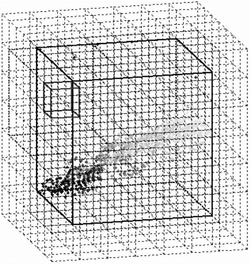
The invention relates to a three-dimensional grid-based airborne lidar point cloud denoising method. It is based on the spatial neighborhood relationship of each point in the point cloud and realizes the denoising of massive point cloud data based on the spatial division of the three-dimensional grid. deal with. This invention makes the internal points of each cubic grid have spatial index attributes by spatially three-dimensional gridding of point cloud data, and determines whether the points in the grid are noise points based on the spatial neighborhood relationship between the three-dimensional spatial grids. . Discrete noise points and point cloud subjects are judged based on the spatial neighborhood characteristics between unit three-dimensional grids, thereby filtering out discrete and clustered noise points caused by terrain scanning. By using the average point spacing of the three-dimensional grid edges with appropriate correlation coefficients Long can greatly reduce the error in judging noise points. This method is different from previous traditional denoising algorithms and provides a new idea for airborne lidar point cloud denoising.

Description

Technical field: [0001] The invention relates to a method of denoising processing of massive point cloud data based on the spatial neighborhood relationship of each point in the point cloud under the spatial division basis of the three-dimensional grid, especially the airborne lidar point cloud denoising process based on the three-dimensional grid. noise method. Background technique: [0002] With the rapid development of 3D laser scanning technology, people can easily obtain 3D point cloud data on the surface of objects in the real world, so 3D point cloud data models are widely used in virtual reality, reverse engineering, urban modeling, etc. In the mass point cloud data obtained by airborne lidar during scanning, a large number of non-surface points are acquired, which may be impurities in the atmosphere, flying birds, or error points that are extremely low on the surface. These points are generally called noise points. These noise points must be filtered out before rad...

Claims


Application Information

Patent Timeline
Patent Type & Authority Patents(China)
IPC IPC(8): G06T5/00G06T7/00
CPCG06T2207/10012G06T5/70
Inventor 张旭晴单咏华
Owner JILIN UNIV
Learn More