GNSS signal-based radar height finding system and using method thereof
A signal and radar technology, applied in the field of radar altimetry system, can solve the problems of high cost, low time resolution, and low observation time resolution, and achieve the effect of low cost, long observation time, and large coverage
- Summary
- Abstract
- Description
- Claims
- Application Information
AI Technical Summary
Problems solved by technology
Method used
Image
Examples
Embodiment Construction
[0041] In order to better understand the present invention, the content of the present invention is further illustrated below in conjunction with the examples, but the content of the present invention is not limited to the following examples. Those skilled in the art can make various changes or modifications to the present invention, and these equivalent forms are also within the scope of the claims listed in this application.
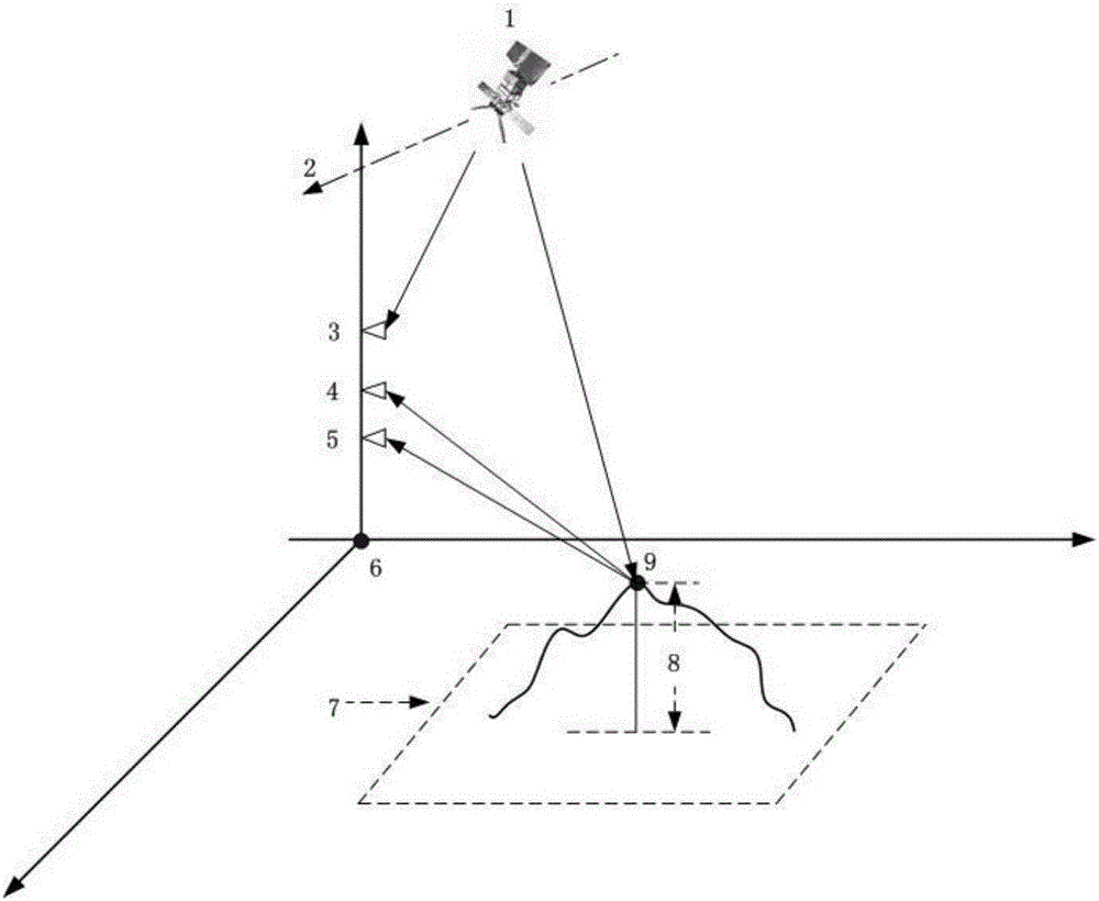
[0042] Such as figure 1As shown, the basic principle of the radar altimetry system based on GNSS signals of the present invention is: assume that the receiver and the observation area are in the three-dimensional local coordinates with the local coordinate origin 6 as the origin, and 7 is the entire observation area. The single-point target 9 to be measured is a certain point target in the entire observation area 7 , and the height relative to the ground plane of the local coordinates is the height 8 of the target to be measured. The present invention...
PUM
| Property | Measurement | Unit |
|---|---|---|
| Bandwidth | aaaaa | aaaaa |
Abstract
Description
Claims
Application Information
 - R&D
- Intellectual Property
- Life Sciences
- Materials
- Tech Scout
- Unparalleled Data Quality
- Higher Quality Content
- 60% Fewer Hallucinations
Browse by: Latest US Patents, China's latest patents, Technical Efficacy Thesaurus, Application Domain, Technology Topic, Popular Technical Reports.
© 2025 PatSnap. All rights reserved.Legal|Privacy policy|Modern Slavery Act Transparency Statement|Sitemap|About US| Contact US: help@patsnap.com


