On-satellite laser altimeter rough error elimination method integrated with multi-source data

A laser altimeter and multi-source data technology, applied in the direction of instruments, radio wave measurement systems, etc., can solve the problems of low data density, unsatisfactory mapping, and the influence of dual line array image elevation adjustment, so as to improve adaptability , high applicability effect

Inactive Publication Date: 2016-08-17
SHANGHAI INST OF TECHNICAL PHYSICS - CHINESE ACAD OF SCI
View PDF4 Cites 9 Cited by
  • Summary
  • Abstract
  • Description
  • Claims
  • Application Information

AI Technical Summary

Problems solved by technology

However, due to the low density of spaceborne laser altimeter data, it is impossible to form a planar point set, and there is no spatial correlation between each data.
As a result, the existing gross error removal algorithm cannot be effectively applied to the gross error removal of sp

Method used


Image

  • On-satellite laser altimeter rough error elimination method integrated with multi-source data
  • On-satellite laser altimeter rough error elimination method integrated with multi-source data
  • On-satellite laser altimeter rough error elimination method integrated with multi-source data

Examples


Embodiment Construction

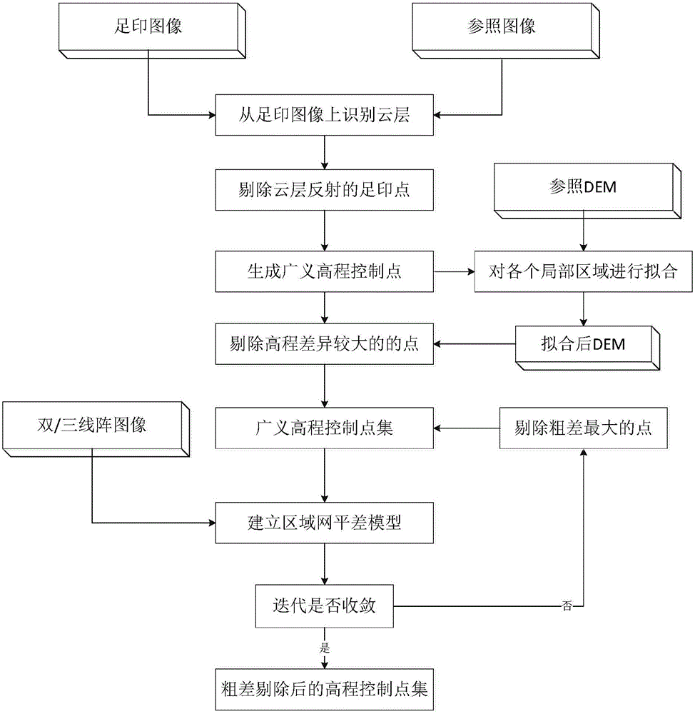
[0035] In order to better illustrate the technical solutions and advantages of the present invention, the implementation process of the present invention will be further described below in conjunction with the accompanying drawings.

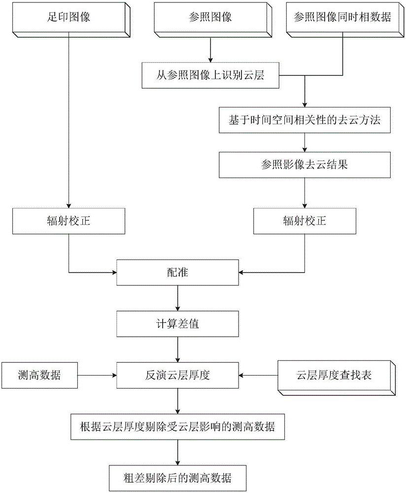
[0036] In the first step of the present invention, the reflectivity is calculated from the altimeter echo, and the echo data with abnormal reflectivity is eliminated. According to the waveform calibration data of the spaceborne laser altimeter, the energy value J corresponding to the waveform is obtained from the DN value:

[0037] J=a*DN+b

[0038] In the formula, a and b are the coefficients of radiation calibration. Atmospheric correction is performed on the echo data, and the output energy J of the laser is used 0 and atmospheric aerosol content, calculate the reflectivity of the echo:

[0039] f=((J-J ↑ ) / τ-J ↓ ) / J 0 τ

[0040] After obtaining the reflectivity data, the clutter can be eliminated by eliminating the echo data whose refle...


PUM


Abstract

The invention discloses a method for removing gross errors of a space-borne laser altimeter integrated with multi-source data. The method is as follows according to specific steps: (1) calculate the echo reflectivity, and then remove the laser echo data whose reflectivity is too low; (2) Identify the position of the cloud layer from the image of the footprint camera and remove the laser echo data reflected by the cloud layer; (3) With the support of auxiliary data, generate generalized elevation control points from the echo data of the altimeter; (4) Use the reference DEM data Auxiliary elimination of gross errors in the altimetry data; (5) Substituting the altimetry data into the stereoscopic image as elevation control points to assist in the block adjustment under weak intersection conditions, and continuously eliminating the point with the largest elevation difference until the adjustment The result converges. The elevation control point data can be obtained through this method, and the production precision of the global terrain data can be improved. Since the present invention combines multiple data to eliminate gross errors, the problem of low precision under a single reference source is avoided, and it has the characteristics of good robustness and high precision.

Description

technical field [0001] The invention belongs to the technical field of remote sensing and earth observation, and relates to a method for eliminating gross errors of a spaceborne laser altimeter integrated with multi-source data. Background technique [0002] Due to the influence of aerosol on the laser transmission path, the waveform decomposition and the error in the production process of the generalized elevation control point, there are some gross errors in the generalized elevation control point obtained by the spaceborne laser altimeter. As the source of elevation control points for stereo mapping satellites, the gross error contained in the spaceborne laser altimeter will have a great impact on the adjustment accuracy of the dual line array images of the stereo mapping satellites. Reliable gross error elimination means to remove elevation control points containing gross errors from the spaceborne laser altimeter altimetry data set. [0003] One of the existing methods...

Claims


Application Information

Patent Timeline
IPC IPC(8): G01S7/497
CPCG01S7/497
Inventor 谢锋杨贵舒嵘王建宇
Owner SHANGHAI INST OF TECHNICAL PHYSICS - CHINESE ACAD OF SCI
Why Eureka
Try Eureka