Tidal river network tide level forecasting method based on hydrodynamic force numerical simulation
A numerical simulation and hydrodynamic technology, applied in CAD numerical modeling, electrical digital data processing, special data processing applications, etc., can solve problems such as difficult convergence, limited forecast time, and inability to meet long-term and medium-term forecast requirements.
- Summary
- Abstract
- Description
- Claims
- Application Information
AI Technical Summary
Problems solved by technology
Method used
Image
Examples
Embodiment
[0067] See figure 1 , figure 1 It is a flowchart of a method for forecasting the tide level of a tidal river network based on hydrodynamic numerical simulation disclosed in this embodiment. figure 1 A tidal river network tide level prediction method based on hydrodynamic numerical simulation is shown, which specifically includes the following steps:
[0068] Step S1, select an appropriate research area according to the forecast position, and determine the lower boundary of the estuary and the upper control station and boundary;
[0069] Step S2, performing section division and terrain interpolation on the channel within the research area;
[0070] Step S3, establishing a one-dimensional unsteady flow hydrodynamic mathematical model of the network river area between the upstream control station and the downstream estuary boundary; the specific steps are as follows:
[0071] Step S31, the mathematical model of the one-dimensional power flow adopts Saint-Venant's equations, an...
Embodiment 2
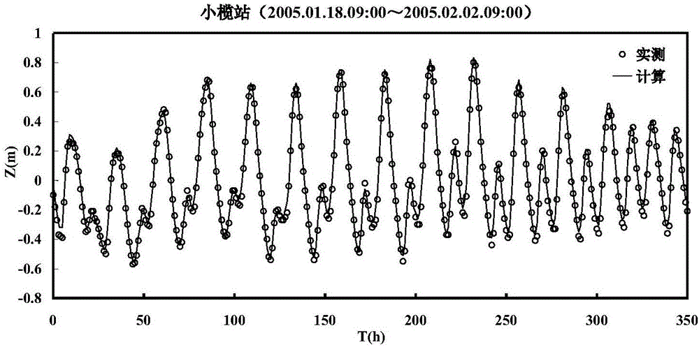
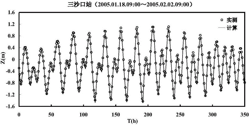
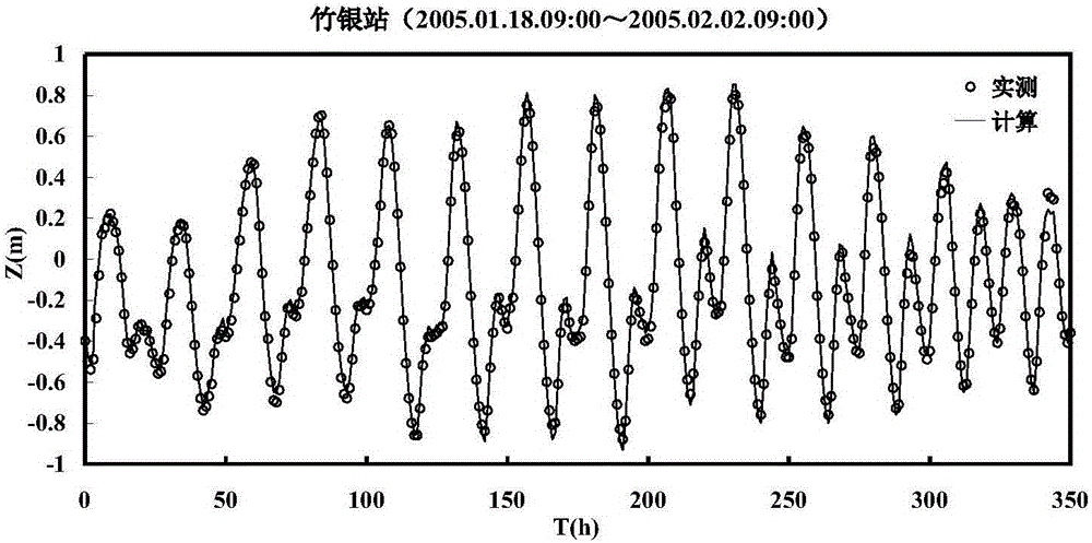
[0108] The present invention will be further described in detail with the example of tide level prediction of the outer river in the Shundawei dispatching system in the Pearl River Delta river network and the accompanying drawings.
[0109] (1) According to the location characteristics of Zhongshun Dawei, determine the research scope of the tide level forecasting model—including the West, Beijiang Delta, Dongjiang Delta, Guangzhou Outlet Channel, and Tanjiang Channel; the upper boundary is taken from the following control hydrological (level) stations: Xijiang Wuzhou, Beijiang Shijiao, Laoyagang (Liuxi River), Qilinzui (Zengjiang), Dongjiang Boluo, Tanjiang Shizui Station; the lower boundary is taken to the eight gate control stations: Dahu, Nansha, Fengmamiao, Heng Menmen and Modaomen Lantern Hill, Huangjin, Xipaotai, Guanchong, see Figure 3(a) and Figure 3(b);
[0110] (2) Carry out section division and topographic interpolation on the channel, with a total of 4140 sections,...
PUM
 Abstract
Description
Claims
Application Information
 - R&D
- Intellectual Property
- Life Sciences
- Materials
- Tech Scout
- Unparalleled Data Quality
- Higher Quality Content
- 60% Fewer Hallucinations
Browse by: Latest US Patents, China's latest patents, Technical Efficacy Thesaurus, Application Domain, Technology Topic, Popular Technical Reports.
© 2025 PatSnap. All rights reserved.Legal|Privacy policy|Modern Slavery Act Transparency Statement|Sitemap|About US| Contact US: help@patsnap.com


