Stationary satellite-based fire remote sensing and monitoring method

A static satellite and remote sensing monitoring technology, applied in fire alarms, forest fire alarms, special data processing applications, etc., to achieve strong mobility and improve early warning and emergency response rates

Inactive Publication Date: 2017-03-15
INST OF REMOTE SENSING & DIGITAL EARTH CHINESE ACADEMY OF SCI
View PDF2 Cites 51 Cited by
  • Summary
  • Abstract
  • Description
  • Claims
  • Application Information

AI Technical Summary

Problems solved by technology

[0004] The present invention proposes a remote sensing monitoring method for stationary satellite fires, which solves the problems of automatic

Method used


Image

  • Stationary satellite-based fire remote sensing and monitoring method
  • Stationary satellite-based fire remote sensing and monitoring method
  • Stationary satellite-based fire remote sensing and monitoring method

Examples


Embodiment Construction

[0036] In order to make the objectives, technical solutions, and advantages of the present application clearer, the technical solutions of the present application will be described clearly and completely in conjunction with specific embodiments of the present application and the corresponding drawings. Obviously, the described embodiments are only a part of the embodiments of the present application, rather than all the embodiments. Based on the embodiments in this application, all other embodiments obtained by those of ordinary skill in the art without creative work fall within the protection scope of this application.

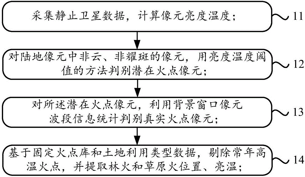
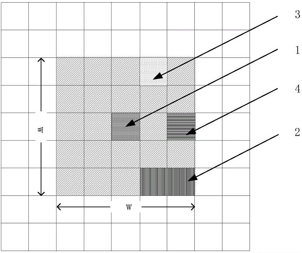
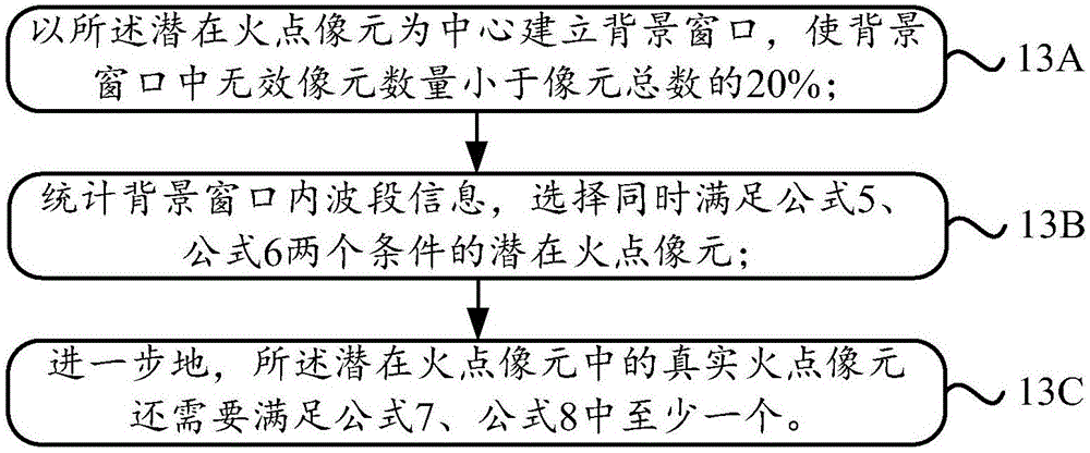
[0037] The method of the present invention is mainly based on geostationary satellite data, assisted by land use type data and historical fixed fire point database, automatically extracts forest and grassland fire points, quickly monitors the dynamic fire spreading trend, and makes an assessment of disaster losses after a disaster. Therefore, the present inventi...


PUM


Abstract

The invention discloses a stationary satellite-based fire remote sensing and monitoring method which solves the problem of automatic extraction of fire points in a forest and grassland, monitoring of a fire spreading situation and estimation of fire loss based on a stationary satellite. The method comprises the following steps: acquiring stationary satellite data, and calculating brightness temperature of image elements; judging latent fire point image elements from non-cloud and non-flare image elements in land image elements by using a method of a brightness temperature threshold value, and performing statistical judgment on the fire point image elements according to wave band information of background window image elements; culling out all-year-round high-temperature fire points based on a fixed fire point library and land utilization type data, and extracting positions and brightness temperatures of forest fire and grassland fire; providing a fire spreading situation sequence according to forest fire and grassland fire remote sensing and monitoring results of observation frequencies of the stationary satellite; estimating the loss caused by the forest fire or the grassland fire. The method disclosed by the invention quickly monitors a dynamic change of a disaster target, so that the efficiency for prewarning and emergently handling major disasters in China is further improved.

Description

Technical field [0001] The invention relates to the field of thermal infrared remote sensing monitoring. In particular, it relates to a remote sensing monitoring method for forest fire and grassland fire based on geostationary satellite data. Background technique [0002] Forest fires and grassland fires can damage forestry or animal husbandry production and cause significant economic losses. At the same time, a large number of greenhouse gases and aerosols released by fires will change the chemical composition of the atmosphere and have a great impact on the environment and climate change. Therefore, the study of forest and grassland fire monitoring and early warning technologies has important practical and long-term historical significance. Remote sensing technology has good objectivity, strong integrity, fast response speed, and low cost. It can play a huge role in forest and grassland fire disaster monitoring, early warning and loss assessment. Compared with the applicatio...

Claims


Application Information

Patent Timeline
IPC IPC(8): G06F19/00G08B17/00
CPCG08B17/005G16Z99/00
Inventor 范萌陈良富李莘莘邹铭敏余超胡斯勒图苏林
Owner INST OF REMOTE SENSING & DIGITAL EARTH CHINESE ACADEMY OF SCI
Why Eureka
Try Eureka