Single-viewing-field multifunctional optical sensor and realization method

An optical sensor, multi-functional technology, applied in astronomical navigation, integrated navigator, camera device and other directions, can solve the problems of reducing the accuracy of target feature extraction, complex image synthesis algorithm, composite image ghosting phenomenon, etc., to avoid image features The loss of information, the improvement of navigation accuracy, the effect of low cost

Active Publication Date: 2017-05-17
BEIHANG UNIV
View PDF7 Cites 13 Cited by
  • Summary
  • Abstract
  • Description
  • Claims
  • Application Information

AI Technical Summary

Problems solved by technology

The disadvantage is that it takes up a lot of storage resources, the image synthesis algorithm is complex, and the frame rate is low
Since the spacecraft is always in motion, the displacement of th

Method used


Image

  • Single-viewing-field multifunctional optical sensor and realization method
  • Single-viewing-field multifunctional optical sensor and realization method
  • Single-viewing-field multifunctional optical sensor and realization method

Examples


Embodiment Construction

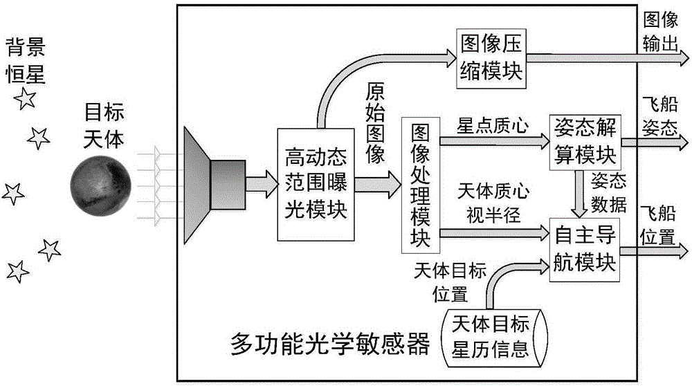
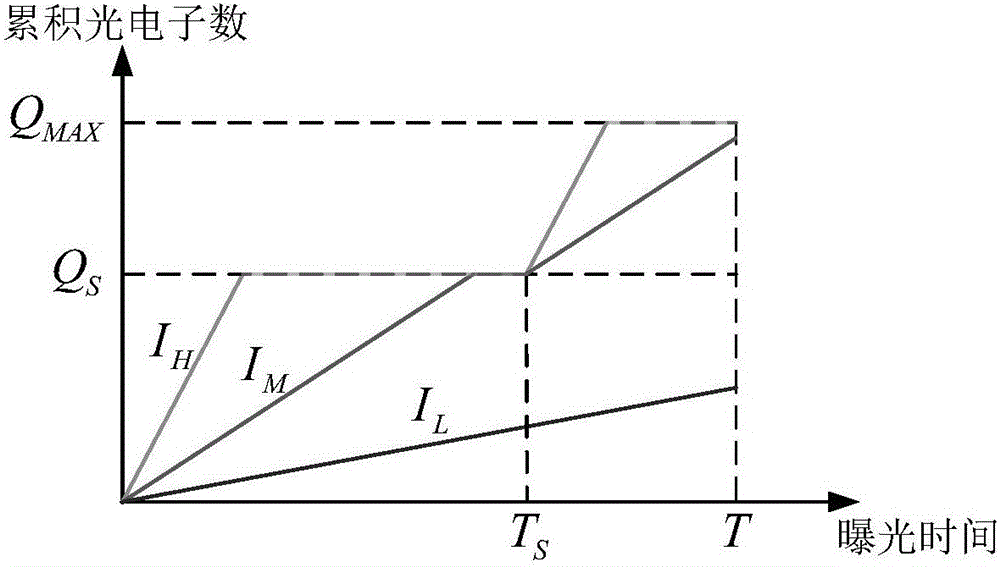
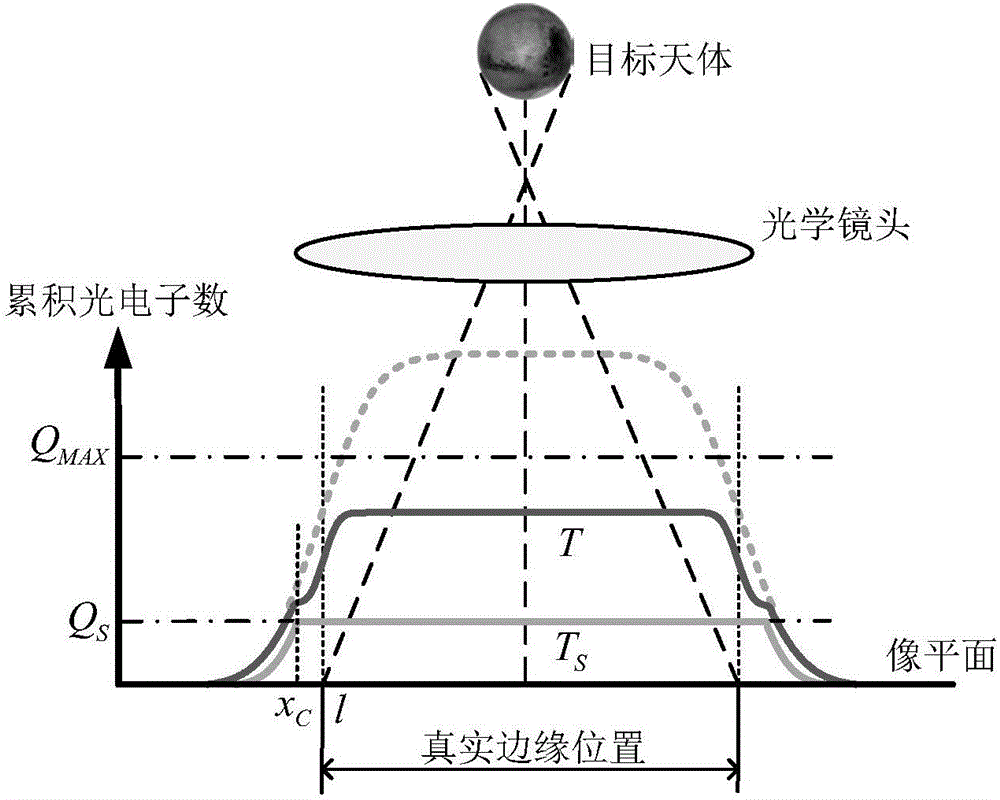
[0048] Such as figure 1 Shown is the functional block diagram of the multifunctional optical sensor, which mainly includes: high dynamic range exposure module, image processing module, attitude calculation module, autonomous navigation module and image compression module. The basic working principle is as follows: use high-resolution imaging device CMV20000 (5120×3840 pixels), use variable potential well exposure capacity technology to image star points and celestial objects, and perform real-time image processing. The centroid of the star point and the edge of the celestial object in the image are extracted separately. The star point centroid is recognized by the star map of the attitude calculation module to calculate the current attitude of the spacecraft. The edge of the celestial object is processed to obtain the vector direction from the multifunctional optical sensor to the celestial object and the vector direction from the celestial object to the sun, and the position...


PUM


Abstract

The invention relates to a single-viewing-field multifunctional optical sensor and a realization method. The sensor integrates functions of a star sensor, a navigation sensor and a spatial optical camera and comprises a dynamic range exposure module, an image processing module, a posture calculation module, a self-navigation module and an image compression module. Functions of a conventional navigation system with multiple sensors combined are realized through a single sensor, so that system complexity is greatly simplified, and weight and cost are lowered.

Description

technical field [0001] The invention relates to a single-field multifunctional optical sensor and a realization method, belonging to the technical field of optical autonomous navigation. Background technique [0002] Optical autonomous navigation is an indispensable key technology in deep space exploration missions. It is usually realized through the cooperation of multiple optical sensors, mainly including star sensors, sun sensors, optical navigation cameras and other equipment. The star sensor obtains the attitude information of the spacecraft, and the navigation camera captures the image of the target celestial body with a star background, and combines the current attitude of the spacecraft to solve the line-of-sight vector of the target celestial body, and then calculates the position of the spacecraft according to the geometric relationship. The optical navigation system in the form of multi-sensor combination is not only complex in structure, high in cost, high in wei...

Claims


Application Information

Patent Timeline
IPC IPC(8): G01C21/24G01C21/02G01C11/02
Inventor 江洁王昊张广军
Owner BEIHANG UNIV
Why Eureka
Try Eureka