
Big data-based time-space confusion exposure degree assessment system and method

A big data, spatiotemporal technology, applied in the field of spatiotemporal confusion exposure assessment system, can solve problems such as the evaluation accuracy of public health effects, sparse monitoring data, prediction uncertainty, etc., to achieve excellent prediction accuracy effect, wide application prospect, The effect of improved modeling accuracy

Inactive Publication Date: 2018-03-13
INST OF GEOGRAPHICAL SCI & NATURAL RESOURCE RES CAS
View PDF7 Cites 12 Cited by
  • Summary
  • Abstract
  • Description
  • Claims
  • Application Information

AI Technical Summary

Problems solved by technology

At present, the research on air pollution at home and abroad is also based on PM 2.5 is the focus, but it is affected by various environmental factors and human factors, and is limited by the time scale and spatial scale of monitoring data, making the PM 2.5 There are certain uncertainties in the prediction of concentration, and it is difficult to make efficient and accurate prediction
However, due to the fact that domestic related research has just started, the monitoring data is sparse for the vast areas of China, which in turn affects the accuracy of public health effect assessment. Therefore, an efficient, accurate and low-error prediction method is urgently needed for public health research. to protect the safety of the public
[0003] In short, the existing environmental exposure such as PM 2.5 The main disadvantage of the estimation method is the limited auxiliary data and the lack of big data support; the model algorithm used lacks the consideration of spatial correlation, which also limits the further application of these methods

Method used


Image

  • Big data-based time-space confusion exposure degree assessment system and method
  • Big data-based time-space confusion exposure degree assessment system and method
  • Big data-based time-space confusion exposure degree assessment system and method

Examples


specific Embodiment approach

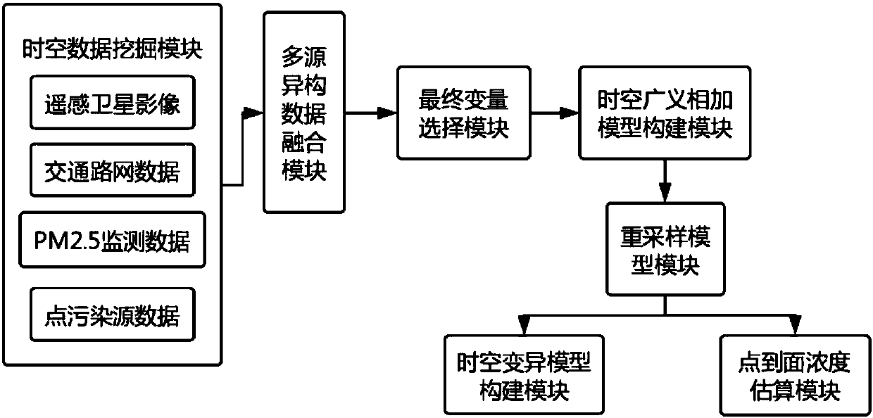
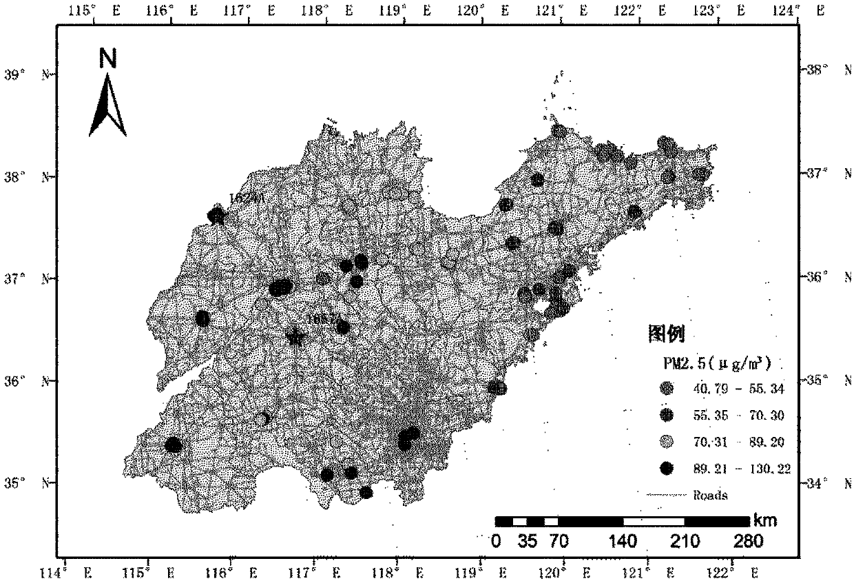
[0097] (1) Spatio-temporal data mining module: considering environmental pollutants such as PM 2.5 The complexity of the influencing factors of concentration, using multi-source data on PM 2.5 Concentration prediction in order to reduce the prediction bias, the first is to determine the research area ( figure 1 ) preliminary predictor variables, including remote sensing data (aerosol, land use, NDVI) and monitoring data from ground monitoring stations; reanalysis data with higher temporal and spatial resolution to extract meteorological factors; road data and data from research Air pollution enterprise data released by the district government; social and economic data, these data come from different fields, most of which are obtained by online mining technology; and the use of massive data makes the prediction results of the model closer to reality, and the accuracy is greatly improved. Specifically include the following categories:

[0098] (11) Through reanalysis data MERR...


PUM


Abstract

The invention relates to a big data-based time-space confusion exposure degree assessment system and method. The system comprises a time-space data mining block, a multi-source heterogeneous data fusion module, a final variable selection module, a time-space generalized additive model building module, a re-sampling model module, a variation function time-space modeling module and a concentration estimation module; massive time-space data is mined; a relationship between multiple influence factors and pollutant concentration is established by adopting an accumulative nonlinear method; and through residual variation function fitting, spatial autocorrelation is considered, so that the prediction precision and effect are greatly improved.

Description

technical field [0001] The invention relates to a time-space confusion exposure evaluation system and method based on massive big data, belonging to the technical field of environmental health. Background technique [0002] The current monitoring data of environmental pollutants is sparse, and early data is lacking. However, the spatio-temporal resolution of the existing calculation model prediction is extremely limited, making it difficult to achieve refined pollutant estimation. PM 2.5 For example, in recent years, the problem of air pollution has become increasingly prominent, and the impact of air pollutants on human health has aroused great public concern. PM is the most harmful air pollutant to human health 2.5 . At present, the research on air pollution at home and abroad is also based on PM 2.5 is the focus, but it is affected by various environmental factors and human factors, and is limited by the time scale and spatial scale of monitoring data, making the PM ...

Claims


Application Information

Patent Timeline
Patent Type & Authority Applications(China)
IPC IPC(8): G06Q10/04G06Q50/26
CPCG06Q10/04G06Q50/26
Inventor 李连发方颖张杰昊王劲峰
Owner INST OF GEOGRAPHICAL SCI & NATURAL RESOURCE RES CAS
Learn More