Virtual control point obtaining method based on laser range finding and object space matching

A technology of virtual control points and laser ranging, which is applied in measuring devices, radio wave measuring systems, image data processing, etc. It can solve problems such as point cloud coordinate errors, DEM accuracy that cannot meet requirements, and point cloud strips that cannot be well matched. , to achieve the effect of improving the elevation accuracy

Pending Publication Date: 2018-04-06
WUHAN AI BIRD UAV
View PDF0 Cites 15 Cited by
  • Summary
  • Abstract
  • Description
  • Claims
  • Application Information

AI Technical Summary

Problems solved by technology

In the actual production of LiDAR data processing, it is found that the elevation error of the point cloud is generally between 0.3m and 1.0m, especially when the accuracy of the POS equipment is not high and the

Method used


Image

  • Virtual control point obtaining method based on laser range finding and object space matching
  • Virtual control point obtaining method based on laser range finding and object space matching
  • Virtual control point obtaining method based on laser range finding and object space matching

Examples


Embodiment Construction

[0035] The following will clearly and completely describe the technical solutions in the embodiments of the present invention with reference to the accompanying drawings in the embodiments of the present invention. Obviously, the described embodiments are only some, not all, embodiments of the present invention. Based on the embodiments of the present invention, all other embodiments obtained by persons of ordinary skill in the art without creative efforts fall within the protection scope of the present invention.

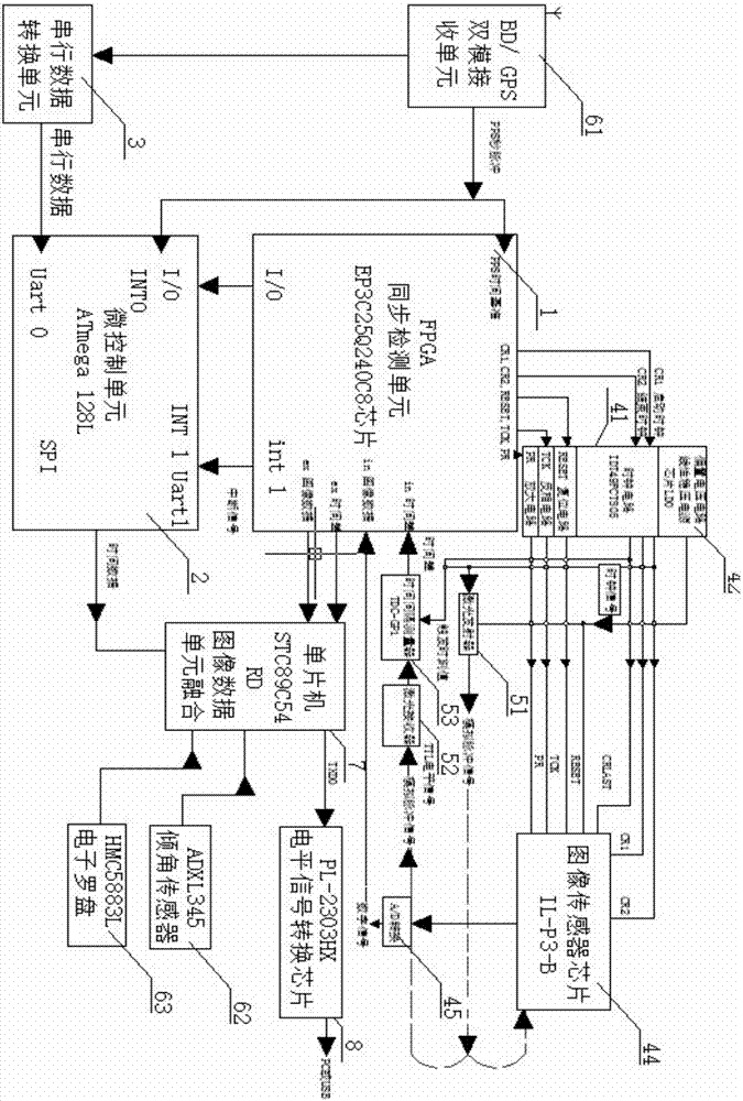
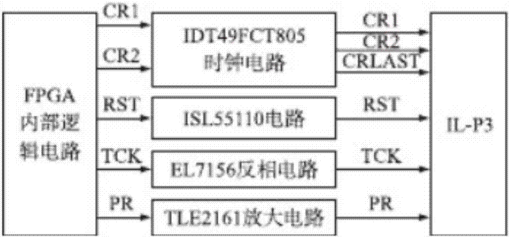
[0036] The present invention provides a measurement device based on laser distance measurement and object space matching virtual control point, which consists of a storage battery 9 for power supply, a synchronous detection unit 1, a micro control unit 2, a serial data conversion unit 3, an aerial camera assembly 4, Composed of laser ranging component 5, POS data component 6, image data fusion unit 7, level data conversion chip 8,

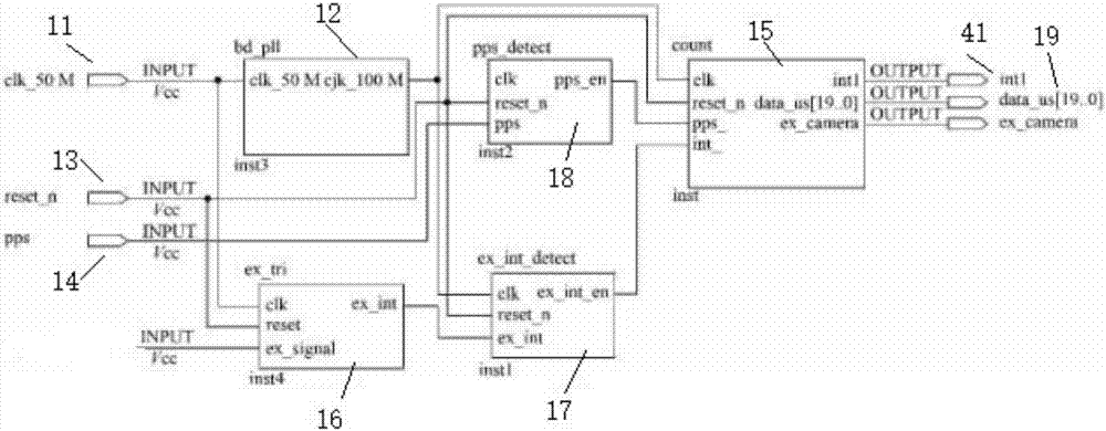
[0037] Synchronization detection...


PUM


Abstract

The invention relates to a measurement device and method based on laser distance measurement and object space matching virtual control points, and relates to the field of aerial triangle surveying and mapping of unmanned aerial vehicles. Including data acquisition, feature point extraction and matching, digital surface model generation, matching point probabilistic object coordinate acquisition, refined matching results, correction of external elements, calculation of ground coordinates, etc. The UAV is also equipped with a surveying and mapping device, including obtaining Aerial cameras for aerial images, long-range laser rangefinders for obtaining point cloud data, and airborne positioning devices for obtaining approximate outer orientation elements and instantaneous time stamp data of aerial cameras. Realize accurate surveying and mapping of ground objects.

Description

technical field [0001] The present invention relates to the technical field of automatic control, in particular to a method for acquiring virtual control points based on laser ranging and object matching. Background technique [0002] Airborne Light Detecting and Ranging (Airborne Light Detecting and Ranging, Airborne LiDAR) is a rapid acquisition technology of 3D terrain data that integrates laser scanners and Positioning and Orientation System (Positioning and Orientation System, POS). The airborne LiDAR device emits a laser beam to the ground at a certain frequency and receives the laser signal reflected by the ground object. The distance between the scanner and the ground object is calculated according to the time difference between the transmitted signal and the reflected signal, and then combined with the current attitude of the platform obtained by the POS device to calculate the ground. The three-dimensional coordinates of the object. This process is called direct g...

Claims


Application Information

Patent Timeline
IPC IPC(8): G06T7/33G06T7/269G06T7/521G06T7/70G01S19/47
CPCG06T7/269G06T7/33G06T7/521G06T7/70G01S19/47
Inventor 王效波张辰辰
Owner WUHAN AI BIRD UAV
Why Eureka
Try Eureka