
GIS-based bus route planning method

A bus route and bus technology, applied in special data processing applications, instruments, electrical digital data processing, etc., can solve problems such as congestion, less passenger transfer times, and short travel time

Active Publication Date: 2018-10-12
ZHEJIANG UNIV OF TECH
View PDF4 Cites 13 Cited by
  • Summary
  • Abstract
  • Description
  • Claims
  • Application Information

AI Technical Summary

Problems solved by technology

[0006] In order to overcome the deficiencies of delayed arrival, overload, congestion, high bus repetition rate and passenger difficulty caused by unreasonable bus route planning, the present invention proposes a bus route planning method, using the rich network analysis module in the ArcGIS platform Combining Dijkstra's ant colony hybrid optimization algorithm with the spatial analysis function provides a set of bus route planning methods that can reduce passenger transfer times and travel time

Method used


Image

  • GIS-based bus route planning method
  • GIS-based bus route planning method
  • GIS-based bus route planning method

Examples


Embodiment Construction

[0037] The present invention will be further described below in conjunction with the accompanying drawings.

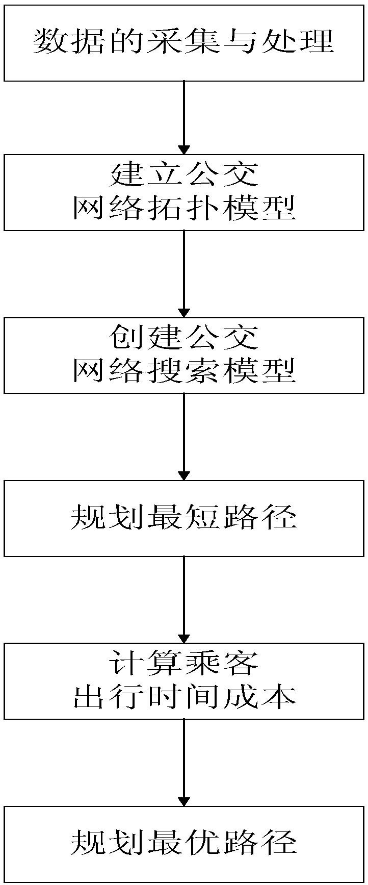
[0038] refer to Figure 1 to Figure 4 , a GIS-based bus route planning method, including the following steps:

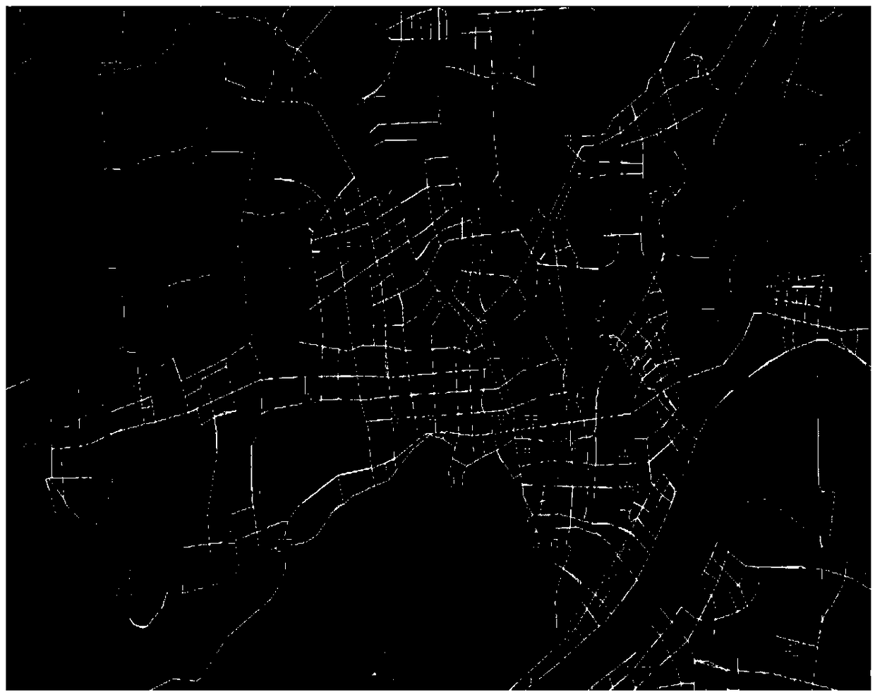
[0039] A1. Data collection and processing. The collected data includes passenger flow data, passenger density data, bus stop data, departure station time and road information data, which are made into traffic network data sets, such as figure 2 shown;

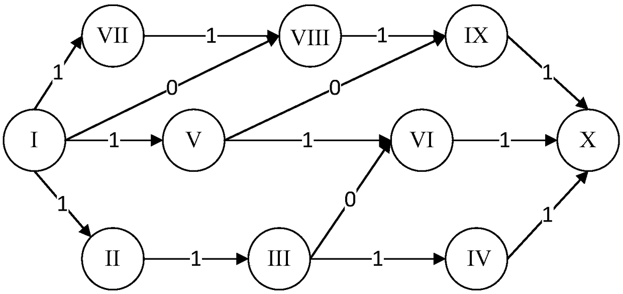
[0040] A2. Establish a bus network topology model, abstract the actual city bus network into a topological network diagram, analyze the spatial location relationship of bus stops, merge bus stops that can meet the needs of walking transfers, and abstract them into the same transfer By nodes, the design principles are as follows:

[0041] A2.1 Stations with the same name on the same line but in different directions are merged into the same transfer node;

[0042] A2.2 The stations with the same name that o...


PUM


Abstract

The invention provides a GIS-based bus route planning method. Firstly, in view of the bus route problem, the shortcomings such as delaying to station, overload, congestion, high bus repetition rate and difficult riding of passengers caused by unreasonable bus route planning in the current stage, and a series of impact factors of vehicle capacity, road condition and population density distributionare analyzed, a vector map and data of the whole city are obtained, and a road network data set is established; and secondly, a scientific and rational bus route method is established by using the spatial network analysis technology of GIS in combination with the Dijkstra ant colony hybrid optimization algorithm. The invention provides a bus route planning method with higher passenger travelling efficiency.

Description

technical field [0001] The invention relates to the fields of route planning, intelligent optimization and computer application, and in particular to a GIS-based method for bus route planning. Background technique [0002] With the rapid development of our country's social economy, the scale of the city is expanding rapidly, and the urban population is also growing at a high speed. According to the National Bureau of Statistics, as of the end of 2016, my country currently has 860 cities, including 32 megacities, 44 large cities, and more than 400 small cities. The urbanization rate has reached 57.35%. While promoting the development of urbanization, the number of urban motor vehicles has increased sharply, accompanied by the increasingly serious urban road traffic congestion. Among them, the unreasonable layout planning of public transportation is a common problem in urban transportation. With the rapid growth of urban residents, the original public transport system can no ...

Claims


Application Information

Patent Timeline
IPC IPC(8): G06F17/30G06Q10/04G06Q50/30
CPCG06Q10/047G06Q50/40
Inventor 李章维宋焦朋周晓根王柳静谢腾宇张贵军
Owner ZHEJIANG UNIV OF TECH
Learn More