Unmanned aerial vehicle deception route planning method based on ant colony algorithm

An ant colony algorithm and route planning technology, applied in vehicle position/route/altitude control, calculation, calculation model and other directions, can solve the problems of poor terrain adaptability and control accuracy, deceive acceleration and speed, etc., and achieve strong terrain adaptability. , the effect of improving the control accuracy

Inactive Publication Date: 2018-11-06
HARBIN INST OF TECH +1
View PDF6 Cites 12 Cited by
  • Summary
  • Abstract
  • Description
  • Claims
  • Application Information

AI Technical Summary

Problems solved by technology

[0007] The purpose of the present invention is to solve the problem that the existing black-flying UAV deception route planning only introduces deception acceleration and speed on the bas

Method used


Image

  • Unmanned aerial vehicle deception route planning method based on ant colony algorithm
  • Unmanned aerial vehicle deception route planning method based on ant colony algorithm
  • Unmanned aerial vehicle deception route planning method based on ant colony algorithm

Examples


specific Embodiment approach 1

[0040] Specific implementation mode one: the specific process of a method for planning a UAV deception route based on ant colony algorithm in this implementation mode is as follows:

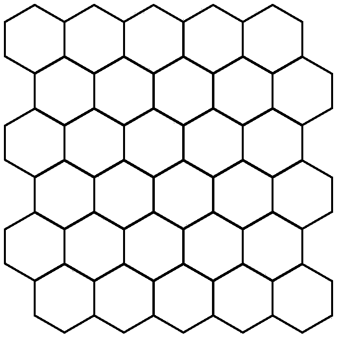
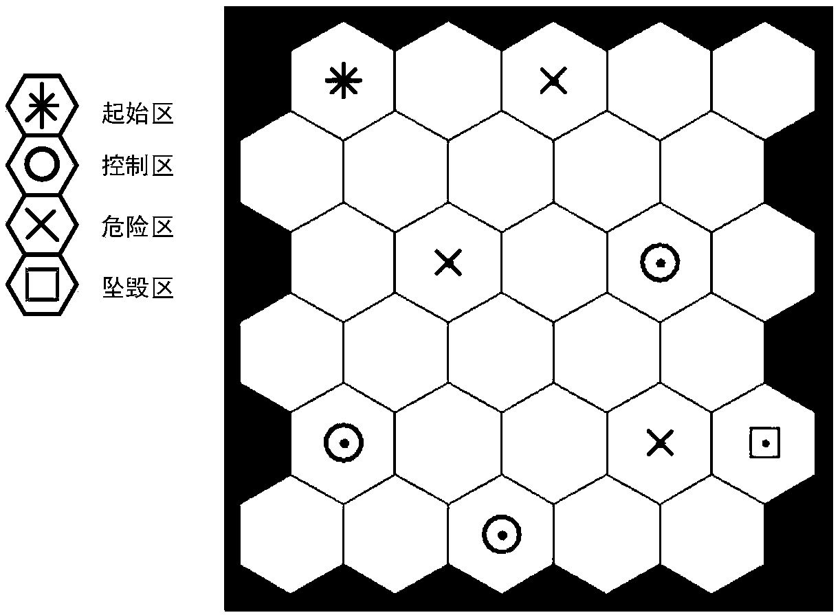
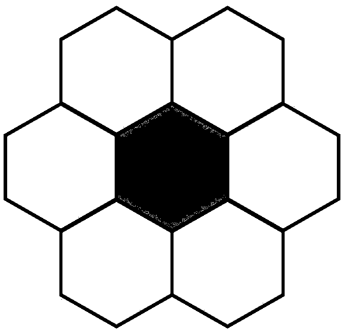
[0041] Step 1. Modeling In this paper, grid modeling is considered for the flight area, and each grid is regarded as a grid area, and the planned route is formed by connecting the center points of the grid. Cutting the map into squares and hexagons (honeycomb type) can realize the gridding of the map and discretize the original continuous map. Considering that the angle of hexagonal routing to adjacent cells is more flexible during the routing process, the present invention adopts a cellular discrete method to carry out cellular gridding on the flight area of ​​the UAV, and aims at the cellular grid for unmanned Classify the drone flight area, set the starting area of ​​the drone flight area, the dangerous area of ​​the drone flight area, the control area of ​​the drone flight area and the crash ...

specific Embodiment approach 2

[0092] Embodiment 2: The difference between this embodiment and Embodiment 1 is that the connection matrix in the step 1 represents:

[0093]

[0094] 0 indicates that the cities are not connected, and 1 indicates that the cities are connected;

[0095] Matrix A limits that ants can only choose to choose the next city in the city adjacent to the current city, for example: line 18 has A(18,3)=1,A(18,6)=1,A(18, 21) = 1, the other columns in row 18 are 0.

[0096] Other steps and parameters are the same as those in Embodiment 1.

specific Embodiment approach 3

[0097] Embodiment 3: This embodiment differs from Embodiment 1 or Embodiment 2 in that: the value of the pheromone influencing factor α in step 3 is 0≤α≤1.

[0098] Other steps and parameters are the same as those in Embodiment 1 or Embodiment 2.


PUM


Abstract

The invention discloses an unmanned aerial vehicle deception route planning method based on the ant colony algorithm, and relates to an unmanned aerial vehicle deception route planning method based onthe ant colony algorithm. The object of the invention is to solve the problem that the existing black-flying unmanned aerial vehicle deception route planning only introduces the deception acceleration and speed on the basis of the existing real route, which results in poor adaptability to terrain and control precision. The process includes: 1, classifying a flight area of the unmanned aerial vehicle through a cellular grid, and setting an initial zone, a danger zone, a control zone and a crash zone; 2, updating the pheromone concentration in the ant colony algorithm; 3, obtaining the transition probability in the ant colony algorithm; and 4, calculating the transition probability between the current city and the next city when the ant starts from the initial zone, selecting the city withthe highest transfer probability as the next destination city till the crash zone is reached, and obtaining a deception route based on the ant colony algorithm in the flight area of the unmanned aerial vehicle. The unmanned aerial vehicle deception route planning method based on the ant colony algorithm is used in the field of unmanned aerial vehicle deception route planning.

Description

technical field [0001] The invention relates to an unmanned aerial vehicle deception route planning method based on an ant colony algorithm. Background technique [0002] The deceptive jamming technology based on the global navigation system refers to changing the positioning result of the receiver by generating or forwarding navigation signals, so that the receiver can be positioned at a false position or fly along a wrong route. machine. [0003] Black flying drones are drones that illegally fly into controlled airspace; [0004] For black-flying UAVs that illegally fly into the controlled airspace, it is necessary to develop a guiding route for them after exploring the real route of the known receiver. The setting of the guiding route should be based on the following principles: 1) Make the black-flying UAV avoid Open urban areas with a lot of people; 2) make the black flying drone tend to the military control area that can control the drone; 3) make the black flying dr...

Claims


Application Information

Patent Timeline
IPC IPC(8): G05D1/10G01C21/20G06N3/00
CPCG01C21/20G05D1/101G05D1/104G06N3/006
Inventor 韩帅张佳琪刘宁庆蔚保国高芳邹徳岳孟维晓
Owner HARBIN INST OF TECH
Why Eureka
Try Eureka