Method and device of detecting whether GNSS terminal is on or below overhead road

A detection method and a detection device technology, which are applied in the field of intelligent transportation, can solve problems such as judgment errors, and achieve the effect of improving accuracy

Active Publication Date: 2018-11-13
QIANXUN SPATIAL INTELLIGENCE INC
View PDF16 Cites 9 Cited by
  • Summary
  • Abstract
  • Description
  • Claims
  • Application Information

AI Technical Summary

Problems solved by technology

However, the above scheme needs to know the initial elevated up / down state, and needs to detect and record the user's up / downhill history, which is not available for power-on
For example, when the user starts navigation on the elevated, since there is no information and uphill / downhill records of the previous user's up / down on the elevated, it will still lead to an error in the judgment of the elevated on / off

Method used


Image

  • Method and device of detecting whether GNSS terminal is on or below overhead road
  • Method and device of detecting whether GNSS terminal is on or below overhead road
  • Method and device of detecting whether GNSS terminal is on or below overhead road

Examples


Embodiment 1

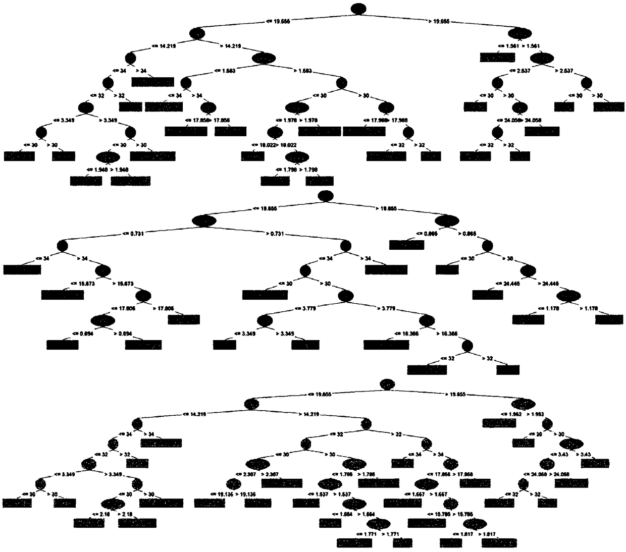
[0031] In the model learning stage, the observation data of GNSS terminals on the elevated and GNSS terminals under the elevated are collected as a data set, and the "bootstrapping" method is used to generate more than one set of sampling data. Correspondingly, a decision tree is generated, but unlike the general decision tree, in order to add disturbance to the feature selection, the feature candidate set for selecting the optimal feature in the above decision tree splitting metric is not all features, but all features A subset of , and the resulting multiple decision trees form a random forest.

[0032] The data set includes WGS84 longitude, WGS84 latitude, GNSS elevation, azimuth, number of satellites, north speed, east speed, ground speed, north position error standard deviation, east position error standard deviation, ground position error standard Any of several eigenvalues ​​of deviation, standard deviation of northward speed error, standard deviation of eastward speed ...

Embodiment 2

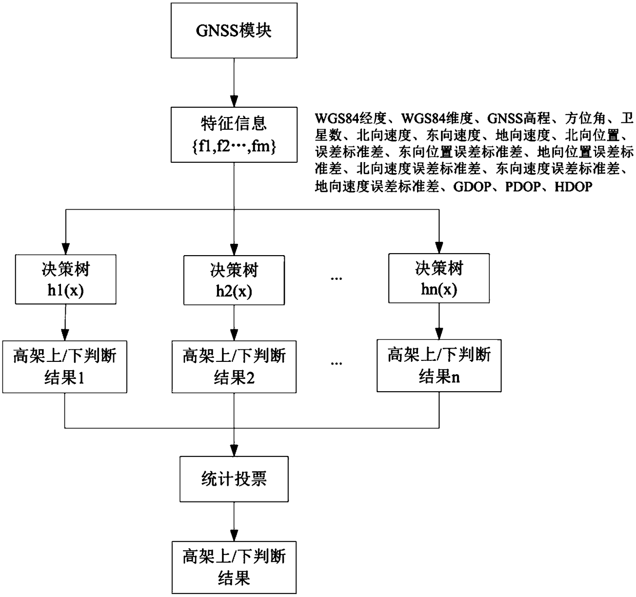
[0034] figure 1 It is a flow chart of the detection method on or under the elevated road based on random forest in the present invention. In the model application stage, the information provided by the GNSS module in the read terminal is used as input features, including WGS84 longitude, WGS84 latitude, GNSS elevation, azimuth, Number of satellites, north speed, east speed, ground speed, north position error standard deviation, east position error standard deviation, ground position error standard deviation, north speed error standard deviation, east speed error standard deviation, ground speed Error standard deviation, GDOP (Geometric Dilution of Precision, geometric precision factor), PDOP (PositionDilution of Precision, three-dimensional positioning ambiguity), HDOP (Horizontal Dilution of Precision, two-dimensional positioning ambiguity), respectively recorded as the feature {f 1 , f 2 ..., fm}, m=17.

[0035] Import the above features into the random forest model system...

Embodiment 3

[0047] The present invention also provides a detection device for a GNSS terminal on or under the elevated, comprising:

[0048] The GNSS module is used to provide observation data and perform feature extraction to obtain the observation feature value of the GNSS terminal;

[0049] A decision-making result generation module, used to input the observed characteristic value into the random forest model, and the random forest model gives more than one decision-making result according to the observed characteristic value;

[0050] Elevated up / down judgment module, based on the classification of the decision results of GNSS terminals on the elevated or GNSS terminals under the elevated, the decision results accounting for more than 50% are used as a random forest model to give the judgment result of the GNSS terminal on the elevated or under the elevated .

[0051] Preferably, the decision result includes the information that the GNSS terminal is on the elevated or the GNSS termin...


PUM


Abstract

The invention provides a method and device of detecting whether a GNSS (Global Navigation Satellite System) terminal is on or below an overhead road. The method includes the steps: inputting the acquired observation characteristic value of the GNSS terminal into a random forest model, wherein the random forest model gives more than one decision-making result according to the observation characteristic value, classifying the decision-making results according to whether the GNSS terminal is on or below the overhead road, and taking the decision-making result with an occupation proportion greaterthan 50% as a judgment result, about whether the GNSS terminal is on or below the overhead road, given by the random forest model. The method and device of detecting whether a GNSS terminal is on orbelow an overhead road directly utilize the GNSS information, use machine learning to learn the corresponding model according to the signal data in the environments on and below the overhead road, canimprove the accuracy of discriminating on / below condition of the overhead road, do not depend on other sensors, do not need the previous related upgrade / downgrade records, and can be available once the device is started.

Description

technical field [0001] The invention relates to the technical field of intelligent transportation, in particular to a detection method for a GNSS terminal on or under an elevated bridge. Background technique [0002] In order to accurately plan the navigation path in road traffic navigation, it is necessary to accurately obtain the position of the carrier. The general navigation software will use the GNSS (Global Navigation Satellite System) equipment on the terminal for positioning, and integrate inertial devices and map matching However, the above-mentioned equipment and technologies focus on obtaining and improving the plane positioning accuracy, which solves the problem of position acquisition and offset improvement in the plane direction, but the positioning accuracy in the elevation direction is still insufficient. [0003] With the urbanization process of the society, the urban population is gradually increasing, followed by the increasing demand for transportation, s...

Claims


Application Information

Patent Timeline
Patent Type & Authority Applications(China)
IPC IPC(8): G01S19/23
CPCG01S19/23
Inventor 刘克强
Owner QIANXUN SPATIAL INTELLIGENCE INC
Why Eureka
Try Eureka