Obstacle detection and road surface segmentation algorithm based on three-dimensional laser radar

A three-dimensional laser and obstacle detection technology, applied in measurement devices, re-radiation of electromagnetic waves, radio wave measurement systems, etc., can solve the problems of small grid map range, limited running speed, single features, etc., and achieve simple and effective data processing. , improved accuracy, clear segmentation effect

Inactive Publication Date: 2018-11-16
WUHAN UNIV OF TECH
View PDF7 Cites 47 Cited by
  • Summary
  • Abstract
  • Description
  • Claims
  • Application Information

AI Technical Summary

Problems solved by technology

[0003] Kammel et al. [2] proposed a method to detect roads using the maximum height difference in the point cloud in the grid, but the detection accuracy of this method is related to the grid size. Compared with the 3D point cloud data accuracy (0.2cm), the grid accuracy (20cm*20cm) is small, and limited by the running speed, the range of the grid map is small, and a large amount of data is lost
Moosmann et al. [3] segmented point cloud images based on the region growing method to extract road areas. This graph-based segmentation algorithm has high precision and can handle all radar data, but the feature is single, easily disturbed by noise, and the algorithm is less robust. Difference

Method used


Image

  • Obstacle detection and road surface segmentation algorithm based on three-dimensional laser radar
  • Obstacle detection and road surface segmentation algorithm based on three-dimensional laser radar
  • Obstacle detection and road surface segmentation algorithm based on three-dimensional laser radar

Examples


Embodiment Construction

[0059] In order to make the object, technical solution and advantages of the present invention clearer, the present invention will be further described in detail below in conjunction with the accompanying drawings and embodiments. It should be understood that the specific embodiments described here are only used to explain the present invention, not to limit the present invention.

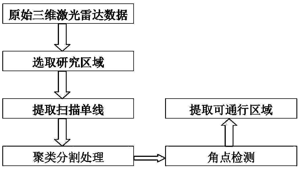
[0060] The obstacle detection and road surface segmentation algorithm based on three-dimensional laser radar of the present invention comprises the following steps:

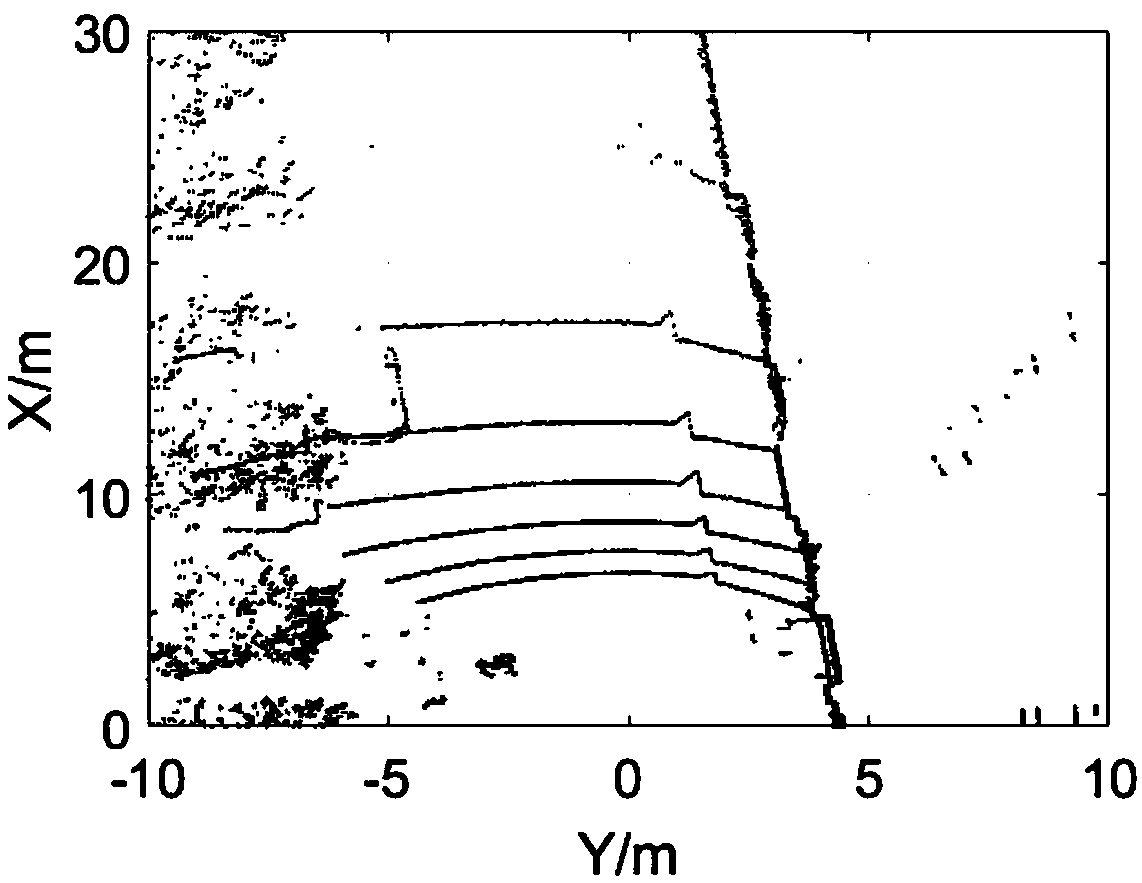
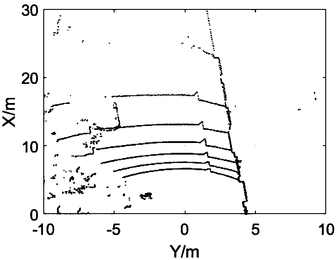
[0061] Step 1: The 3D lidar scans the surrounding environment, obtains the point cloud data of the surrounding environment, and converts the point cloud data from the lidar coordinate system to the local Cartesian coordinate system after correction;

[0062] Step 2: Extracting three-dimensional lidar interest data points from the point cloud data, the interest data points refer to the point cloud data in front of the vehicle, specific...


PUM


Abstract

The invention discloses an obstacle detection and road surface segmentation algorithm based on a three-dimensional laser radar, and the algorithm comprises the steps: (1), scanning the surrounding environment through the three-dimensional laser radar to obtain the point cloud information of the surrounding environment, and transforming the point cloud information to a local right-angle coordinatesystem from the coordinate system of the laser radar; (2), extracting an interest data point of the three-dimensional laser radar; (3), extracting a laser radar scanning single line through a radar detection angle clustering method; (4), segmenting the laser radar scanning single line through neighborhood fuzzy clustering based on AIC criterion; (5), accurately locating a road edge and a road surface line end point through corner detection. Compared with the prior art, the method can achieve the real-time and effective extraction of a passable region of a road surface, is high in precision andreliability, is small in judgment error in a recognition process, and can be widely used for an actual occasion of the extraction of the passable region of a structured road based on the three-dimensional laser radar.

Description

technical field [0001] The invention relates to the field of unmanned driving technology, in particular to an obstacle detection and road surface segmentation method based on three-dimensional laser radar. Background technique [0002] Perceiving the three-dimensional environment is an important task in the research process of unmanned vehicles. According to the detection method, it can be divided into obstacle detection based on laser radar, obstacle detection based on color machine vision, obstacle detection based on stereo vision, and obstacle detection based on millimeter wave or ultrasonic radar [1] . Since laser radar is used as a sensor, it has the advantages of high detection accuracy and fast response speed. The present invention uses Velodyne 16-line laser radar to detect obstacles and extract passable areas. [0003] Kammel et al. [2] proposed a method to detect roads using the maximum height difference in the point cloud in the grid, but the detection accuracy ...

Claims


Application Information

Patent Timeline
Patent Type & Authority Applications(China)
IPC IPC(8): G01S17/89G01S17/93G01S7/48
CPCG01S7/48G01S17/89G01S17/931
Inventor 邹斌王磊董富颜伏伍
Owner WUHAN UNIV OF TECH
Why Eureka
Try Eureka