Fast raster-vector conversion method of remote sensing images
A remote sensing image and raster technology, applied in the field of raster to vector, can solve the problems of slow conversion speed, inability to fully utilize multi-core processors or cluster performance, etc., achieve the effect of increasing conversion speed, reducing calculation amount, and accelerating conversion speed
- Summary
- Abstract
- Description
- Claims
- Application Information
AI Technical Summary
Problems solved by technology
Method used
Image

Examples
Embodiment Construction
[0018] The present invention will be further described in detail below in conjunction with the accompanying drawings and specific embodiments.
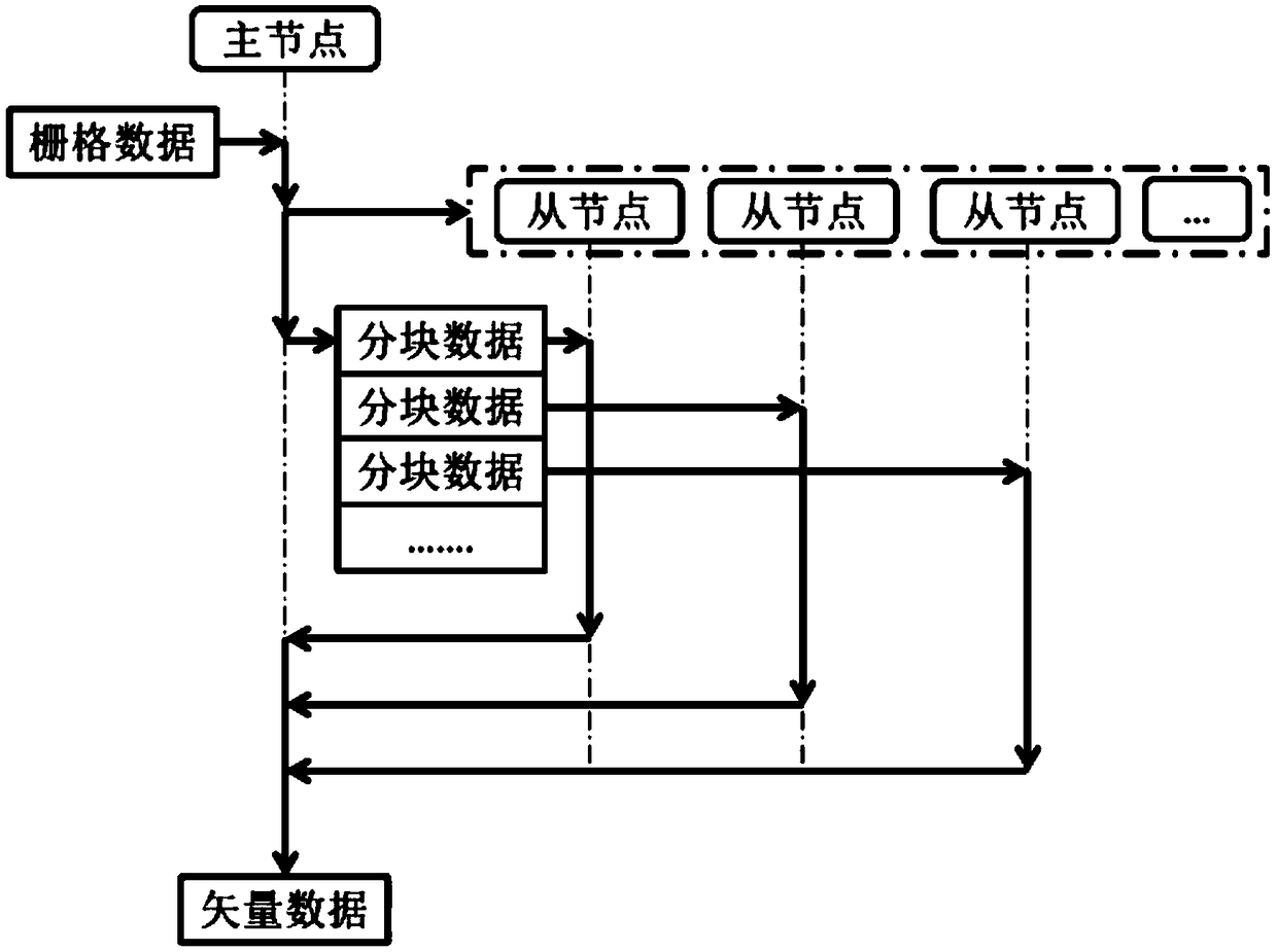
[0019] Such as figure 1 A fast raster-to-vector method for remote sensing images is shown, that is, by starting multiple nodes to process the image to be converted, the master node is responsible for splitting the image, creating a processing task, starting the slave node and sending the task to The slave nodes process, and the slave nodes return the processed results to the master node for merging.
[0020] The overall steps are as follows:
[0021] Step 1. Start the master node, split the image to be processed, and divide the image into small blocks of 1024×1024 pixels. You only need to record the split information, and there is no need to actually split it;
[0022] Step 2. Create processing tasks with the split image information, and each task corresponds to a piece of image data;
[0023] Step 3. The master node starts the sub...
PUM
 Abstract
Description
Claims
Application Information
 - Generate Ideas
- Intellectual Property
- Life Sciences
- Materials
- Tech Scout
- Unparalleled Data Quality
- Higher Quality Content
- 60% Fewer Hallucinations
Browse by: Latest US Patents, China's latest patents, Technical Efficacy Thesaurus, Application Domain, Technology Topic, Popular Technical Reports.
© 2025 PatSnap. All rights reserved.Legal|Privacy policy|Modern Slavery Act Transparency Statement|Sitemap|About US| Contact US: help@patsnap.com