method and a system for retrieving forest stock volume based on high-score satellite remote sensing data made in China

A high-resolution satellite and remote sensing data technology, applied in the field of forest stock volume inversion, can solve the problems of low accuracy, affect quantitative analysis of remote sensing images, and poor applicability, and achieve the effect of improving the inversion accuracy.

Pending Publication Date: 2019-02-15
GZH BEIDOU TECH GRP
View PDF5 Cites 11 Cited by
  • Summary
  • Abstract
  • Description
  • Claims
  • Application Information

AI Technical Summary

Problems solved by technology

However, due to problems such as terrain fluctuations and tree crown shadows that will seriously affect various quantitative analyzes of remote sensing images, th

Method used


Image

  • method and a system for retrieving forest stock volume based on high-score satellite remote sensing data made in China
  • method and a system for retrieving forest stock volume based on high-score satellite remote sensing data made in China
  • method and a system for retrieving forest stock volume based on high-score satellite remote sensing data made in China

Examples


Embodiment 1

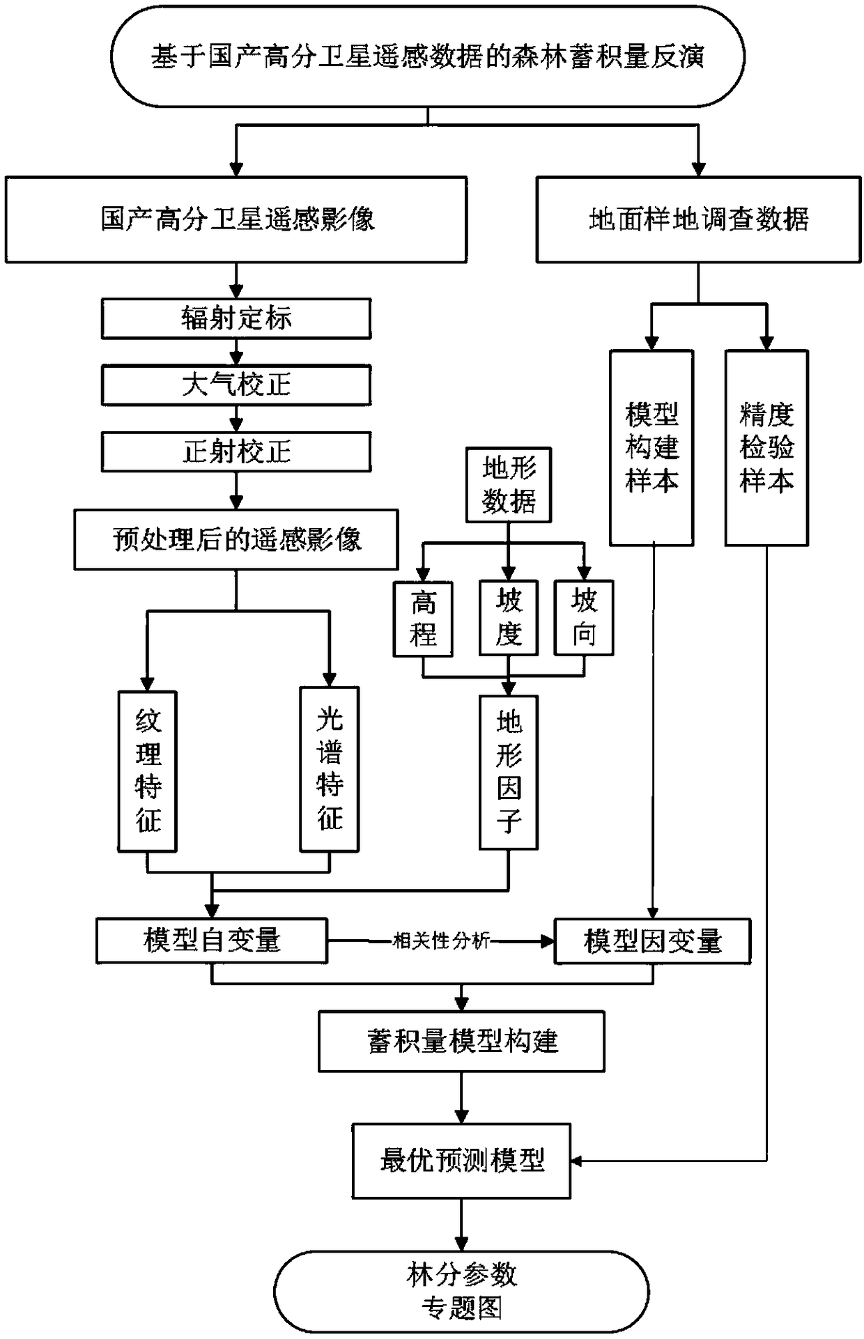
[0041] The implementation example of the present invention is based on the remote sensing data of Gaofen No. 2 to invert the forest volume in the research area, and the technical route refers to figure 1 ,Specific steps are as follows:

[0042] Step a, the volume calculation of the sample plot in the study area, using the calculation formula of the numerical table method according to the ground survey data, to obtain the measured value of the forest volume (SV) of the sample plot.

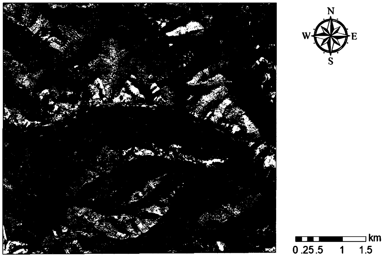
[0043]Step b, image preprocessing, for GF-2 remote sensing images (such as figure 2 ) for preprocessing, including radiometric calibration, atmospheric correction and orthorectification of the image respectively.

[0044] This example completes the radiation calibration of the data in the remote sensing image processing software ENVI5.0 by querying the absolute radiation calibration coefficient of the GF-2 satellite in the "Annual Absolute Radiation Calibration Coefficient of Domestic Land Obser...

Embodiment 2

[0056] During specific implementation, the method provided by the present invention can realize automatic inversion in a modularized manner based on the software system. The example of the present invention also correspondingly proposes a kind of forest volume inversion system based on domestic high-resolution satellite remote sensing data, including the following modules:

[0057] The first module, the acquisition module of the forest volume of the sample plot, uses the numerical table method to calculate the actual measured value of the forest volume of the sample plot;

[0058] The second module, the image preprocessing module, respectively includes radiometric calibration, atmospheric correction and orthorectification of the image, and obtains the preprocessed panchromatic and multispectral remote sensing images;

[0059] The third module, the image texture feature variable selection module, conducts correlation analysis between the panchromatic image texture features of d...


PUM


Abstract

The invention discloses a forest stock inversion method based on the high-score satellite remote sensing data made in China, which adopts a number table method to calculate the measured value of the forest stock in a sample plot. Based on the pretreatment of remote sensing data, the panchromatic texture features and multi-spectral vegetation index features of different windows are extracted. The correlation between the image features and the measured volume is analyzed, and the image features with significant correlation are selected as the variables of the model. The terrain factors of the sample plot are extracted according to the terrain data. Finally, based on the measured data, texture features, spectral features and topographic factors, a forest stock inversion model is constructed.The invention also discloses a forest stock retrieval system based on the high-score satellite remote sensing data made in China. The invention makes full use of the advantages of retrieving forest stock from the high-score satellite remote sensing data made in China, and further improves the precision of the forest stock retrieval.

Description

technical field [0001] The invention relates to the field of forest stock volume inversion, in particular to a forest stock volume inversion method and system based on domestic high-resolution satellite remote sensing data. Background technique [0002] In recent years, China's forest resource monitoring is developing in a large-scale, large-scale, and short-term direction. The traditional forest resource monitoring methods are mainly manual field surveys, which are time-consuming and laborious, and are not conducive to large-scale or large-scale acquisition. Adapt to the needs of forestry production and ecological construction under the new situation. In recent years, remote sensing technology has been widely used in the research of forest composition and the rapid extraction of forest stand parameters due to its advantages of wide monitoring range, fast data collection, and cost saving. Strong technical support provides new technical means for forest management. [0003]...

Claims


Application Information

Patent Timeline
IPC IPC(8): G06F17/50
CPCG06F30/20
Inventor 谢士琴汪泽民吴嗣亮
Owner GZH BEIDOU TECH GRP
Why Eureka
Try Eureka