Laneway patrolling unmanned aerial vehicle system based on machine vision and navigation method

A technology of machine vision and navigation methods, applied in the field of navigation, can solve problems such as complex base station layout, time-consuming, and complex algorithms

Active Publication Date: 2019-05-14
CHINA COAL RES INST +1
View PDF6 Cites 15 Cited by
  • Summary
  • Abstract
  • Description
  • Claims
  • Application Information

AI Technical Summary

Problems solved by technology

However, the above method is not easy to implement in the mine roadway, and there are problems such as complex base station...

Method used


Image

  • Laneway patrolling unmanned aerial vehicle system based on machine vision and navigation method
  • Laneway patrolling unmanned aerial vehicle system based on machine vision and navigation method
  • Laneway patrolling unmanned aerial vehicle system based on machine vision and navigation method

Examples


Embodiment Construction

[0041] The present invention will be further described below in conjunction with the accompanying drawings. The following examples are only used to illustrate the technical solutions of the present invention more clearly, but not to limit the protection scope of the present invention.

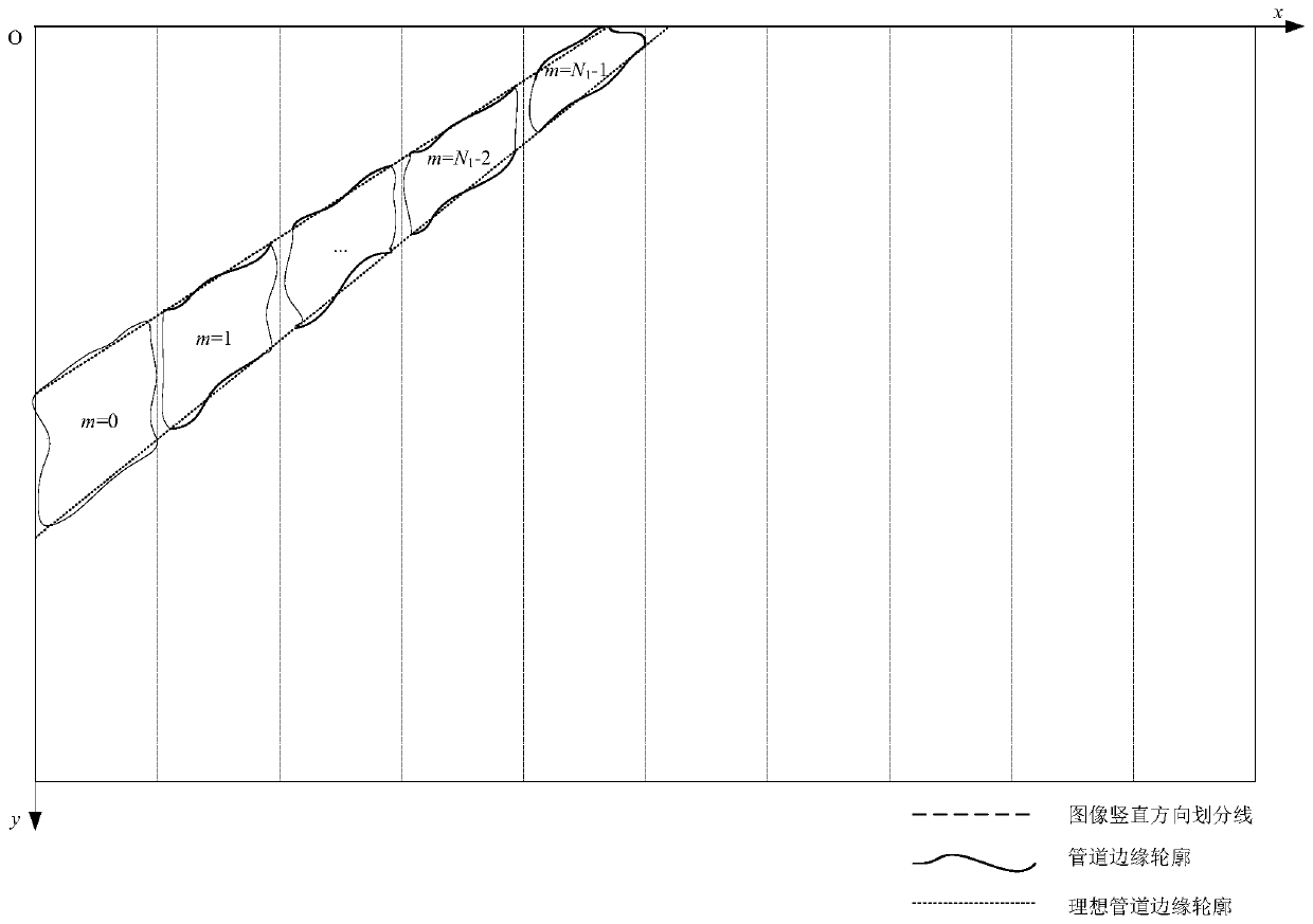
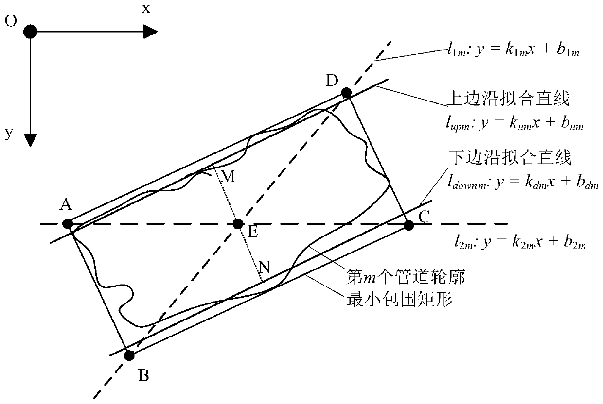
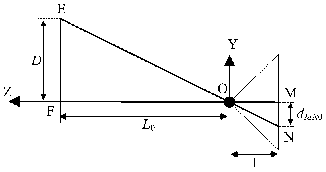
[0042] The roadway inspection UAV system based on machine vision involved in the present invention is that the lithium battery on the UAV carrier provides the power source for the entire system; after power-on, all components are initialized, including UAV IMU initialization and machine The on-board processor starts automatically, etc.; after the initialization is successful, the inspection drone takes off and hovers to a suitable height. The on-board processor processes the images collected by the monocular camera in real time, detects the pipeline in the roadway environment and calculates the yaw angle. Guide drones to carry out inspection work.

[0043] After this patent adopts the vision-ba...


PUM


Abstract

The invention discloses a laneway patrolling unmanned aerial vehicle system based on machine vision and a navigation method. A high quality laneway space image is obtained through adoption of a monocular camera. Pipes in the image are detected and processed through utilization of a machine vision algorithm. Distance from centers of the pipes to an optical center of the camera, and included anglesbetween the centers of the pipes and the optical center of the camera are computed. Yaw angles of a patrolling unmanned aerial vehicle in a laneway are further obtained. The yaw angles are fed back toan unmanned aerial vehicle flight controller for adjustment of a course. The distance from the unmanned aerial vehicle to laneway boundaries and barriers are detected in real time through utilizationof an ultrasonic distance sensor, so the unmanned aerial vehicle is guaranteed to fly in the laneway safely and finish a patrolling task. According to the system and the method, equipment such as a track does not need to be set up in the laneway, so navigation cost of a patrolling robot is remarkably reduced; influence of a laneway environment limited light condition on navigation precision is effectively overcome; computing complexity is low; patrolling timeliness requirement of narrow and closed space such as the laneway can be satisfied; and the system and the method are applicable to navigation and obstacle avoidance of the patrolling unmanned aerial vehicle for detecting dangerous factors in the narrow and closed space such as a mine laneway.

Description

technical field [0001] The invention relates to a roadway inspection unmanned aerial vehicle system and a navigation method based on machine vision, and belongs to the technical field of navigation. Background technique [0002] Daily inspection of dangerous factors such as dangerous gas and water accumulated in the mine roadway is a vital link to ensure mine production and personnel safety. Hazardous gases in roadways usually refer to explosive gases gushing from coal seams and rock formations during the mining of coal or carbonaceous shale non-coal deposits. Its main components are mainly methane, carbon monoxide, hydrogen sulfide, sulfur dioxide and heavy hydrocarbons, etc. The accumulated water in the roadway will make the air humid, making all kinds of underground electrical production equipment prone to rust and lead to short-circuit failure. Therefore, it is very important to conduct daily inspections of potential risk factors in roadways. At present, roadway inspe...

Claims


Application Information

Patent Timeline
IPC IPC(8): G05D1/10G01S15/93G01C11/04G01C11/02
Inventor 程健郭雪亮郭一楠安鸿波陈亮李会军
Owner CHINA COAL RES INST
Why Eureka
Try Eureka