

Airborne photoelectric high-precision passive positioning method suitable for sea surface target
A passive positioning, high-precision technology, applied in ground navigation, navigation through speed/acceleration measurement, navigation and other directions, can solve problems such as large application limitations, achieve small application limitations, reduce weight, positioning design and implementation simple method effect
- Summary
- Abstract
- Description
- Claims
- Application Information
AI Technical Summary
Problems solved by technology
Method used
Image

Examples
Embodiment Construction
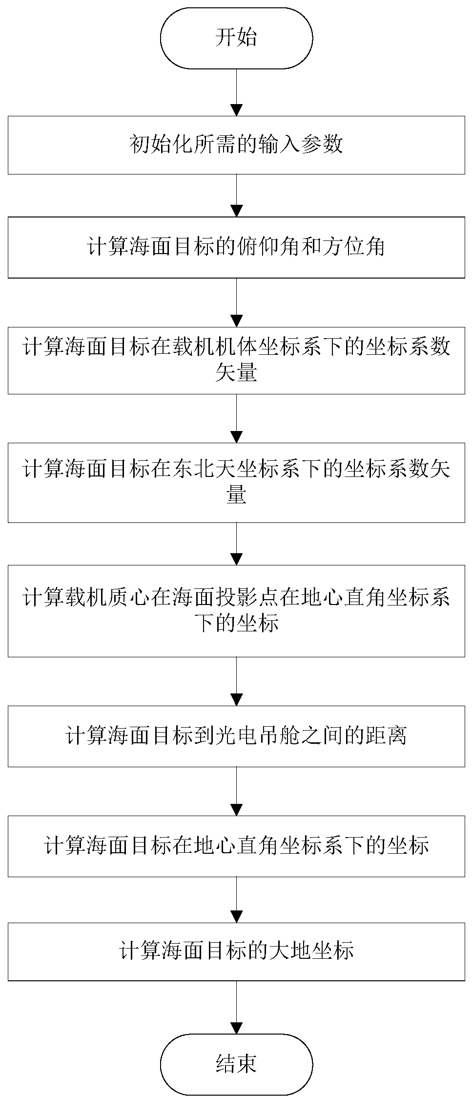
[0020] Embodiments of the present invention are described in detail below, and the embodiments are exemplary and intended to explain the present invention, but should not be construed as limiting the present invention.
[0021] The invention provides an airborne photoelectric high-precision passive positioning method suitable for sea targets, comprising the following steps:
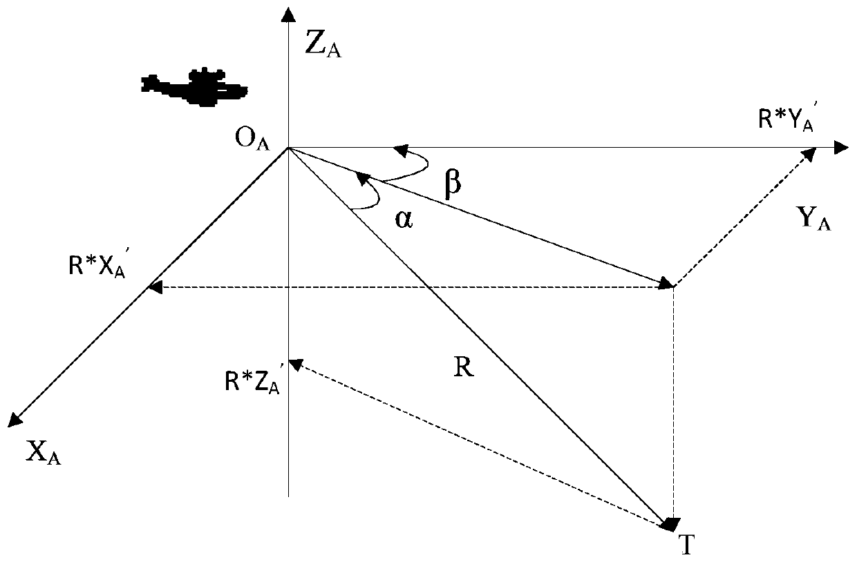
[0022] 1) Input parameters required for initialization, including aircraft longitude L, aircraft latitude B, aircraft altitude H, aircraft true heading θ, aircraft pitch angle ε, aircraft roll angle γ, photoelectric pod aiming line azimuth Corner T x , Elevation angle T of the aiming line of the photoelectric pod y , target horizontal pixel deviation σ x , target vertical pixel deviation σ y , video image horizontal resolution R x , Video image vertical resolution R y , Video image horizontal field of view V x , Video image vertical viewing angle V y .
[0023] 2) Calculate the pitch angle α of th...
PUM
 Abstract
Description
Claims
Application Information