Remote-sensing image building change detection method
A technology of change detection and remote sensing images, which is applied in the field of remote sensing image processing, can solve the problems of manual participation, etc., and achieve the effects of improving detection accuracy, reducing manpower burden, and good detection performance
- Summary
- Abstract
- Description
- Claims
- Application Information
AI Technical Summary
Problems solved by technology
Method used
Image
Examples
Embodiment Construction
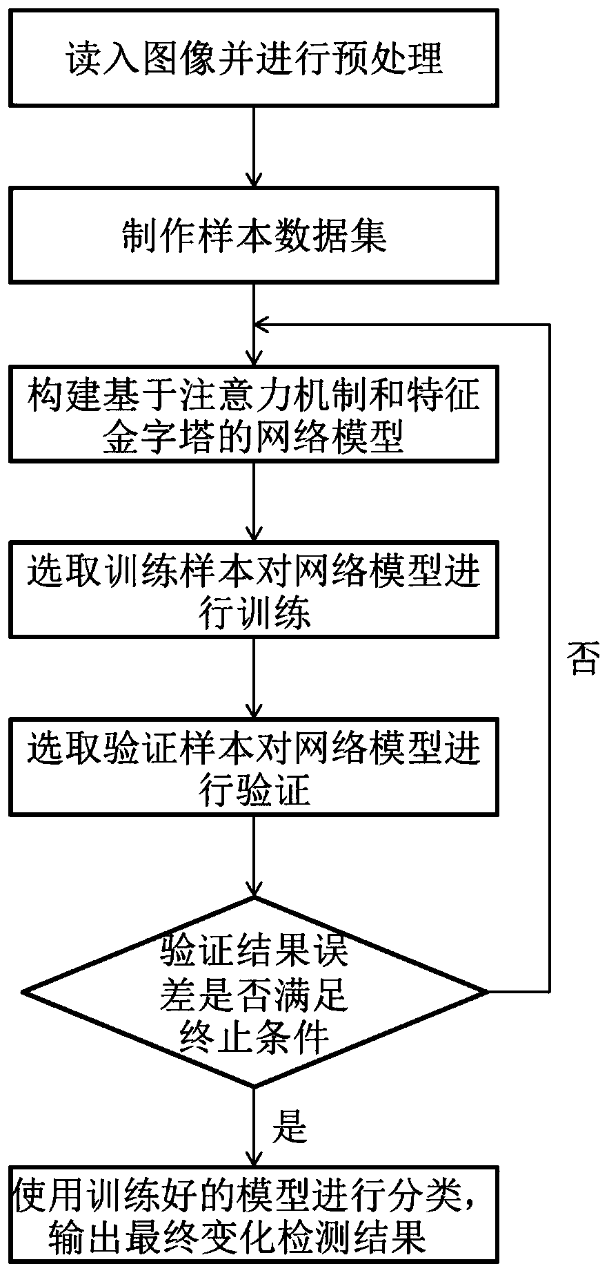
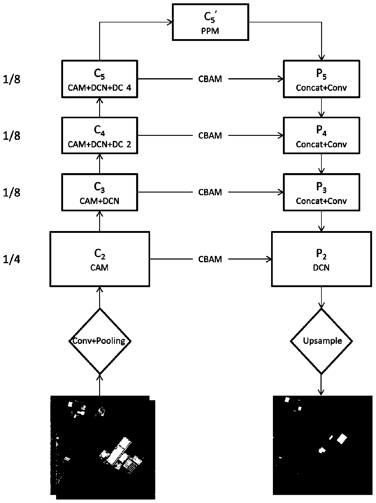
[0039] In order to better illustrate a method for detecting building changes in remote sensing images based on an attention mechanism and a feature pyramid network involved in the present invention, the present invention will be described in further detail below in conjunction with the accompanying drawings and specific embodiments:
[0040] Step 1, read in the image and preprocess it.
[0041] First, select the high-resolution remote sensing image T of the same area in two phases 1 and T 2 , including three channels of R, G, and B. The specific selection principle: select data taken in different years, similar dates, and climate and meteorological conditions, with consistent spatial resolution, and use the same preprocessing method to eliminate geometric and radiation differences. non-significant change.
[0042] Secondly, using the RPC Orthorectification Workflow process tool in the ENVI software, combined with the known high-resolution satellite remote sensing image RPC p...
PUM
 Abstract
Description
Claims
Application Information
 - R&D
- Intellectual Property
- Life Sciences
- Materials
- Tech Scout
- Unparalleled Data Quality
- Higher Quality Content
- 60% Fewer Hallucinations
Browse by: Latest US Patents, China's latest patents, Technical Efficacy Thesaurus, Application Domain, Technology Topic, Popular Technical Reports.
© 2025 PatSnap. All rights reserved.Legal|Privacy policy|Modern Slavery Act Transparency Statement|Sitemap|About US| Contact US: help@patsnap.com


