

Method for constructing three-dimensional terrain scene model of road
A technology of scene model and road 3D, applied in 3D modeling, structured data retrieval, geographic information database, etc., can solve the problems of high cost and low accuracy of terrain model, save time and labor cost, low cost, convenient Effects of disaster simulation
- Summary
- Abstract
- Description
- Claims
- Application Information
AI Technical Summary
Problems solved by technology
Method used
Image

Examples
Embodiment
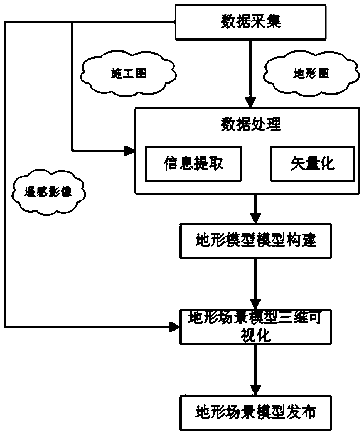
[0049] Such as Figure 1-Figure 4 As shown, a method for constructing a road three-dimensional terrain scene model includes the following steps:
[0050] (1) Data collection.
[0051] Data collection is the primary task of establishing a highway digital terrain model, including the collection of terrain data along the highway, the collection of tunnel and roadbed engineering drawings, and the collection of remote sensing image maps.
[0052] Topographic data is mainly a two-dimensional topographic map represented by contour lines. Engineering drawings of tunnels and subgrades should include cross-section data, longitudinal section data, and horizontal curve information of the center line. Topographic maps and engineering drawings are provided by relevant departments.
[0053] The remote sensing image map uses the map download software to download the image map of the corresponding area through four-point coordinates, etc., and saves it as a tiff format image. At this point, t...
PUM
 Abstract
Description
Claims
Application Information