

Bottom-up-based urban motor vehicle emission list compilation technical method and system
A bottom-up, motor vehicle technology, applied in the field of urban motor vehicle emission inventory compilation system, can solve problems such as the inability to reflect road traffic emissions, and achieve the effect of improving accuracy
- Summary
- Abstract
- Description
- Claims
- Application Information
AI Technical Summary
Problems solved by technology
Method used
Image

Examples
Embodiment 1
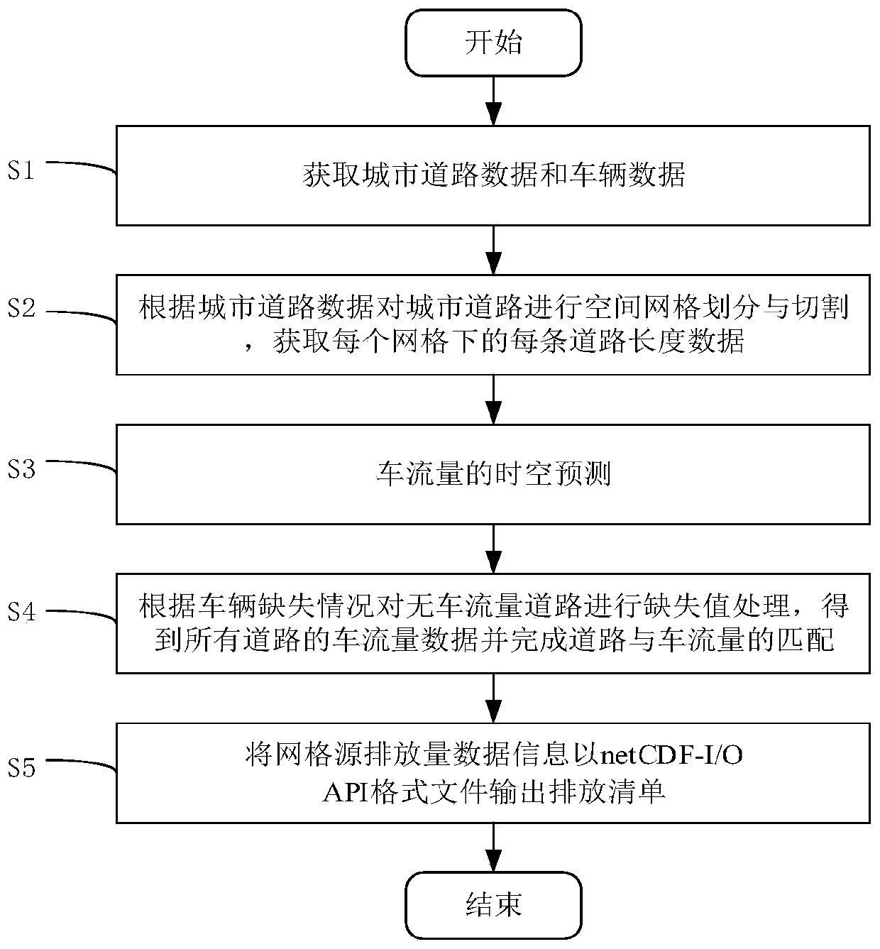
[0055] Such as figure 1 As shown, the technical method based on bottom-up urban motor vehicle emission inventory preparation includes the following steps:
[0056] S1: Obtain urban road data and vehicle data;
[0057] S2: Carry out spatial grid division and cutting of urban roads according to urban road data, and obtain the length data of each road under each grid;
[0058] S3: Spatio-temporal prediction of traffic flow;
[0059] S4: Carry out missing value processing on roads with no traffic flow according to the lack of vehicles, obtain the traffic flow data of all roads and complete the matching of roads and traffic flow;
[0060] S5: Export the grid source emission data information to the netCDF-I / O API format file to output the emission inventory.
[0061] In the specific implementation process, if the traffic volume on the road is not missing, step S3 is directly skipped to perform the matching of the road and the traffic volume.
[0062] In the specific implementati...
Embodiment 2
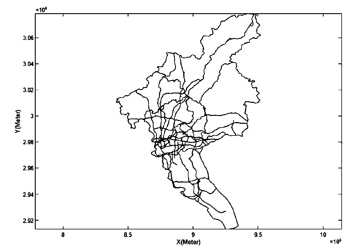
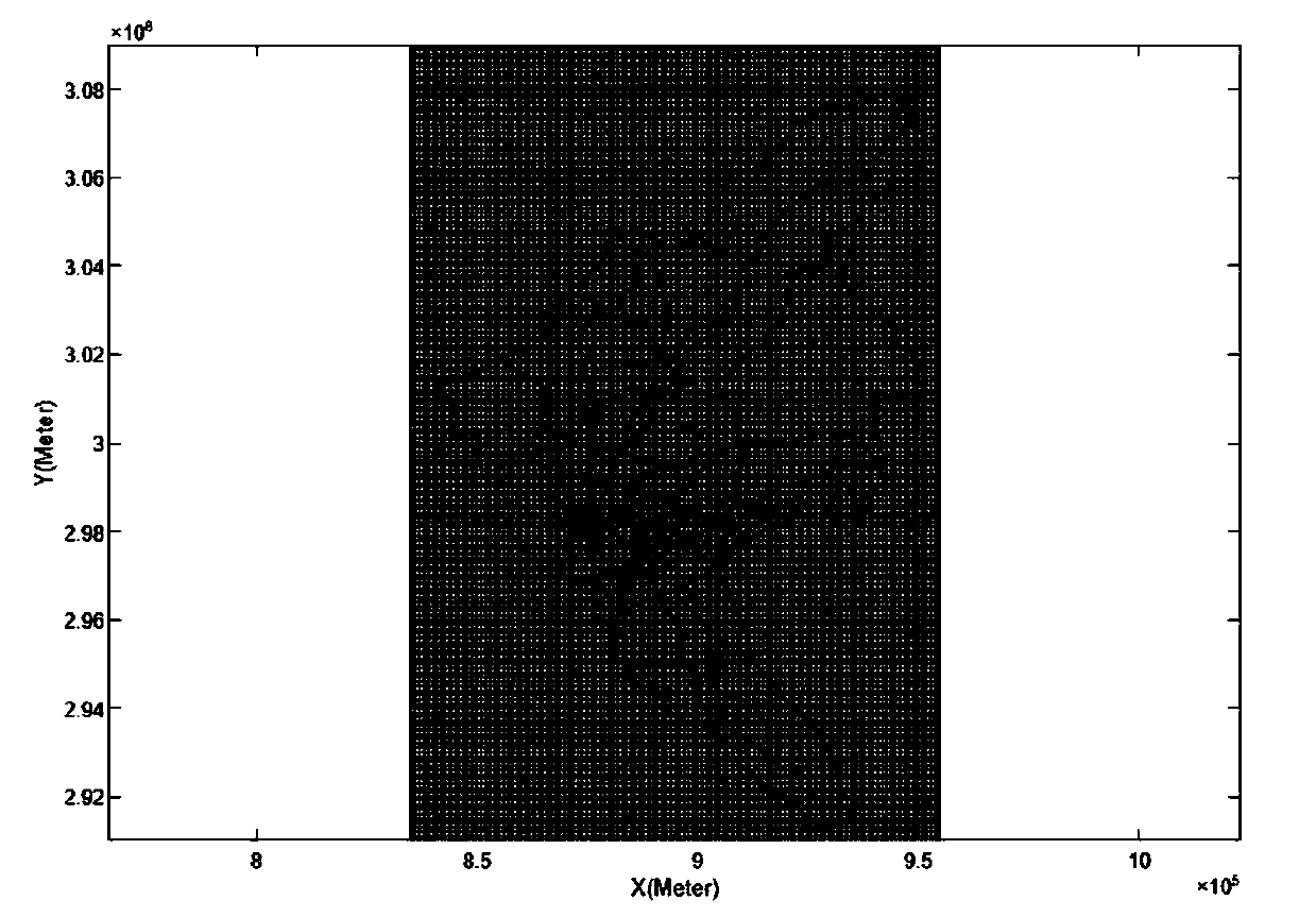
[0081] More specifically, on the basis of Embodiment 1, Guangzhou City is taken as an example to further describe the method provided in the embodiment of the present invention. Such as figure 2 , image 3 As shown, the GIS boundary map and road network map of Guangzhou are collected, and the coordinate system adopts Lambert projection. Among them, the GIS boundary map of Guangzhou contains 11 districts, namely Yuexiu District, Liwan District, Haizhu District, Tianhe District, Baiyun District, Huangpu District, Panyu District, Huadu District, Nansha District, Zengcheng District, and Conghua District.
[0082] In the specific implementation process, the Guangzhou road network map selects three types of roads: expressway, expressway and national highway. Among them, it is assumed that the expressway and expressway in Guangzhou are all two-way six-lane, and the national highway is two-way four-lane.
[0083] In the specific implementation process, in terms of the classificatio...
Embodiment 3
[0094] More specifically, the system based on the bottom-up technical method of urban motor vehicle emission inventory compilation includes basic data management module, grid division module, vehicle flow matching module, emission calculation module and result display module; among them:
[0095] The basic data management module is used to obtain urban road data and vehicle data, and manage related data;
[0096] The grid division module is used to divide and cut urban roads into spatial grids, and obtain the total length of roads under each grid;
[0097] The traffic flow matching module is used to ensure that there is a corresponding traffic flow on each road in the space-time dimension, and in the time dimension, the missing value processing is carried out on the road without traffic flow, and in the space dimension, a BP neural network model is constructed, Predict the absence of vehicles on roads with no traffic flow, and then complete the matching of roads and traffic fl...
PUM
 Abstract
Description
Claims
Application Information