
A multi-physics field collaborative water inrush monitoring method

A multi-physics field and water inrush technology, applied in the field of comprehensive geophysical exploration, can solve problems such as missed detection and false alarms, and achieve the effects of preventing abnormal alarms, preventing safety accidents, and improving accuracy

Active Publication Date: 2021-07-09
ANHUI HUIZHOU GEOLOGY SECURITY INST
View PDF7 Cites 2 Cited by
  • Summary
  • Abstract
  • Description
  • Claims
  • Application Information

AI Technical Summary

Problems solved by technology

[0007] The technical problem to be solved by the present invention is to provide a method for comprehensive warning of water inrush in the surrounding space of the construction area based on the three-dimensional space natural field, so as to solve the problem of missed detection and false alarm in the prior art

Method used


Image

  • A multi-physics field collaborative water inrush monitoring method
  • A multi-physics field collaborative water inrush monitoring method
  • A multi-physics field collaborative water inrush monitoring method

Examples


Embodiment 1

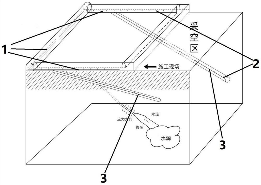
[0037] Such as figure 1As shown, the present embodiment provides a multi-block monitoring system based on multi-physical field, which is applied to the inherst water warning of the underground coal mine back surface, in order to reduce the input of hardware laying and data processing, the line is set. It also needs to determine the location and watering of the water storage space in advance before, and can arrange the sensor along the roadway and working surface, and the elastic wave field of the entire construction area, transient electromagnetic field and electric field data, and determine the monitoring based on comprehensive physical probe analysis technology. Region, specifically, the seismic wave field is found and the bottom plate is constructed such as a fault, the development of the column, etc., thereby finding the water storage space in the current space, and then obtaining the bottom plate of the acquired area by transient electromagnetic field and electric field. To d...

Embodiment 2

[0064] The present embodiment is a multi-physical field ausheater monitoring system for traffic tunnels, including microseismic signal line and electromagnetic signal lines set in both sides of the tunnel, and determine the water through the previous data acquisition and analysis. The water storage space is above the tunnel. Two drilling holes are also taken on the tunnel top plate according to the orientation of the determined water storage space, and a natural electric field potential signal line is arranged, and the sensor interval on the natural electric field potential signal is respectively. The same is 2 meters, the masking principle of the above system is identical to the embodiment, and details are not described herein again.

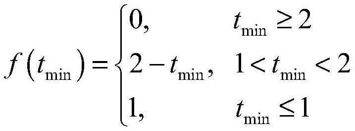
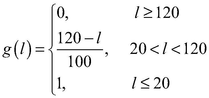
[0065] The method predicted in this embodiment is the same as that of the example, but the acceleration of adjacent time periods is considered when the predictive matter time is predicted.

[0066] The water tide speed of T1 to T2 is:

[0067] T2 t...


PUM


Abstract

The invention provides a multi-physical field coordinated water inrush monitoring method. If there is a sensor that exceeds the natural electric field potential threshold, and the natural electric field potential of the sensor changes continuously, and the sensors at adjacent positions change synchronously, the electric field gradient extreme value point is obtained. , if the position of the gradient extreme point and the signal source position of the abnormal electromagnetic radiation signal and the abnormal microseismic signal are all within the risk distance, there is a risk of water inrush in the current space; if there is a sensor that exceeds the threshold of the natural electric field potential change rate, the specific For the electric field data within a period, if the natural electric field potential changes continuously and the sensors in adjacent positions change synchronously, there is a risk of water inrush in the current space. The present invention has the advantages of comprehensively judging whether there is a risk of water inrush based on the change of the natural electric field potential and the changes of the elastic wave field and the electromagnetic radiation field, thereby improving the accuracy of the judgment and preventing the situation of missing reports.

Description

Technical field [0001] The present invention relates to the field of integrated geophysical exploration techniques, and more particularly to a multi-block monitoring method of multi-physics. Background technique [0002] The accident caused by the in underground projects seriously threatens normal construction safety, and even threatens the safety of workers; the formation of underground engineering surgery must have the following conditions: there must be a water source, water-saving channel development, affected by construction The fracture channel is further expanded, and finally formed a matter. In the formation process, there is generally experienced several stages: the first stage is the elastic change stage, the shape is the coal rock stress change, there is electromagnetic radiation phenomenon; the second stage is the stage of plastic change, and it is shown as a microbe-like emission; third At the stage, seepage flow is formed in the water guide channel, which is manifes...

Claims


Application Information

Patent Timeline
Patent Type & Authority Patents(China)
IPC IPC(8): E21F17/18G01V3/00G01V1/28
CPCE21F17/18G01V1/288G01V3/00Y02A90/30
Inventor 李纯阳倪圣军王宗涛李飞赵耀王来格黄飞龙张立好
Owner ANHUI HUIZHOU GEOLOGY SECURITY INST
Learn More