Minisatellite splicing imaging ground simulation system

A ground simulation and imaging technology, applied in the field of small satellite remote sensing simulation imaging, to achieve the effect of strong reliability, high flexibility and high accuracy

Active Publication Date: 2020-04-28
CHANGCHUN INST OF OPTICS FINE MECHANICS & PHYSICS CHINESE ACAD OF SCI
View PDF6 Cites 4 Cited by
  • Summary
  • Abstract
  • Description
  • Claims
  • Application Information

AI Technical Summary

Problems solved by technology

[0005] In order to solve the problem that there is an urgent need for a common ground simulation test equipment for in-orbit mosaic imaging of small satellites, the present invention provides a ground simulation system for mosaic imaging of small satellites

Method used


Image

  • Minisatellite splicing imaging ground simulation system
  • Minisatellite splicing imaging ground simulation system
  • Minisatellite splicing imaging ground simulation system

Examples


Embodiment Construction

[0028] The present invention will be described in further detail below in conjunction with the accompanying drawings and embodiments.

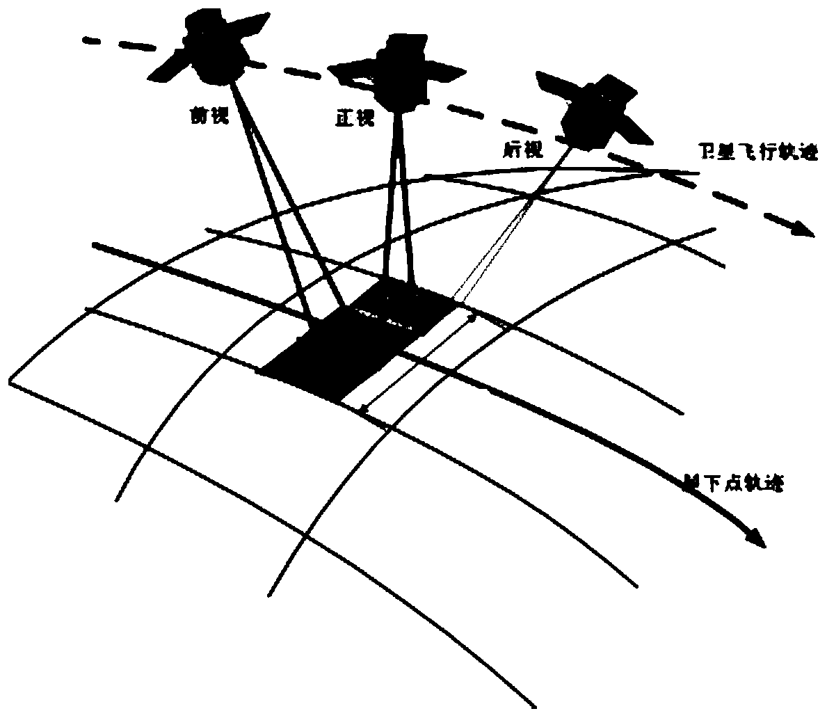
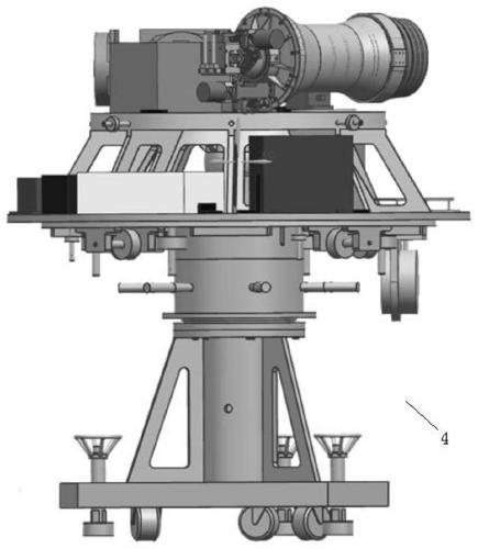
[0029] The invention relates to a ground simulation system for splicing and imaging of small satellites. According to the on-orbit imaging process of small satellites, corresponding proportional mapping is performed on imaging physical quantities to build a ground simulation imaging simulation system. The process of small satellite in-orbit imaging mosaic imaging is as follows: figure 1 As shown in Fig. 1 , the small satellite images the sub-satellite point trajectory along the flight trajectory, and splices the front-view, front-view and rear-view imaging images. A ground simulation system for mosaic imaging of small satellites, the system includes an air floating platform 4 , a camera imaging unit, a moving guide rail and a target unit 8 . The camera imaging unit is set on the high-precision air bearing platform 4, and the target unit 8 is ...


PUM


Abstract

A minisatellite splicing imaging ground simulation system relates to the technical field of minisatellite remote sensing simulation imaging, solves the problem that general ground simulation test equipment for minisatellite on-orbit splicing imaging is needed urgently, and comprises an air floating platform, a camera imaging unit, a moving guide rail and a target unit; the camera imaging unit is arranged on the air floating platform, and the target unit is arranged on the moving guide rail; the air floating platform simulates the space working environment of the small satellite camera imagingunit, the target unit can move up and down and left and right on the moving guide rail, an image can be displayed on the target unit, the displayed image can move left and right, and the camera imaging unit images the target unit. The system is easy to operate, high in accuracy, high in reliability and high in flexibility, small satellite splicing imaging ground simulation is achieved, universality is achieved for small satellite on-orbit splicing imaging ground simulation, and meanwhile the application field of the air floating platform is expanded.

Description

technical field [0001] The invention relates to the technical field of small satellite remote sensing simulation imaging, in particular to a small satellite mosaic imaging ground simulation system. Background technique [0002] On-orbit remote sensing satellites obtain ground observation target information through space-borne cameras, which have the advantages of long earth observation time and stable imaging, and are widely used in many fields such as weather forecasting, environmental protection, resource exploration, near-Earth observation, and military reconnaissance. The observation range of remote sensing satellites for ground target imaging has a great relationship with the imaging mode. For general static imaging, only one push-broom along the track is performed to obtain images of a certain width. Large observation range, therefore, in order to obtain remote sensing images of a larger target area in the vertical direction, the target area can be repeatedly pushed an...

Claims


Application Information

Patent Timeline
Patent Type & Authority Applications(China)
IPC IPC(8): G06F30/20G06T3/40
CPCG06T3/4038
Inventor 常琳陈高杰杨秀彬徐伟黎艳博岳炜
Owner CHANGCHUN INST OF OPTICS FINE MECHANICS & PHYSICS CHINESE ACAD OF SCI
Why Eureka
Try Eureka