
Simulation satellite cloud atlas generation method based on generative adversarial network and numerical model product

A satellite cloud image and numerical model technology, applied in the field of meteorology, can solve the problems of poor simulation effect at the initial forecast time, a large number of computing resources, and the inability to simulate the visible light channel of the satellite cloud image, so as to achieve easy deployment and application and low computing resources. Effect

Active Publication Date: 2020-05-29
中国人民解放军空军研究院战场环境研究所
View PDF15 Cites 7 Cited by
  • Summary
  • Abstract
  • Description
  • Claims
  • Application Information

AI Technical Summary

Problems solved by technology

[0003] In the prior art method, the radiation brightness temperature can be calculated through the radiation transfer mode (RTTOV mode or CRTM mode, etc.), so as to generate the simulated satellite cloud image of the infrared channel. There are certain deficiencies and defects in this method, specifically as follows: (a ), cannot simulate the visible light channel of satellite cloud image
Since the simulation method based on the radiation transfer mode can only calculate the radiation brightness temperature, it can only simulate the infrared channel data of the cloud image, but cannot calculate the albedo data of the visible light channel, so it cannot simulate the visible light channel of the satellite cloud image; (2) Initial forecast Time simulation is not good
The method based on the radiation transfer model needs to go through a start-up process to obtain a stable output. In actual use, the products of the general model are basically usable after 6 hours of the initial prediction time; (3), the basic input data required by the radiation transfer model There are many categories and corresponding height layers, and multiple relevant time-time boundary layer data are required, which have high requirements for input data conditions; (4), the calculation process of the radiative transfer model requires a large amount of computing resources. It is generally difficult to meet the requirements of computing resource conditions in the actual business work of the station

Method used


Image

  • Simulation satellite cloud atlas generation method based on generative adversarial network and numerical model product
  • Simulation satellite cloud atlas generation method based on generative adversarial network and numerical model product
  • Simulation satellite cloud atlas generation method based on generative adversarial network and numerical model product

Examples


Embodiment 1

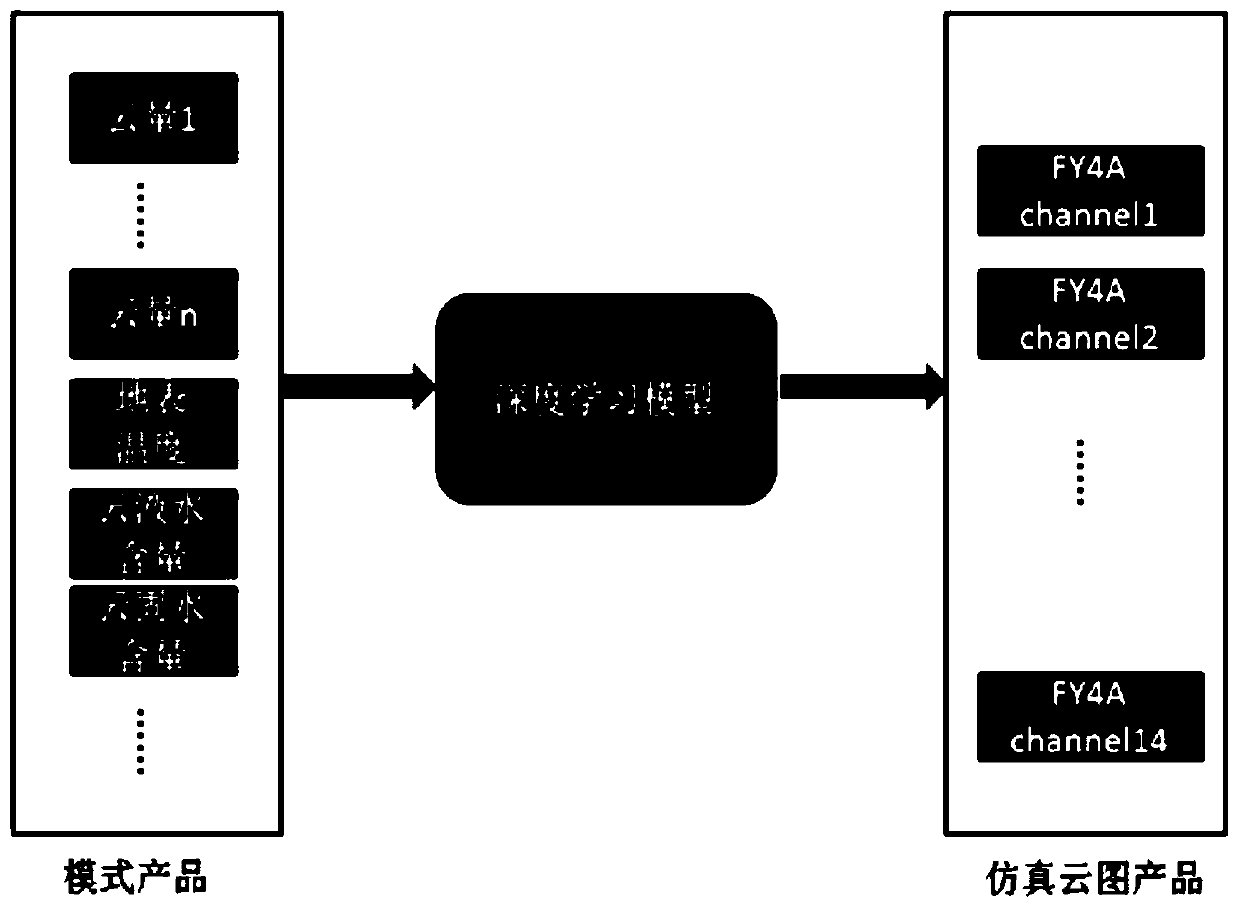
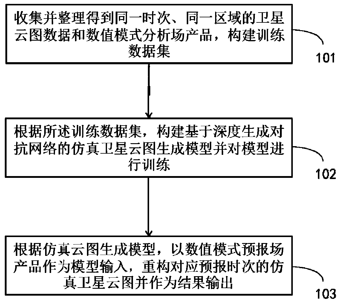
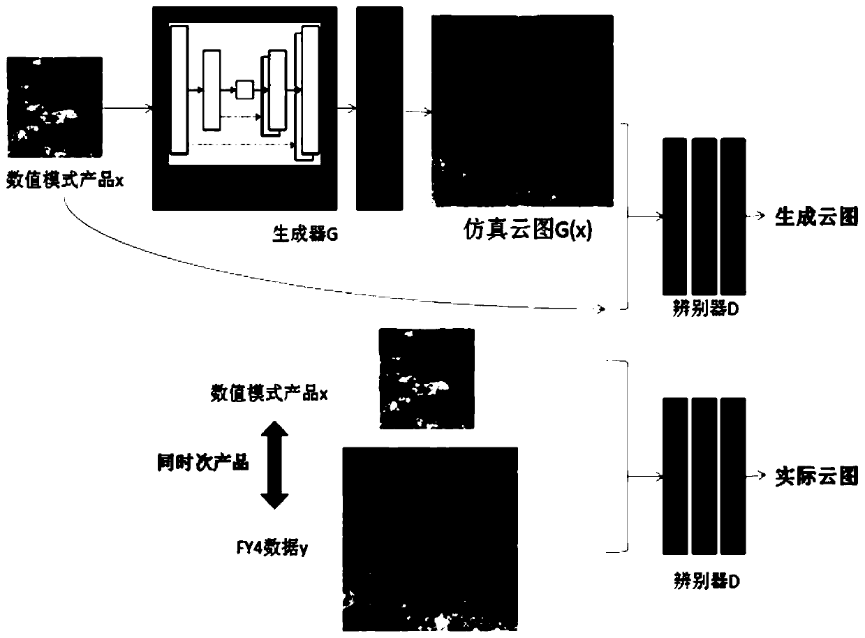
[0059] Step 101, collecting and sorting historical numerical model products (products of numerical model analysis field) and satellite cloud image data at the same time and in the same area to construct a paired training data set.

[0060] The selected numerical model products are the reanalysis field products with a resolution of 0.25×0.25° in the fine-grid numerical weather forecast products provided by the European Center for Medium-Range Weather Forecasting and the products with a resolution of 4 km from the Fengyun 4A (FY-4A) geostationary meteorological satellite. The coverage of selected products is from 10°N to 50°N, and from 110°E to 150°E. Since the data acquisition of the FY-4A geostationary meteorological satellite started in April 2018, the training data selected hourly data from April 1 to July 20, 2018, totaling more than 2,500 hours of data.

[0061] (1) FY-4A satellite data

[0062] The FY-4A geostationary meteorological satellite is the first satellite of my...


PUM


Abstract

The invention provides a simulation satellite cloud atlas generation method based on a generative adversarial network and a numerical model product, and the method comprises the steps: collecting andarranging satellite cloud atlas data and a numerical model analysis field product at the same time and in the same region, and constructing a training data set; constructing a simulation satellite cloud picture generation model based on a deep generative adversarial network according to the training data set, and training the model; and according to the simulation satellite cloud picture generation model, reconstructing a simulation satellite cloud picture corresponding to the forecast time by taking the numerical model forecast field product as model input, and outputting the simulation satellite cloud picture as a result. According to the invention, the purpose of generating the simulation satellite cloud atlas by the numerical model product is achieved.

Description

technical field [0001] The invention belongs to the technical field of meteorology, and relates to a method for generating a simulated satellite cloud image, in particular to a method for generating a simulated satellite cloud image based on a generative confrontation network (GAN) and numerical model products. Background technique [0002] With the rapid development of satellite remote sensing technology, satellite cloud images play an increasingly important role in weather analysis and forecasting. Satellite cloud images can be used to analyze cloud system structures and their activity patterns at different scales, and cloud image data are intuitive and easy to understand. Important information for forecasters to analyze weather phenomena. However, since the satellite cloud image is a kind of real-time monitoring data, only the satellite cloud image of the past time can be obtained in the actual business process, and the satellite cloud image of several hours or tens of ho...

Claims


Application Information

Patent Timeline
IPC IPC(8): G06T11/00G06N3/04G06N3/08G06F30/20
CPCG06T11/001G06N3/084G06N3/045
Inventor 程文聪张文军王志刚邢平
Owner 中国人民解放军空军研究院战场环境研究所
Learn More