Satellite remote sensing method for monitoring depth of euphotic layer of offshore water body

A technology of true light layer depth and satellite remote sensing, applied in measurement devices, design optimization/simulation, instruments, etc., can solve the problems of complex and changeable optical characteristics, reduce the quality of satellite remote sensing products, etc., to achieve easy popularization and application, and improve remote sensing monitoring capabilities. , the effect of promoting the application

Active Publication Date: 2020-07-28
NANJING UNIV OF INFORMATION SCI & TECH
View PDF2 Cites 2 Cited by
  • Summary
  • Abstract
  • Description
  • Claims
  • Application Information

AI Technical Summary

Problems solved by technology

It should be pointed out that the optical characteristics of coastal waters (such as the Yellow Sea and Bohai Sea in my country) are complex and changeable. rs (λ) There are often certain errors when estimating the above intermediate optical variables, and these errors will be further transmitted to the estimation of the true optical depth, thereby reducing the quality of satellite remote sensing products of the true optical depth

Method used


Image

  • Satellite remote sensing method for monitoring depth of euphotic layer of offshore water body
  • Satellite remote sensing method for monitoring depth of euphotic layer of offshore water body
  • Satellite remote sensing method for monitoring depth of euphotic layer of offshore water body

Examples


Embodiment 1

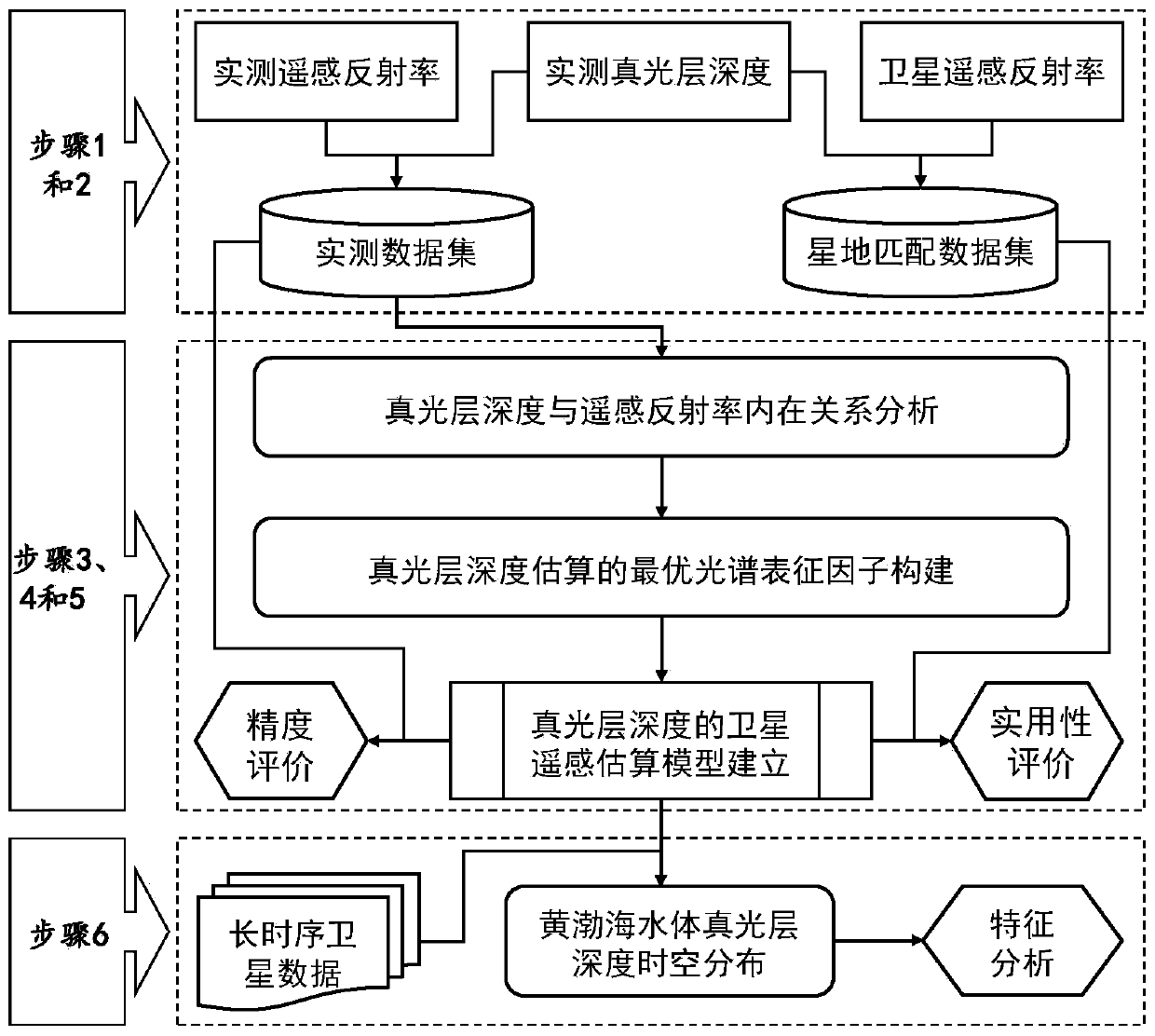
[0026] This embodiment implements the satellite remote sensing method for monitoring the depth of the euphotic zone of the present invention to a certain offshore water in the Yellow Sea, such as figure 1 As shown, the method includes the following specific steps:

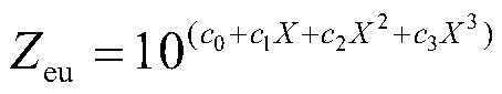
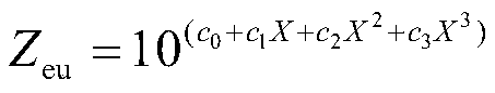
[0027]1) Based on the marine survey voyage, use the free-fall underwater radiation profiler (such as Hyper Profiler II) or the effective photosynthetic radiometer bundled on the temperature-salinity-depth profiler CTD and other in-situ measuring instruments to measure and obtain the effective photosynthetic radiation The profile distribution, and then calculate the true optical layer depth; and use the free-fall underwater radiation profiler or portable ground object spectrometer (such as ASD FieldSpec), measure and calculate the measured remote sensing reflectance, and obtain high-quality field measured data. Considering that the GOCI satellite remote sensing data has a high time resolution (8 images per day, the ...


PUM


Abstract

The invention discloses a satellite remote sensing method for monitoring the depth of a euphotic layer of an offshore water body. The method is based on field measured data, a remote sensing reflectivity optimal spectrum characterization factor for estimating the depth of a euphotic layer is constructed; a new method for estimating the euphotic layer depth by directly utilizing the remote sensingreflectivity is established, and the method is simple and easy to operate, is more suitable for actual satellite remote sensing application, is easier to popularize and apply in other offshore areas,and can promote the development of offshore water euphotic layer depth satellite remote sensing monitoring. According to the method, high-quality euphotic layer depth satellite remote sensing productscan be effectively obtained, the products can directly serve for satellite remote sensing estimation of offshore water body primary productivity, carbon flux, heat exchange and the like, and application of water color remote sensing in offshore marine environment monitoring is promoted. The invention provides a new idea method for estimating the depth of the euphotic layer by utilizing satelliteremote sensing data, and has important significance for improving the remote sensing monitoring capability of the depth of the euphotic layer of the offshore water body and the development of relatedapplication fields.

Description

Technical field: [0001] The invention belongs to the technical field of marine remote sensing, and in particular relates to a satellite remote sensing method for monitoring the depth of the euphotic layer of offshore water bodies. Background technique: [0002] The euphotic depth is an important parameter describing the degree of light penetration in water bodies, and it is defined as the corresponding depth when the effective photosynthetic radiation energy drops to 1% of its seawater surface value. Although the euphotic zone is only a small part of the ocean water body, many biogeochemical processes in the ocean mainly occur in the euphotic zone, which is the most active water layer for marine life. Therefore, mastering the depth of the euphotic layer has important scientific significance for the study and understanding of marine biogeochemical processes and ecosystem evolution, such as the estimation of ocean primary productivity, particulate organic carbon flux, heat exc...

Claims


Application Information

Patent Timeline
Patent Type & Authority Applications(China)
IPC IPC(8): G06F30/20G01D21/02
CPCG01D21/02Y02A90/30
Inventor 王胜强聂君伟吕军孙德勇丘仲锋张海龙
Owner NANJING UNIV OF INFORMATION SCI & TECH
Why Eureka
Try Eureka