Cotton vegetation index remote sensing detection method based on Sentinel-2 satellite

A vegetation index and detection method technology, applied in the field of agricultural remote sensing engineering, can solve the problems of inaccurate or missed monitoring, low precision, low time resolution of satellite data, etc., to achieve high application and promotion value, accurate and fast extraction, The effect of improving detection efficiency

Pending Publication Date: 2020-08-11
航天信德智图(北京)科技有限公司
View PDF10 Cites 4 Cited by
  • Summary
  • Abstract
  • Description
  • Claims
  • Application Information

AI Technical Summary

Problems solved by technology

However, due to the low time resolution of satellite data, it is easy to cause inaccurate or missed monitoring of the beginning and end of key growth periods of crops, which seriously affects the identification accuracy of growth periods.
To sum up, traditional ground survey methods and wide-spec

Method used


Image

  • Cotton vegetation index remote sensing detection method based on Sentinel-2 satellite

Examples


Embodiment Construction

[0013] In order to enable those skilled in the art to better understand the technical solutions of the present invention, the present invention will be further described in detail below in conjunction with the accompanying drawings and preferred embodiments.

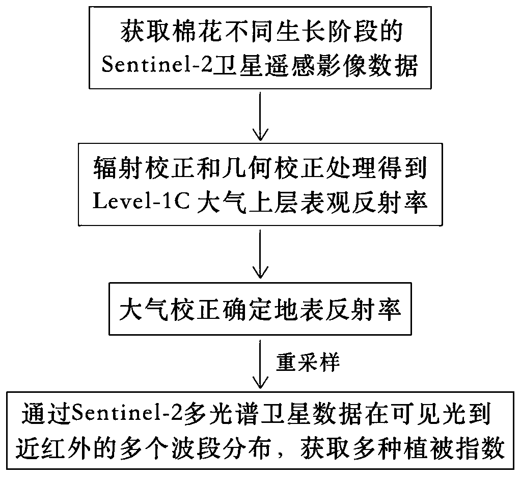
[0014] As shown in the figure, the present invention includes the following steps: according to the distribution characteristics of cotton emergence and stop growth time in the research area, obtain the Sentinel-2 satellite remote sensing image data of different growth stages of cotton in the research area, and the growth period of cotton is divided into 5 periods, That is, the sowing emergence stage, seedling stage, bud stage, flowering boll stage and boll opening stage, wherein the bud stage, flowering age stage and boll opening stage are relatively critical periods in the growth period of cotton; radiation correction and atmospheric correction are performed on the remote sensing image data; Determine the reflectance im...


PUM


Abstract

The invention relates to a cotton vegetation index remote sensing detection method based on a Sentinel-2 satellite. The cotton vegetation index remote sensing detection method comprises the followingsteps of acquiring Sentinel-2 satellite remote sensing image data of cotton in different growth stages in a research area; performing radiation correction and atmospheric correction of the remote sensing image data; determining a reflectivity image of the remote sensing image; through distributing Sentinel-2 multispectral satellite data in a plurality of wave bands from visible light to near infrared, obtaining multiple vegetation indices. The method is advantaged in that the Sentinel-2 satellite data has high spatial-temporal resolution and a specific red edge parameter waveband, ideal data sources can be provided for monitoring of different growth stages of cotton, vegetation indexes of different growth stages of cotton can be extracted more accurately and rapidly, the operation processis simple and flexible, detection efficiency is effectively improved, economic cost is low, powerful tool support is provided for timely analysis of physiological parameters of cotton, and the methodhas high application and popularization values.

Description

technical field [0001] The invention relates to the technical field of agricultural remote sensing engineering, in particular to a remote sensing detection method for cotton vegetation index based on Sentinel-2 satellite. Background technique [0002] my country is the largest cotton-producing country in the world. Cotton is the main raw material for making clothes and quilts in my country. Rapid and accurate extraction of cotton planting information is of great significance for mastering the national cotton planting scale, predicting cotton production, and even the economic development of the textile industry. The traditional observation of crop growth period mainly relies on ground survey, which requires a lot of manpower and material resources. Due to its small observation area and long cycle, it cannot reflect the growth and development of crops in real time, which delays the guidance of agricultural production management. Remote sensing technology is a kind of modern in...

Claims


Application Information

Patent Timeline
IPC IPC(8): G01N21/17G01S19/07G01S19/42
CPCG01N21/17G01S19/07G01S19/42G01N2021/1797
Inventor 史岩岩李培琳戴维序陈勇强
Owner 航天信德智图(北京)科技有限公司
Why Eureka
Try Eureka