Air pollution exposure risk evaluation method and system
A technology of exposure risk and air pollution, applied in the field of air pollution exposure risk assessment methods and systems, can solve problems such as easy to ignore air pollution risks, and achieve the effect of improving rationality
- Summary
- Abstract
- Description
- Claims
- Application Information
AI Technical Summary
Problems solved by technology
Method used
Image
Examples
Embodiment 1
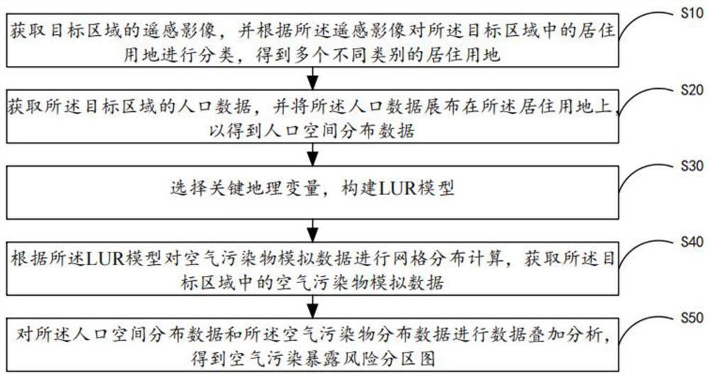
[0049] see figure 1 , is a flow chart of the air pollution exposure risk assessment method provided in the first embodiment of the present invention, including steps:
[0050] Step S10, acquiring the remote sensing image of the target area, and classifying the residential land in the target area according to the remote sensing image to obtain a plurality of different types of residential land;
[0051] Wherein, the remote sensing image is a high-resolution remote sensing image corresponding to the target area, for example, the high-resolution remote sensing image may be an IKONOS remote sensing image with a resolution of 1m;
[0052] Preferably, the target area can be a user preset area, a preset city or a preset country, etc., for example, the target area can be cities such as Beijing, Shanghai, Shenzhen or Nanchang, and further, in this step, by According to the remote sensing image, the residential land in the target area is correspondingly divided into three main resident...
Embodiment 2
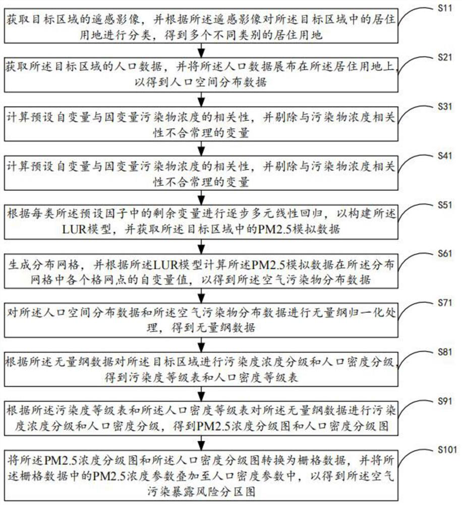
[0065] see figure 2 , is a flowchart of the air pollution exposure risk assessment method provided by the second embodiment of the present invention, including steps:
[0066] Step S11, acquiring the remote sensing image of the target area, and classifying the residential land in the target area according to the remote sensing image to obtain a plurality of different types of residential land;
[0067] Step S21, obtaining population data of the target area, and spreading the population data on the residential land to obtain population spatial distribution data;
[0068] Step S31, calculating the correlation between the preset independent variable and the dependent variable pollutant concentration, and eliminating variables with unreasonable correlation with the pollutant concentration;
[0069] Among them, 42 variables of road, population, land use, and meteorological factors were selected as the preset independent variables of the LUR model. The processing of various factor...
Embodiment 3
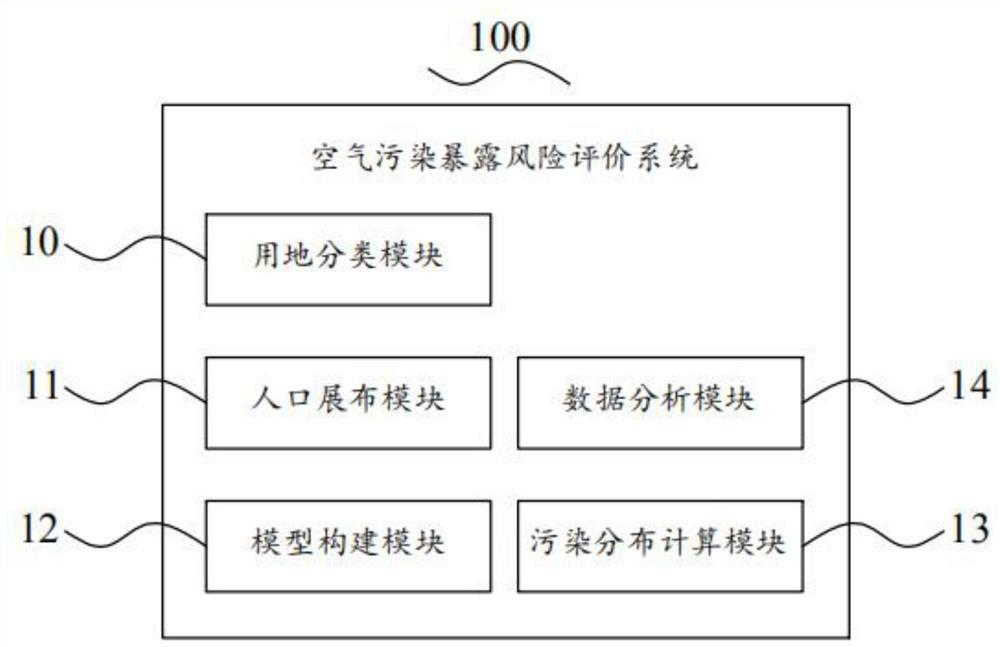
[0090] see image 3 , is a schematic structural diagram of an air pollution exposure risk assessment system 100 provided in the third embodiment of the present invention, including: a land use classification module 10, a population distribution module 11, a model building module 12, a pollution distribution calculation module 13 and a data analysis module 14, in:
[0091] The land use classification module 10 is configured to obtain remote sensing images of the target area, and classify the residential land in the target area according to the remote sensing images to obtain multiple different types of residential land.
[0092] The population distribution module 11 is configured to obtain population data of the target area, and distribute the population data on the residential land to obtain population spatial distribution data.
[0093] The model construction module 12 is used to select key geographic variables and construct a LUR model.
[0094] Wherein, the model building...
PUM
 Abstract
Description
Claims
Application Information
 - R&D
- Intellectual Property
- Life Sciences
- Materials
- Tech Scout
- Unparalleled Data Quality
- Higher Quality Content
- 60% Fewer Hallucinations
Browse by: Latest US Patents, China's latest patents, Technical Efficacy Thesaurus, Application Domain, Technology Topic, Popular Technical Reports.
© 2025 PatSnap. All rights reserved.Legal|Privacy policy|Modern Slavery Act Transparency Statement|Sitemap|About US| Contact US: help@patsnap.com


