Method and system for measuring pose parameters of underground dynamic roadheader fuselage
A technology of position and attitude parameters and roadheader, which is applied in the field of measurement methods and systems for the body position and attitude parameters of an underground dynamic roadheader, can solve problems such as difficulty in ensuring the accuracy of the roadway, so as to improve the position and attitude measurement accuracy, improve the driving quality, and improve the The effect of measurement accuracy
- Summary
- Abstract
- Description
- Claims
- Application Information
AI Technical Summary
Problems solved by technology
Method used
Image
Examples
Embodiment 1
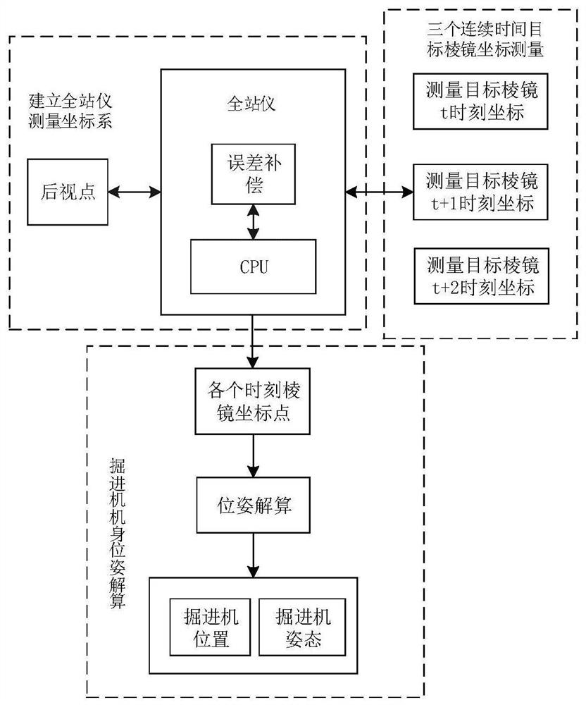
[0063] This embodiment provides a method for measuring the posture parameters of the dynamic tunneling machine body in the mine. The dynamic tunneling machine body posture parameters include the attitude angle of the roadheader body and the distance between the center of the roadheader body and the center axis of the roadway. The attitude angle of the aircraft fuselage is yaw angle, pitch angle and roll angle; One of the two laser targets of the present invention is placed behind the total station for determining the position of the total station in the roadway and establishing the position of the total station. The measurement coordinate system, one is placed at the center of the body of the roadheader for the total station to measure it.
[0064] The total station is a high-precision measuring instrument used to measure the horizontal angle, vertical angle, oblique span and horizontal distance in front of the target prism. The full name of the used total station of the prese...
Embodiment 2
[0092] This embodiment provides a system for measuring pose parameters of an underground dynamic tunneling machine body, including:
[0093] The coordinate establishment module is used to establish the roadway space coordinate system, the roadheader body rigid body coordinate system and the total station measurement coordinate system; and determine the position of the total station in the roadway space coordinate system, so that the total station measurement coordinate system and the roadway The spatial coordinate system establishes a mutual relationship, so that the coordinate values in the measuring coordinate system of the total station are the coordinate values in the roadway spatial coordinate system;
[0094] Specifically, the establishment of the coordinate system by the coordinate establishment module includes:
[0095] Establish the roadway space coordinate system, the starting position of the roadway is the origin, the central axis of the roadway is the y-axis, t...
PUM
 Abstract
Description
Claims
Application Information
 - R&D
- Intellectual Property
- Life Sciences
- Materials
- Tech Scout
- Unparalleled Data Quality
- Higher Quality Content
- 60% Fewer Hallucinations
Browse by: Latest US Patents, China's latest patents, Technical Efficacy Thesaurus, Application Domain, Technology Topic, Popular Technical Reports.
© 2025 PatSnap. All rights reserved.Legal|Privacy policy|Modern Slavery Act Transparency Statement|Sitemap|About US| Contact US: help@patsnap.com


