
Three-dimensional surveying and mapping satellite image data archiving method and system

A satellite image and data archiving technology, applied in image data processing, still image data retrieval, still image data indexing, etc., can solve the problems of reduced system response speed, complexity, and low efficiency, achieve stable data retrieval, and ensure redundancy. Effect

Active Publication Date: 2021-05-07
山东省国土测绘院
View PDF20 Cites 6 Cited by
  • Summary
  • Abstract
  • Description
  • Claims
  • Application Information

AI Technical Summary

Problems solved by technology

Stereoscopic image data is relatively large and complex. If you rely solely on traditional archiving methods such as compression, there will be problems such as low efficiency, waste of storage resources, and unfavorable data sharing.
[0004] At the same time, many enterprises or individuals also hope to see or read relevant remote sensing and geographic information. However, the current data management system sets strict data access permissions, and individuals and other users cannot access it smoothly. Particularity, historical data is generally not deleted, and as time goes by, the amount of data that will not be accessed will increase, which will cause a sharp drop in the response speed of the entire system

Method used


Image

  • Three-dimensional surveying and mapping satellite image data archiving method and system
  • Three-dimensional surveying and mapping satellite image data archiving method and system
  • Three-dimensional surveying and mapping satellite image data archiving method and system

Examples


Embodiment Construction

[0045] The present invention will be further described below in conjunction with the accompanying drawings and embodiments.

[0046] It should be noted that the following detailed description is exemplary and intended to provide further explanation of the present invention. Unless defined otherwise, all technical and scientific terms used herein have the same meaning as commonly understood by one of ordinary skill in the art to which this invention belongs.

[0047] It should be noted that the terminology used here is only for describing specific embodiments, and is not intended to limit exemplary embodiments according to the present invention. As used herein, unless the context clearly dictates otherwise, the singular is intended to include the plural, and it should also be understood that when the terms "comprising" and / or "comprising" are used in this specification, they mean There are features, steps, operations, means, components and / or combinations thereof.

[0048] Th...


PUM


Abstract

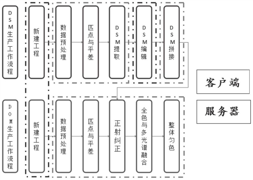
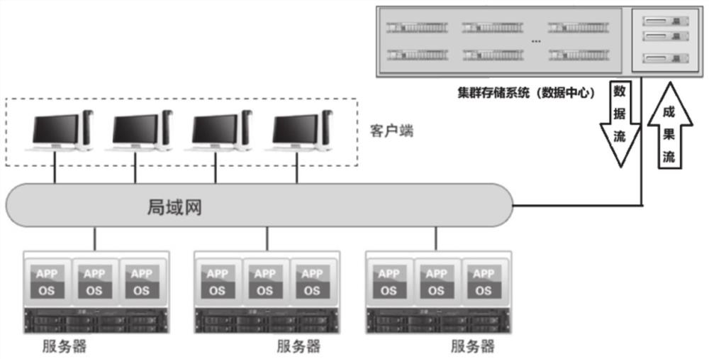
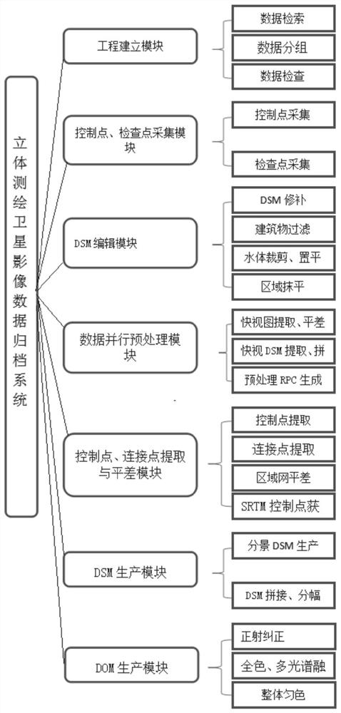
The invention provides a three-dimensional surveying and mapping satellite image data archiving method and system. The method comprises the following steps: classifying received three-dimensional remote sensing image data; carrying out preprocessing and texture analysis on stereoscopic remote sensing image data, generating an image pyramid through wavelet transformation, transforming a top image of the pyramid, carrying out matching based on message propagation, carrying out layer-by-layer matching, and generating a digital surface model; performing radiation correction, differential correction and mosaic on the scanned stereoscopic remote sensing image data pixel by pixel by using a digital elevation model, and cutting according to a set mapsheet range to generate a digital orthoimage map; storing the generated digital surface model, the digital orthophoto map and the three-dimensional remote sensing image data; according to the input information, searching the stored data to find the corresponding data. The data storage space can be saved, the consulting path is provided, and the data processing efficiency is improved.

Description

technical field [0001] The invention belongs to the technical field of image data archiving, and in particular relates to a method and system for archiving stereoscopic surveying and mapping satellite image data. Background technique [0002] The statements in this section merely provide background information related to the present invention and do not necessarily constitute prior art. [0003] With the advancement of science and technology, the application fields of remote sensing and geographic information continue to expand. Stereo image data, as one of the important data in the field of remote sensing and geographic information applications, occupies a great influence. Stereoscopic image data is relatively large and complex. If you rely solely on traditional archiving methods such as compression, there will be problems such as low efficiency, waste of storage resources, and unfavorable data sharing. [0004] At the same time, many enterprises or individuals also hope ...

Claims


Application Information

Patent Timeline
IPC IPC(8): G06F16/11G06F16/51G06F16/55G06F16/583G06T3/40G06T5/00G01C11/00
CPCG06F16/113G06F16/51G06F16/55G06F16/583G06T3/4038G01C11/00G06T5/70
Inventor 戚文来韩娟张鹏石佳桂李永正宗锡华李楠杨勇翟艳青崔靓张红李南王跃强戢朝辉
Owner 山东省国土测绘院
Learn More