Method and system for evaluating layout scheme of highway roadside sensing equipment
A technology for perceiving equipment and program evaluation, applied in instruments, data processing applications, forecasting, etc., can solve problems such as lack of scientific data and theoretical support, equipment selection and layout principles are greatly affected by product performance, etc.
- Summary
- Abstract
- Description
- Claims
- Application Information
AI Technical Summary
Problems solved by technology
Method used
Image
Examples
Embodiment example
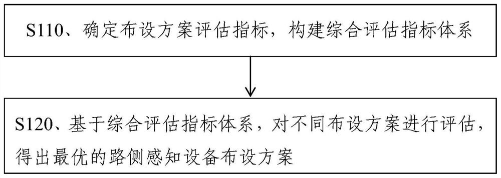
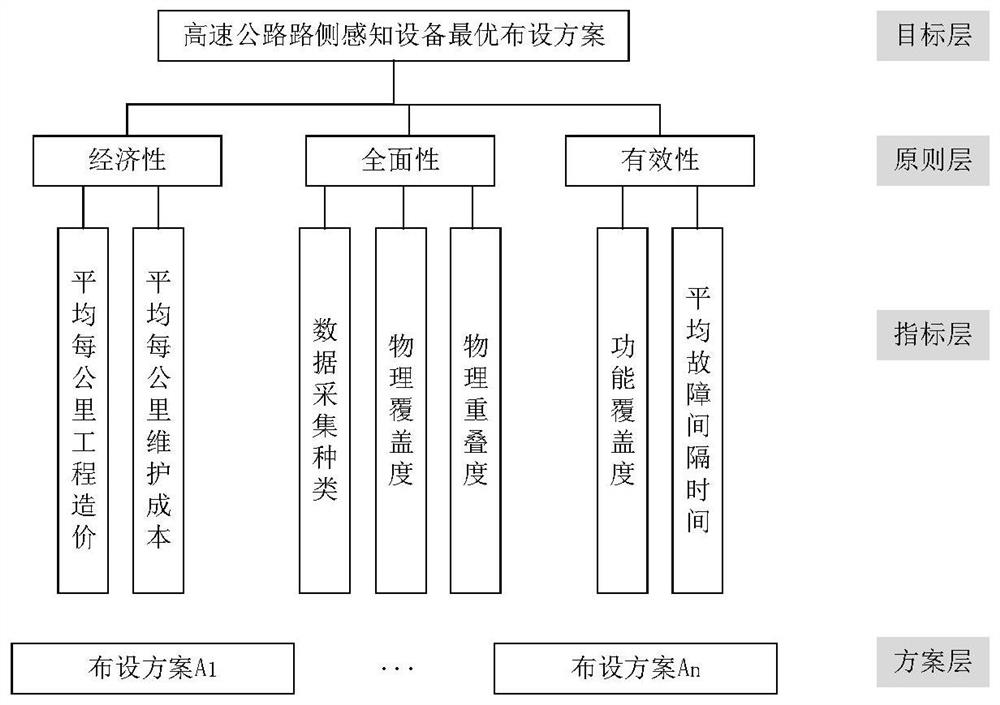
[0089] This evaluation method will construct an evaluation index system for digital infrastructure status, traffic operation status, micro-behavior status, meteorological environment status, etc., so as to conduct evaluation. This paper will take the traffic operation status as an example for case analysis.
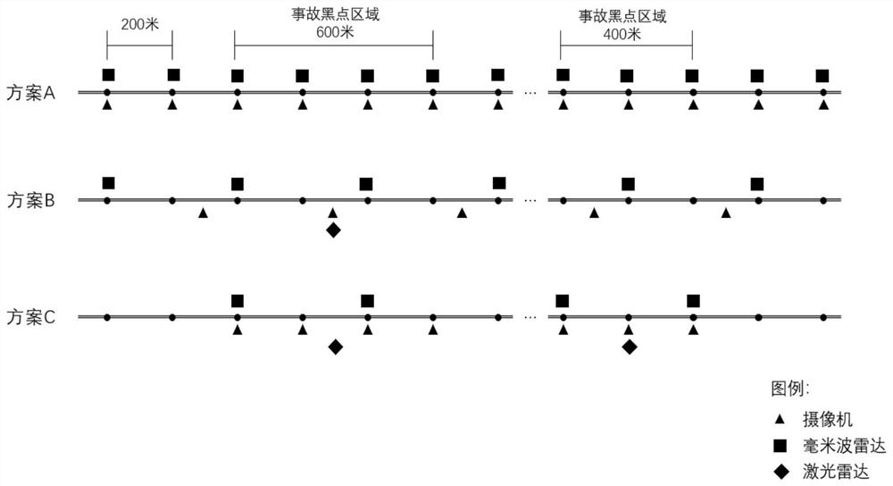
[0090] Through the analysis of the existing roadside sensing equipment layout schemes of typical expressways, this paper designs three roadside sensing equipment layout schemes. The selected equipment is all intelligent roadside equipment that can collect traffic operation status data, including high-definition Camera (effective detection area is about 100 meters), millimeter wave radar (effective detection area is about 350 meters), laser radar (effective detection area is about 300 meters).
[0091] The specific plan layout diagram is as follows: image 3 shown. Among them, plan A is to install a set of high-definition cameras every 200 meters, and a set of millimeter...
PUM
 Abstract
Description
Claims
Application Information
 - R&D
- Intellectual Property
- Life Sciences
- Materials
- Tech Scout
- Unparalleled Data Quality
- Higher Quality Content
- 60% Fewer Hallucinations
Browse by: Latest US Patents, China's latest patents, Technical Efficacy Thesaurus, Application Domain, Technology Topic, Popular Technical Reports.
© 2025 PatSnap. All rights reserved.Legal|Privacy policy|Modern Slavery Act Transparency Statement|Sitemap|About US| Contact US: help@patsnap.com


