Ecological environment fragile area land monitoring method, system and device
A technology for ecological environment and fragile areas, applied in the direction of neural learning methods, biological neural network models, instruments, etc., can solve the problems of low monitoring work efficiency and low monitoring accuracy rate, and achieve high monitoring work efficiency, reduced manpower, and detection The results are accurate
- Summary
- Abstract
- Description
- Claims
- Application Information
AI Technical Summary
Problems solved by technology
Method used
Image
Examples
specific Embodiment approach 1
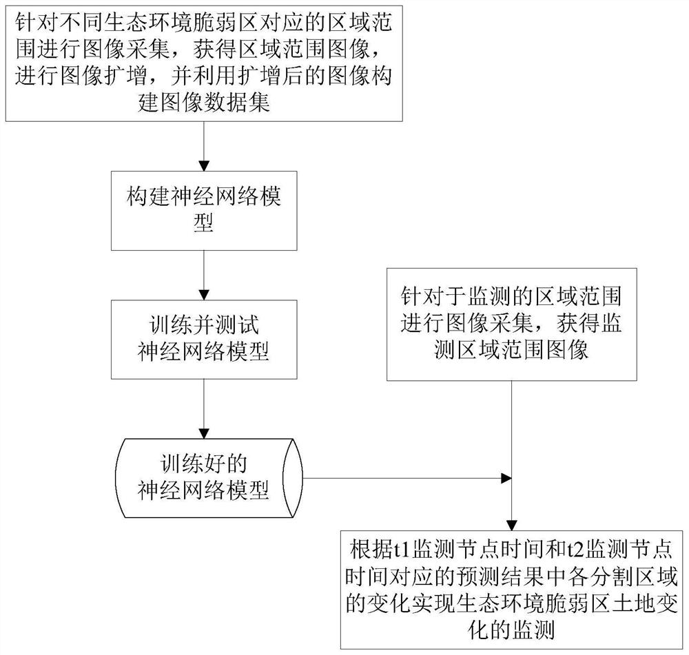
[0048] This implementation mode is a land monitoring method in an ecological environment fragile area, including the following steps:
[0049] 1. Collect images for regions corresponding to different ecological environment fragile areas, and obtain region-wide images;
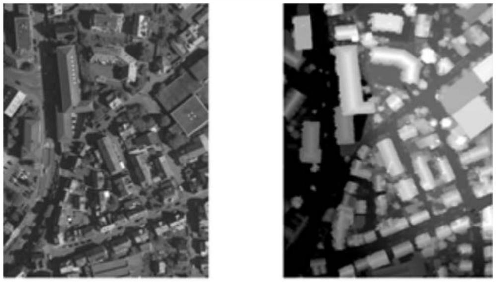
[0050] In fact, the images obtained in various ways can be used for processing. Based on the consideration of the processing effect, this embodiment does not use the Google Earth Engine platform to obtain data, but uses aerial photography to obtain images;
[0051] Based on the method of extracting features and carrying out the overall scheme of the present invention, after research and analysis, it is found that the pixels of the collected images represent the actual real area and must be less than or equal to the real block area threshold, and the block area threshold should not exceed 30 meters * 30 meters, theoretically The smaller the pixels represent the actual real area, the better, but the prediction ac...
specific Embodiment approach 2
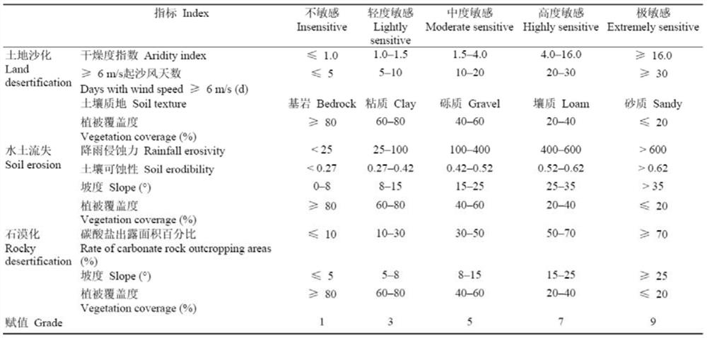
[0097] This embodiment is a method for monitoring land in ecologically fragile areas. In this embodiment, the monitoring of land changes in ecologically fragile areas is realized based on the changes in the prediction results corresponding to the t1 monitoring node time and the t2 monitoring node time. During the process, meteorological data, geographic information data (including elevation data), and soil data in the monitoring area can also be collected, and an ecological sensitivity evaluation index system can be constructed by referring to the "Interim Regulations for Ecological Functional Zoning Technology" to evaluate the sensitivity of the ecological environment ,As shown in table 2.
[0098] Table 2 Eco-environmental sensitivity evaluation indicators and grading assignment
[0099]
[0100] Other steps and parameters are the same as those in the first embodiment.
specific Embodiment approach 3
[0102] This embodiment is a land monitoring system in an ecological environment fragile area, and the system is used to implement a land monitoring method in an ecological environment fragile area.
PUM
 Abstract
Description
Claims
Application Information
 - R&D
- Intellectual Property
- Life Sciences
- Materials
- Tech Scout
- Unparalleled Data Quality
- Higher Quality Content
- 60% Fewer Hallucinations
Browse by: Latest US Patents, China's latest patents, Technical Efficacy Thesaurus, Application Domain, Technology Topic, Popular Technical Reports.
© 2025 PatSnap. All rights reserved.Legal|Privacy policy|Modern Slavery Act Transparency Statement|Sitemap|About US| Contact US: help@patsnap.com


