Path optimization method and system for traversal monitoring of unmanned ship in sea area with complex terrain
A path optimization and unmanned ship technology, applied in the direction of measuring devices, surveying and navigation, instruments, etc., can solve the problems of falling into local optimal solutions, inapplicability, random selection, and repeated coverage, so as to reduce repeated paths, The effect of improving work efficiency
- Summary
- Abstract
- Description
- Claims
- Application Information
AI Technical Summary
Problems solved by technology
Method used
Image

Examples
Embodiment 1
[0052] Preconditions:
[0053] Before traversing, first divide the grid lines according to the range of the traversing sea area and the range of the unmanned shipborne radar, and specify the traversal path according to the order of the grid lines, and drive according to the predetermined route in the absence of obstacles. When an obstacle is encountered, the next traversal point is selected according to formula 1.
[0054] formula:
[0055] Among them, P is the probability corresponding to each point to be traversed, A is the weight of each point to be traversed, and θ is the steering angle.
[0056] Formula description:
[0057] (1) P is the probability corresponding to each point, the larger the P, the higher the probability of the point being selected as the next traversal point;
[0058] (2) A is the weight of the point, which increases sequentially according to the grid line of the unmanned ship from the starting point to the end point, and the weight of the starting...
Embodiment 2
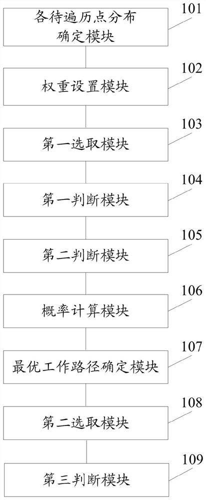
[0081] Such as figure 1 As shown, the present invention also provides a path optimization system for unmanned ships in traversal monitoring in complex terrain sea areas, the system comprising:
[0082] The distribution determination module 101 of the points to be traversed is used to determine the distance between the grid lines within the range of the traversed area and the distribution of the points to be traversed on the grid lines according to the search range and the search area of the unmanned ship radar.
[0083] The weight setting module 102 is configured to increase the corresponding weights from the start grid line to the end grid line, and the weights corresponding to multiple points to be traversed on the same grid line are equal to the weights corresponding to the grid line.
[0084] The first selection module 103 is configured to add all points to be traversed to the remaining pool, select any point to be traversed from the remaining pool as a starting point to...
Embodiment 3
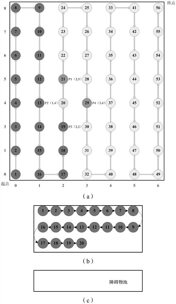
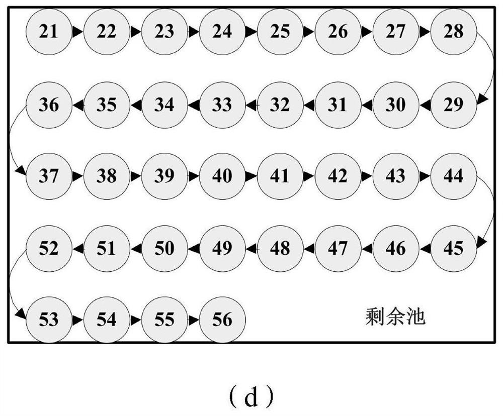
[0095] Such as figure 2 As shown, (a) is an optimal working path diagram, (b) is a schematic diagram of stored points to be traversed in the traversed pool, (c) is a schematic diagram of stored points to be traversed in the obstacle pool, (d) is a schematic diagram of the remaining The schematic diagram of points to be traversed is stored in the pool. Under normal circumstances, there are no obstacles in the traversal sea area, and the unmanned ship traverses step by step according to the divided grid. For example, when the unmanned ship travels to point 20 to be traversed, the traversable points it can scan are point 13 to be traversed, point 19 to be traversed, point 29 to be traversed and point 21 to be traversed, wherein point 13 to be traversed, point to be traversed The traversal point 19 is in the traversed pool and is no longer considered. When the point 29 to be traversed and the point 21 to be traversed are selected, according to formula 1, the weight of the point...
PUM
 Abstract
Description
Claims
Application Information