Cultivated land parcel classification method based on genetic programming algorithm

A technology of genetic programming and plots, which is applied in the field of satellite remote sensing image processing, can solve the problems of GP algorithm in the extraction of cultivated land plots and other problems, and achieve the effect of convenient and effective technical means

Pending Publication Date: 2021-08-10
INST OF AGRI RESOURCES & REGIONAL PLANNING CHINESE ACADEMY OF AGRI SCI
View PDF0 Cites 0 Cited by
  • Summary
  • Abstract
  • Description
  • Claims
  • Application Information

AI Technical Summary

Problems solved by technology

Therefore, some scholars began to explore its application in the field of remote sensing [11,12]...

Method used


Image

  • Cultivated land parcel classification method based on genetic programming algorithm
  • Cultivated land parcel classification method based on genetic programming algorithm
  • Cultivated land parcel classification method based on genetic programming algorithm

Examples


Embodiment Construction

[0042] In order to have a clearer understanding of the technical features, purposes and effects of the present invention, the specific implementation manners of the present invention will now be described with reference to the accompanying drawings.

[0043] The present invention provides a method for classifying cultivated land blocks based on genetic programming algorithm, which is used to obtain the distribution information of cultivated land in a designated geographical area, which includes the following steps:

[0044] In step A, in the satellite image data covering the specified geographical area, the pixels are aggregated into plots, that is, the satellite image data is segmented to obtain plot data.

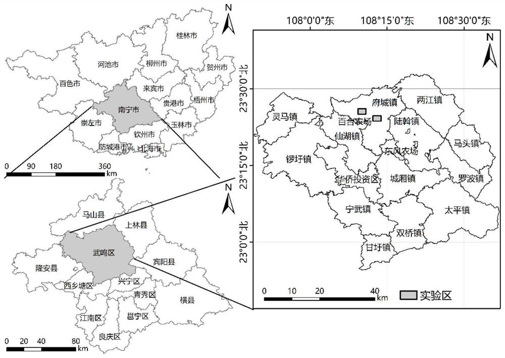
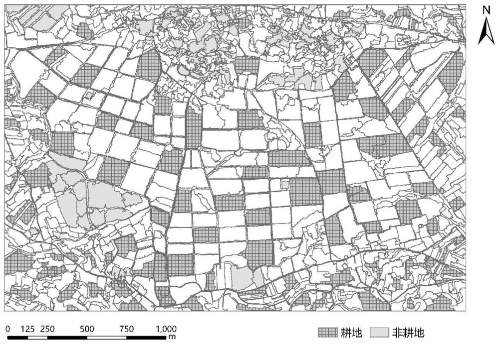
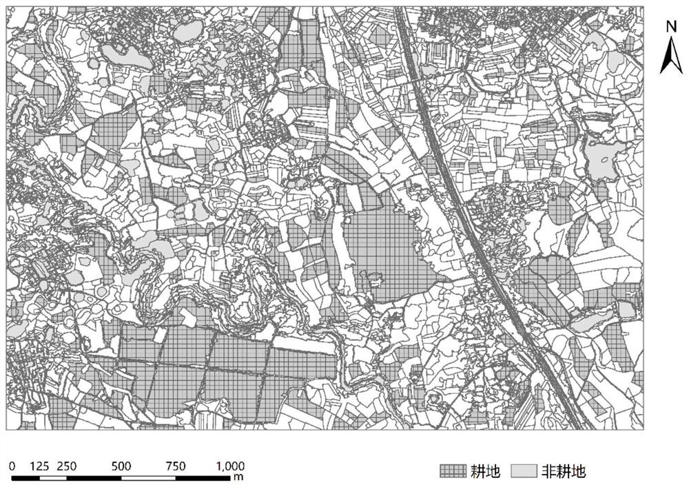
[0045] figure 1A schematic diagram of the location of the geographical area selected by a method for classifying cultivated land plots based on the genetic programming algorithm according to a specific embodiment of the present invention; figure 2 for figure 1 Segmenta...


PUM


Abstract

A cultivated land parcel classification method based on a genetic programming algorithm is used for collecting cultivated land distribution information in a specified geographic region, and comprises the following steps: step A, collecting land parcel data in satellite image data covering the specified geographic region; step B, on the basis of the segmentation data obtained in the step A, sample selection is carried out, training data and test data are divided according to the proportion of 7: 3, feature data are extracted from the selected samples, and normalization processing is carried out to obtain a feature set; and step C, calculating the feature set data obtained in the step B to obtain an individual with the highest overall precision as a feature for finally classifying all the plots, thereby realizing classification and recognition of the cultivated land in the specified geographic region. The genetic programming algorithm-based cultivated land parcel classification method provided by the invention can provide high-precision cultivated land parcel spatial distribution data, thereby providing a convenient and effective technical means for regional scale cultivated land information monitoring.

Description

technical field [0001] The invention relates to a satellite remote sensing image processing method, in particular to a method for obtaining cultivated land block distribution information by utilizing existing satellite remote sensing image data. Background technique [0002] Cultivated land is the basis for the survival and development of human society. Obtaining accurate and timely information on the spatial distribution and dynamic changes of cultivated land is the key to solving hot issues in agricultural land systems such as crop growth monitoring, yield estimation, and food security assessment. A plot is the basic spatial unit of cultivated land utilization, which can reflect important information such as agricultural input, degree of mechanization, and business model. [1,2] . Accurate information on the distribution of cultivated land plots is the basis of refined agriculture research. However, 66% of China's cultivated land is distributed in mountains, hills and pla...

Claims


Application Information

Patent Timeline
IPC IPC(8): G06K9/62G06N3/12
CPCG06N3/126G06F18/24
Inventor 陆苗温彩运毕莹薛冰吴文斌张孟杰
Owner INST OF AGRI RESOURCES & REGIONAL PLANNING CHINESE ACADEMY OF AGRI SCI
Why Eureka
Try Eureka