Tree species identification method based on multi-source remote sensing of unmanned aerial vehicle
An identification method and UAV technology, applied in the field of remote sensing identification, can solve the problems of low identification accuracy, insufficient spatial information for tree species identification in remote sensing images, etc., and achieve the effect of increasing accuracy.
- Summary
- Abstract
- Description
- Claims
- Application Information
AI Technical Summary
Problems solved by technology
Method used
Image
Examples
Embodiment Construction
[0037] Principles and features of the present invention are described below, and examples are only used to explain the present invention, and are not intended to limit the scope of the present invention.
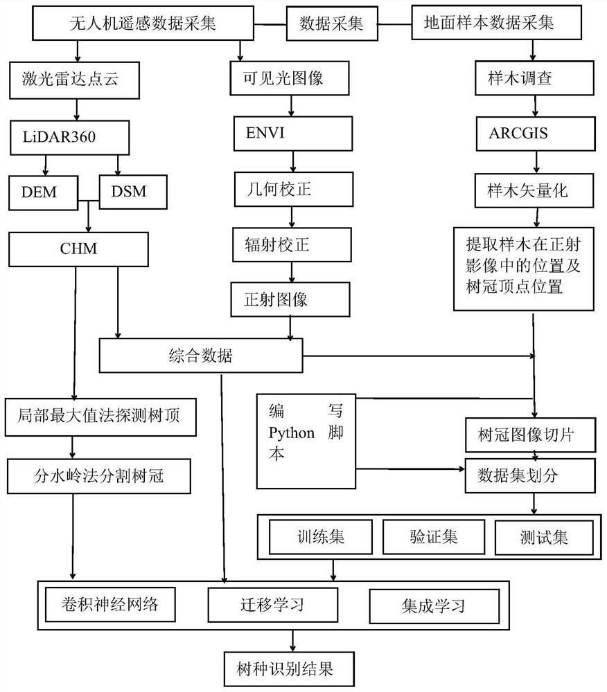
[0038] Such as figure 1 As shown, the following steps are included in this implementation example:
[0039] A Obtain the visible light image and the lidar point cloud, preprocess the lidar point cloud and the visible light image respectively, and obtain the preprocessed lidar point cloud and visible light orthophoto;
[0040] The UAV is equipped with RIEGL VUX-1LR lidar sensor, which realizes high-speed acquisition of lidar point cloud data through the near-infrared (1550nm) laser beam and 330° field of view of the rotating mirror. It is equipped with Sony ILCE-6000 micro-single camera acquisition Visible light data, using PPK dynamic post-processing positioning technology to achieve a high positioning accuracy of 15mm, the data was collected during the vegetation growth se...
PUM
 Abstract
Description
Claims
Application Information
 - R&D
- Intellectual Property
- Life Sciences
- Materials
- Tech Scout
- Unparalleled Data Quality
- Higher Quality Content
- 60% Fewer Hallucinations
Browse by: Latest US Patents, China's latest patents, Technical Efficacy Thesaurus, Application Domain, Technology Topic, Popular Technical Reports.
© 2025 PatSnap. All rights reserved.Legal|Privacy policy|Modern Slavery Act Transparency Statement|Sitemap|About US| Contact US: help@patsnap.com


