
Multi-modal remote sensing data classification method based on graph convolutional network

A convolutional network and remote sensing data technology, applied in the field of image processing, can solve problems such as difficult to achieve classification results, and achieve the effect of enriching diversity, improving capabilities, and enriching node features

Pending Publication Date: 2022-06-03
XIDIAN UNIV
View PDF0 Cites 0 Cited by
  • Summary
  • Abstract
  • Description
  • Claims
  • Application Information

AI Technical Summary

Problems solved by technology

However, this method is only aimed at a single HSI classification task, and does not involve the classification application of multi-source images, so it is difficult to achieve high-precision classification results

Method used


Image

  • Multi-modal remote sensing data classification method based on graph convolutional network
  • Multi-modal remote sensing data classification method based on graph convolutional network
  • Multi-modal remote sensing data classification method based on graph convolutional network

Examples


Embodiment Construction

[0030] Embodiments and effects of the present invention will be further described in detail with reference to the accompanying drawings.

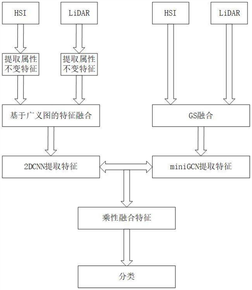
[0031] see figure 1 , the example steps are as follows:

[0032] Step 1. Obtain a hyperspectral dataset.

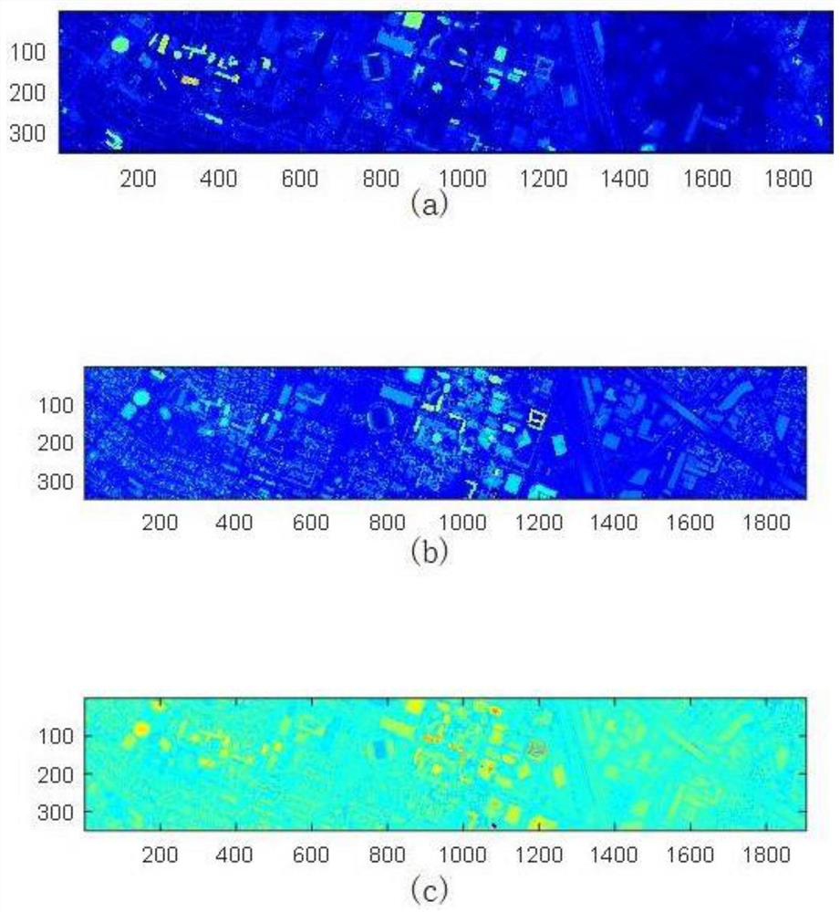
[0033] This example obtains the Houston2012 hyperspectral dataset from an existing public dataset. The hyperspectral dataset is derived from the scene map of the University of Houston and its neighboring urban areas. It contains 144-band hyperspectral image HSI and single-band hyperspectral images The LiDAR image of LiDAR has a pixel value of 349*1905 and contains 15 substance categories.

[0034] Step 2, perform GS fusion on the multi-source image data.

[0035] The GS spectral sharpening method is a fusion method that applies the Gram-Schmidt algorithm to remote sensing images. In this example, the high spatial resolution LiDAR image and the low spatial resolution HSI are fused through the GS fusion method, thereby improving the per...


PUM


Abstract

The invention provides a multi-modal data image fusion classification method based on a graph convolutional network, and mainly solves the problem that the existing hyperspectral image classification precision is low. According to the implementation scheme, a hyperspectral image data set is obtained; performing multi-source data fusion on the original HSI and LiDAR images in a GS fusion mode to obtain a hyperspectral image GS fusion image; respectively extracting invariant attribute features of the HSI image and the LiDAR image, and obtaining an invariant attribute feature fusion image through a feature fusion mode based on a weighted fusion image; inputting the hyperspectral image GS fusion image and the invariant attribute feature fusion result into miniGCN and 2DCNN branches to further extract spectral features and spatial features; carrying out feature fusion on the extracted spectral features and spatial features through a multiplicative fusion strategy; and classifying multiplicative feature fusion results through a classification network. The method reduces the loss of feature information, improves the classification performance, and can be used for hyperspectral image classification.

Description

technical field [0001] The invention belongs to the technical field of image processing, and further relates to a multimodal remote sensing data classification method, which can be used for hyperspectral image classification. Background technique [0002] With the continuous development of image classification technology, remote sensing image classification plays an increasingly important role. Urban planning, land detection, vegetation classification, etc. all depend on the results of material classification in a specific area. Hyperspectral image HSI contains rich spectral information, which can be used to observe and classify ground object information, but HSI cannot distinguish the material categories composed of the same material. This shows that in some specific scenarios, single source image is not conducive to classification, while remote sensing multi-source image classification is gradually applied to material classification. LiDAR image LiDAR contains the spatia...

Claims


Application Information

Patent Timeline
IPC IPC(8): G06V20/10G06V10/80G06V10/764G06V10/82G06K9/62G06N3/04G06N3/08
CPCG06N3/08G06N3/045G06F18/241G06F18/253
Inventor 谢卫莹李艳林张佳青雷杰李云松
Owner XIDIAN UNIV
Learn More