

Small-range dynamic GPS topographic surveying method
A topographic measurement and small-scale technology, applied in the direction of measuring devices, radio wave measurement systems, instruments, etc., can solve the problems of high requirements and increase the efficiency of satellite unlocking
- Summary
- Abstract
- Description
- Claims
- Application Information
AI Technical Summary
Problems solved by technology
Method used
Image

Examples
Embodiment Construction
[0012] The implementation of the present invention will be further described in detail below with reference to the accompanying drawings.
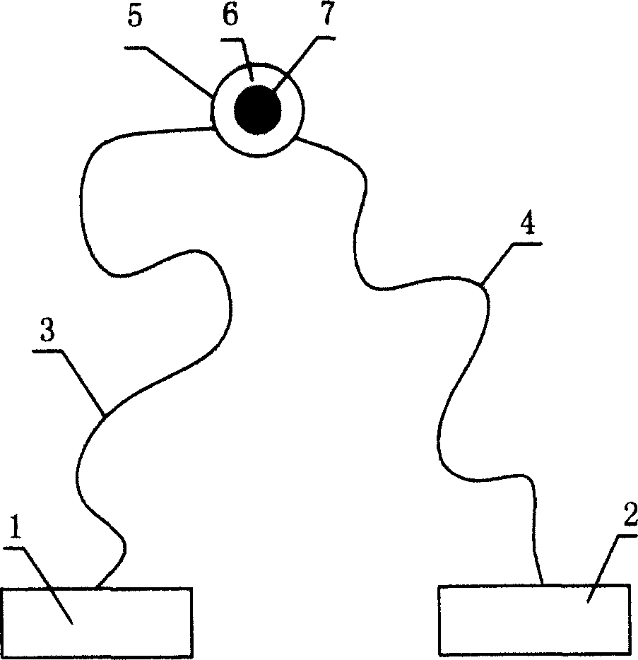
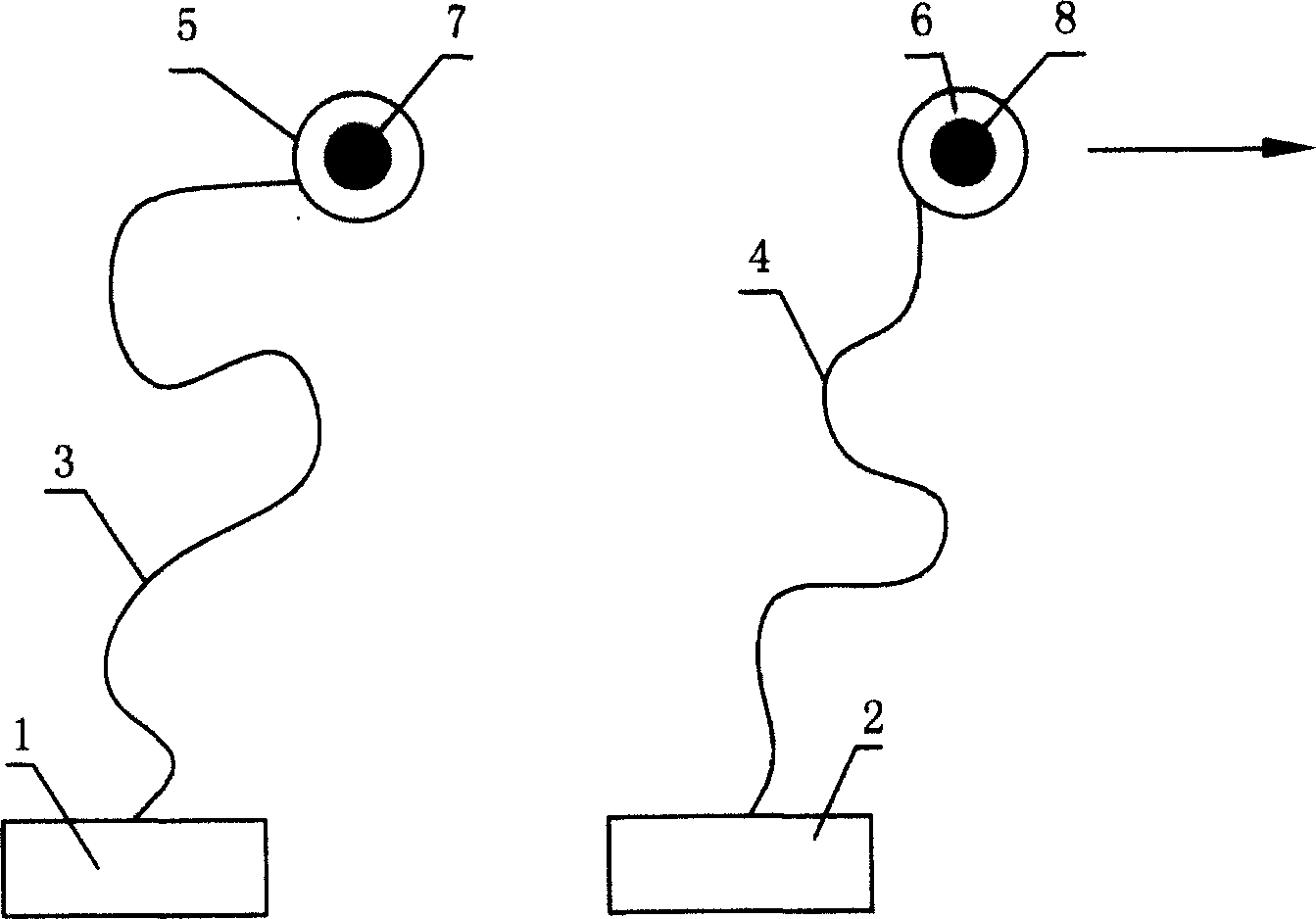
[0013] Such as figure 1 As shown, the two GPS receivers 1 and 2 used for carrier phase differential positioning measurement are connected to their corresponding antennas 5 and 6 through cables 3 and 4, and the antennas 5 and 6 are placed on the same point 7, after Short-term measurement and solution to determine the integer ambiguity of the carrier phase observation, and then, as figure 2 As shown, slowly move the antenna 6 corresponding to the receiver 2 to a new positioning point 8, and lock the satellite according to the traditional dynamic GPS positioning method, and perform continuous and uninterrupted tracking observation.
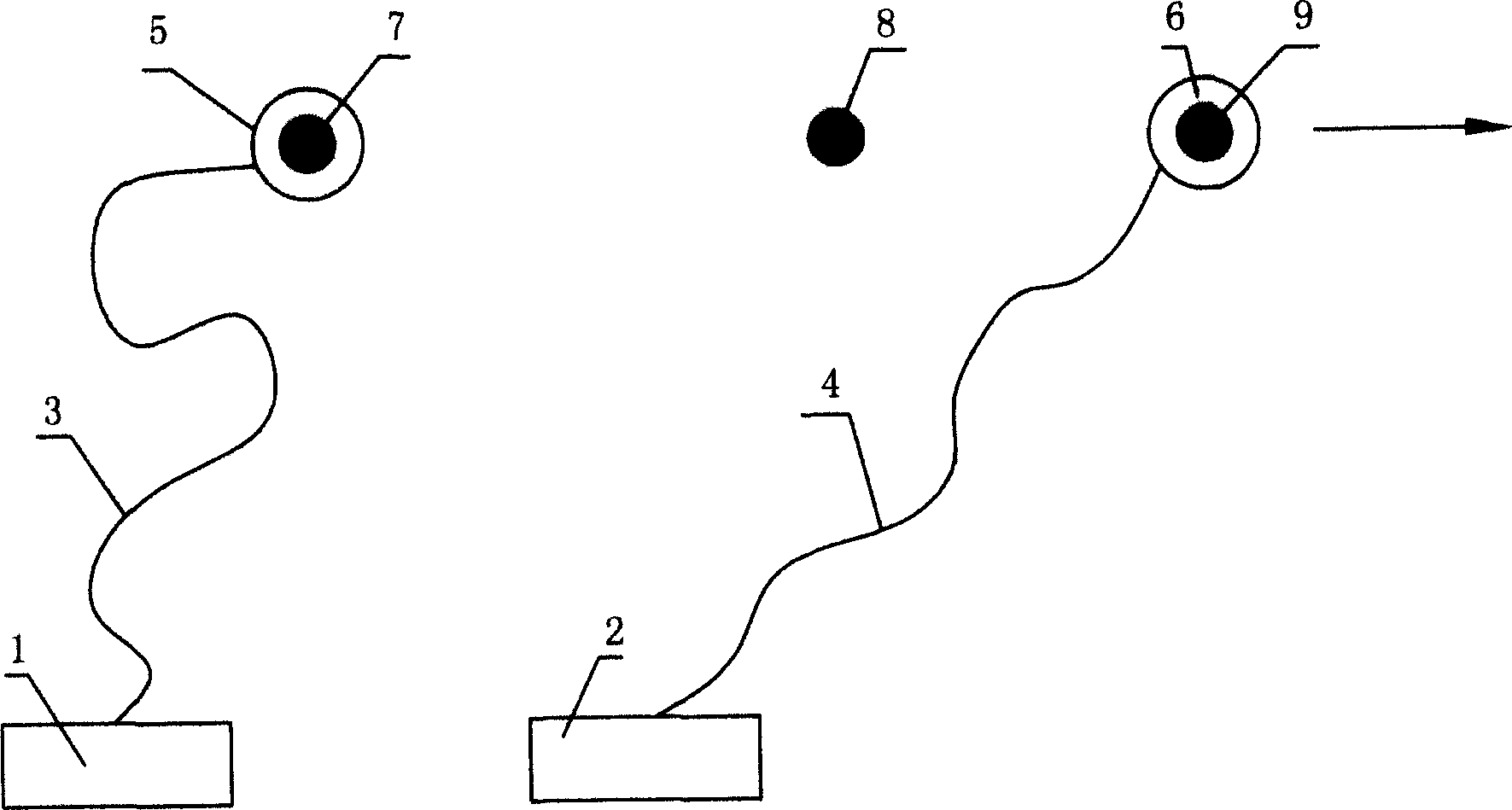
[0014] Such as image 3 As shown, when the antenna 6 of the receiver 2 moves to the point 9, the satellite unlocking phenomenon occurs, and the above steps are restarted from the known point 8.
[0015] All i...
PUM
 Abstract
Description
Claims
Application Information