Method for realizing wheat behavior monitoring and forecasting by utilizing remote sensing and geographical information system technology
A geographic information system and wheat quality technology, applied in the information field, achieves obvious economic benefits and social effects, and reduces application costs
- Summary
- Abstract
- Description
- Claims
- Application Information
AI Technical Summary
Problems solved by technology
Method used
Image

Examples
Embodiment Construction
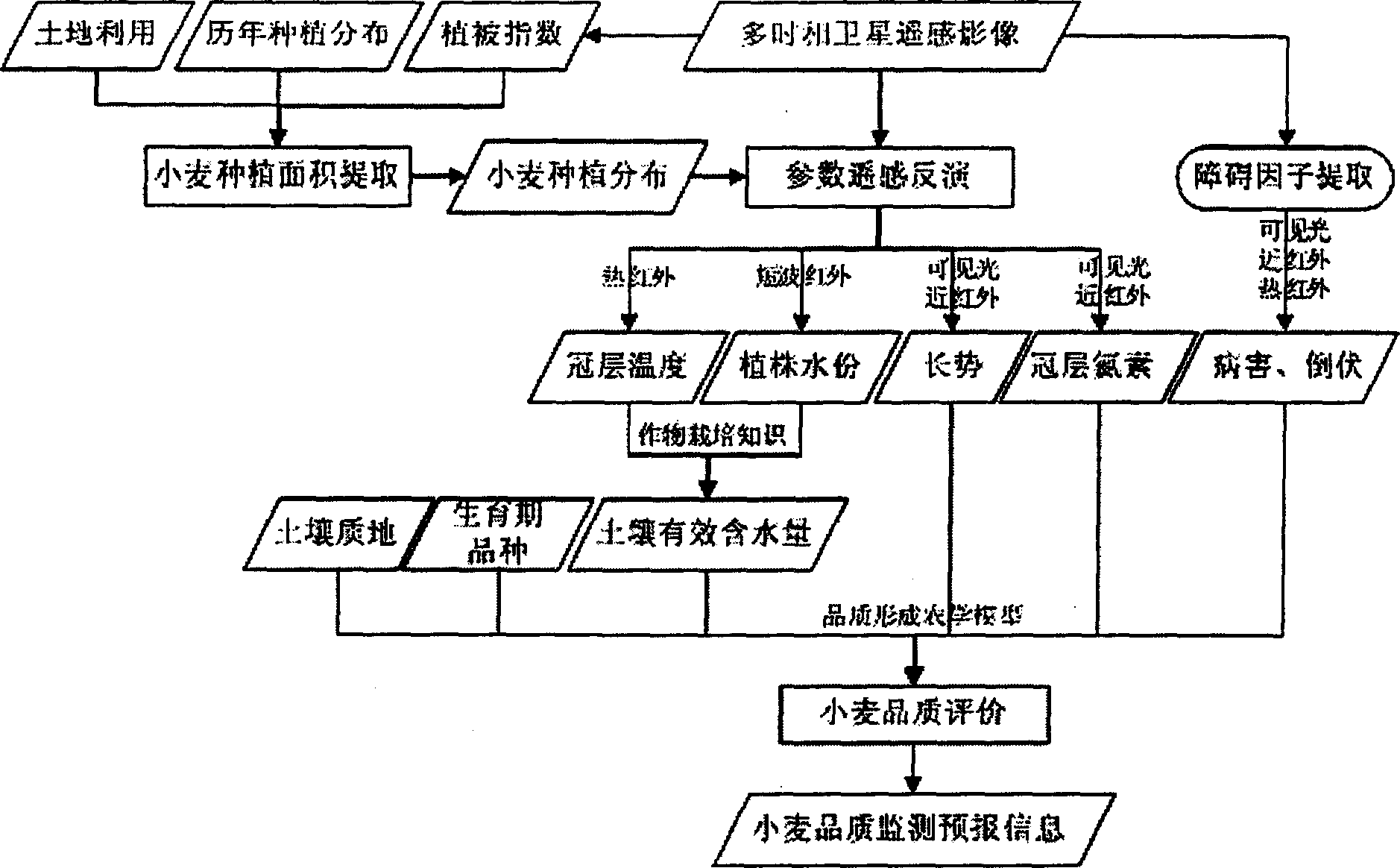
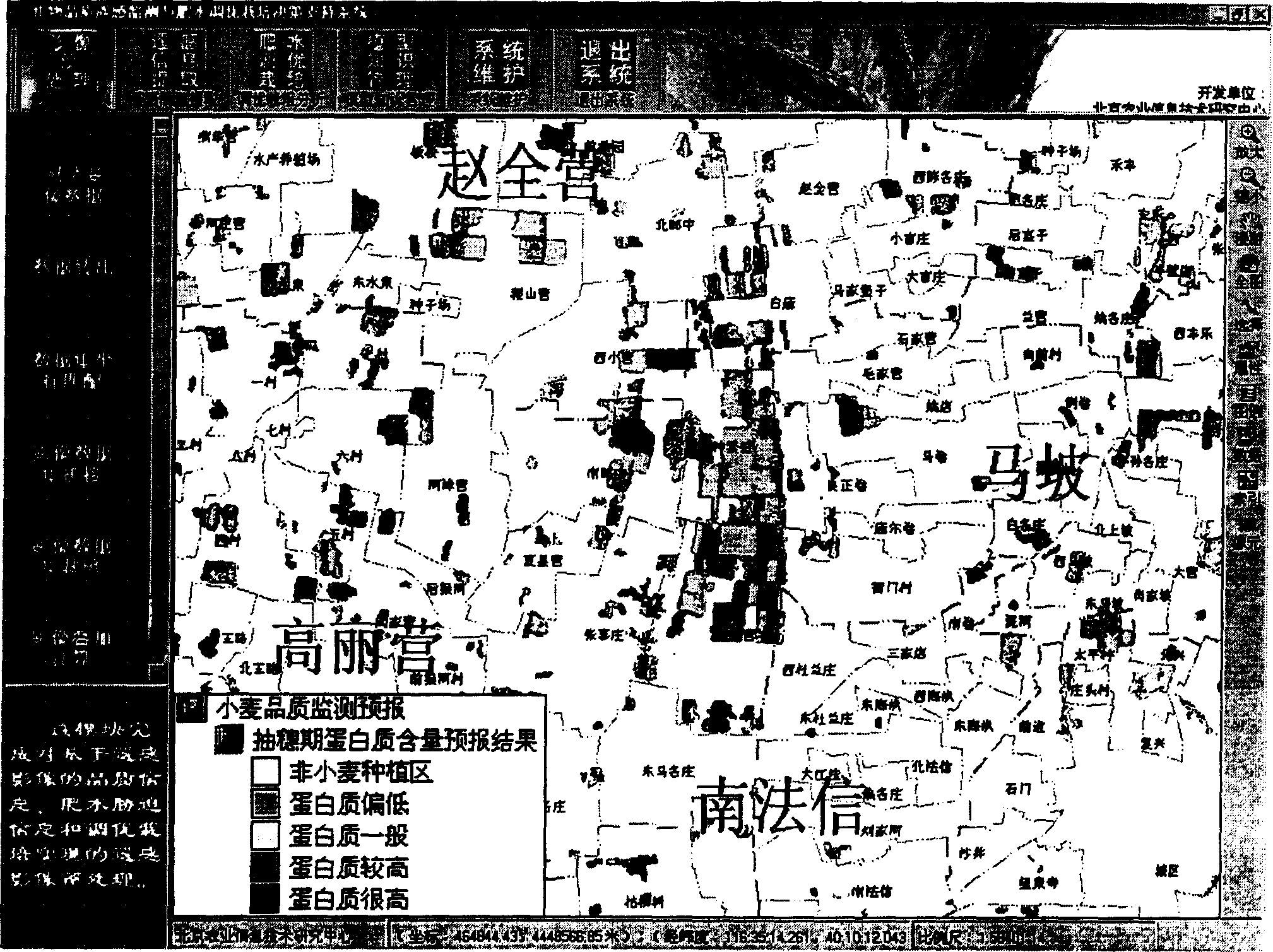
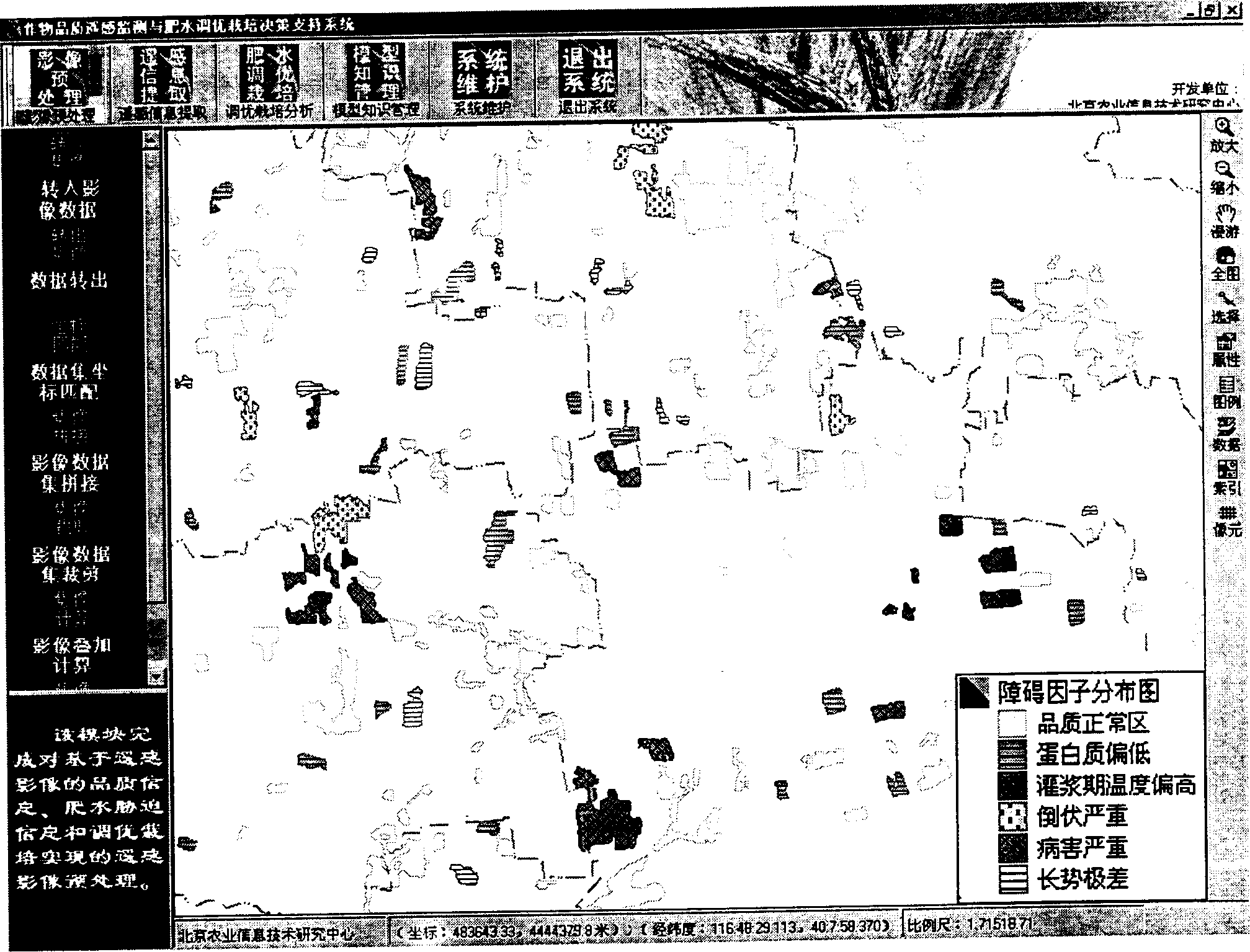
[0024] Now in conjunction with example the present invention is further described, promptly utilizes TM satellite remote sensing image to carry out wheat quality monitoring forecast to Beijing suburb:
[0025] First, three phases of TM remote sensing images were obtained at the heading stage, filling stage and milk maturity stage of winter wheat, and the wheat planting area was extracted by using the normalized difference vegetation index at the heading stage and the filling stage and the past wheat planting area distribution and land use information.
[0026] Secondly, the fifth band of TM (TM5) was used to invert the moisture of wheat plants, the sixth band of TM (TM6) was used to invert the temperature of wheat canopy, and the visible light and near-infrared bands (TM2, TM3, TM4) were used to invert the temperature of wheat plants. Indicators such as the normalized difference vegetation index of growth and biochemical indicators of wheat plants such as the carbon and nitroge...
PUM
 Abstract
Description
Claims
Application Information
 - Generate Ideas
- Intellectual Property
- Life Sciences
- Materials
- Tech Scout
- Unparalleled Data Quality
- Higher Quality Content
- 60% Fewer Hallucinations
Browse by: Latest US Patents, China's latest patents, Technical Efficacy Thesaurus, Application Domain, Technology Topic, Popular Technical Reports.
© 2025 PatSnap. All rights reserved.Legal|Privacy policy|Modern Slavery Act Transparency Statement|Sitemap|About US| Contact US: help@patsnap.com