Method for setting service information and communicty managing based on GIS

A technology for service information and community management, applied in the direction of electrical digital data processing, special data processing applications, instruments, etc., to achieve the effect of reducing data transmission, reducing load, and overcoming a large number of inputs

Inactive Publication Date: 2006-06-14
南京市鼓楼区民政局 +1
View PDF0 Cites 12 Cited by
  • Summary
  • Abstract
  • Description
  • Claims
  • Application Information

AI Technical Summary

Problems solved by technology

Not used for community management and service information establishment

Method used


Image

  • Method for setting service information and communicty managing based on GIS
  • Method for setting service information and communicty managing based on GIS
  • Method for setting service information and communicty managing based on GIS

Examples


Embodiment Construction

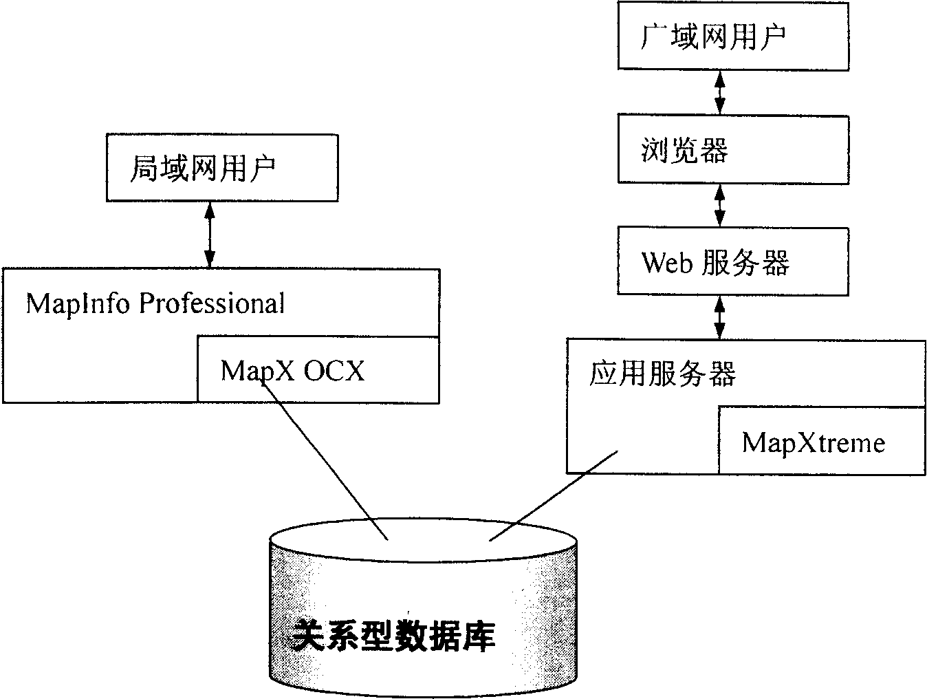
[0052] First bind attribute data to the map, and then create and centralize all data in a SQL server for management and backup based on these data. The middle layer uses technical means such as encrypted connection, user authentication, and secure channel to ensure the connection to the database. safety and reliability.

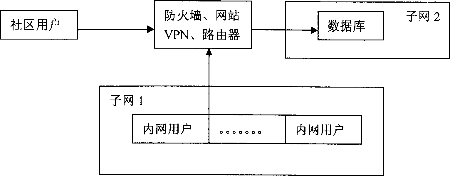
[0053] Once the centralized management of data needs to be realized, we will adopt the following scheme. The database will be completely isolated from the external network and internal network. Once users need to connect to the network to access the community information system, they will use VPN encryption connection technology to connect to the internal network through a router. in the database.

[0054] For the authentication of VPN, we will bind a certificate for each community user to ensure the security of access.

[0055] In terms of database connection, we use encrypted connection to ensure the stability and security of accessing the database.

[00...


PUM


Abstract

The invention is a GIS-based method for establishing community management and service information, firstly binding attribute data to a map, and then based on these data, establishing and collecting all the data in a centralized managing mode into a SQ server for management and backup, where the intermediate layer adopts encrypted link, user attestation, safety channel and other technical means to ensure safety and reliability in database connection. As the centralized management for the database is needed, the database is completely isolated from the extranet and intranet; once a user needs to connect to network to access the community information system, it will use the encrypted link technique of VPN and connect to the intranet database through router. Its character is using module type GIS technique: (1) small and flexible; (2) directly embedding MIS development tool; (3) having strong GIS function.

Description

1. Technical field [0001] The invention relates to a method for GIS-based community management and service information establishment. 2. Background technology [0002] The combination of spatial data and attribute data based on GIS has considerable significance. For example, the two-way query system combines spatial data and attribute data, which can call corresponding spatial data according to attribute data, dynamically display relevant maps, and click on the map. Query, call out the corresponding attribute data, and obtain attribute information. For example, using the advanced MapX5.0 software of the American MapInfo Company as a platform, combined with the geographic information system (electronic map) developed by the Bureau of Land and Resources, it can be linked with basic information such as all residents, household registrations, and individual social organizations in various communities to achieve more Intuitive and more convenient graphic and text integration, mu...

Claims


Application Information

Patent Timeline
Patent Type & Authority Applications(China)
IPC IPC(8): G06F17/30H04L12/28
Inventor 沈剑荣孙在宏张光华郑峰陶家坤后斌吴长彬沈方伟彭英明发斌朱广金蒋玉平
Owner 南京市鼓楼区民政局
Why Eureka
Try Eureka