
Method and apparatus for navigation using instantaneous doppler measurements from satellites

a satellite and instantaneous technology, applied in the field of satellite positioning system processing, can solve the problems of inability to accurately determine the location of the receiver, inconvenient processing, and time-consuming

Inactive Publication Date: 2006-10-12
AVAGO TECH WIRELESS IP SINGAPORE PTE
View PDF15 Cites 20 Cited by
  • Summary
  • Abstract
  • Description
  • Claims
  • Application Information

AI Technical Summary

Problems solved by technology

The process of searching for and acquiring GPS signals, reading the ephemeris data for a multiplicity of the satellites, and computing the location of the receiver from this data is time consuming, often requiring several minutes.
In many cases, this lengthy processing time is unacceptable and, furthermore, greatly limits battery life in miniaturized portable applications.
However, even with prior knowledge of position and three satellites, there are instances where two solutions for position may be found within a region (e.g., the United States) and, as such, the receiver will not be able to uniquely fix its initial position.
In such an environment, conventional GPS receivers may not be able to uniquely determine an initial position.
It is time consuming and often impossible to decode the HOW, particularly with weak signals, or in environments (such as forests, or urban canyons) where the signal is blocked intermittently and frequently enough to prevent a standard GPS receiver from decoding HOW.

Method used


Image

  • Method and apparatus for navigation using instantaneous doppler measurements from satellites
  • Method and apparatus for navigation using instantaneous doppler measurements from satellites
  • Method and apparatus for navigation using instantaneous doppler measurements from satellites

Examples


first embodiment

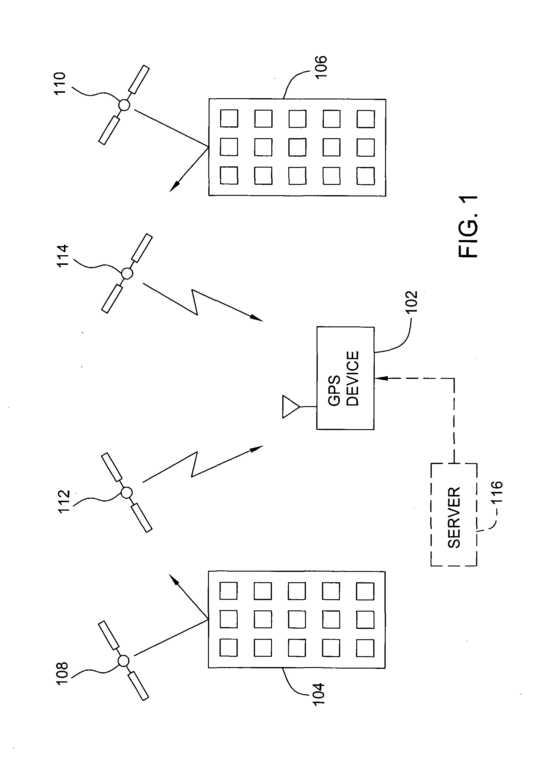
[0040] More specifically, in a first embodiment, a first fix for position of a GPS device is obtained with a single satellite, given a-priori knowledge of the clock and velocity unknowns and a-priori knowledge of approximate position. This embodiment may arise in practice if the GPS device is integrated within a cell-phone and has access to a wireless communication system. At step 302, a pseudorange is measured from the GPS device to one satellite. At step 304, a Doppler measurement is obtained for the signal transmitted by the one satellite. At step 308, an approximate position of the GPS device is obtained, for example, from the location of cell-towers within the wireless communication system. Precise time and frequency may be obtained from the wireless communication system, providing a-priori knowledge of tC, tS, and fc. A-priori knowledge of velocity may be obtained either from an external measurement, or by assuming velocity equals zero (often a good assumption when the GPS dev...

second embodiment

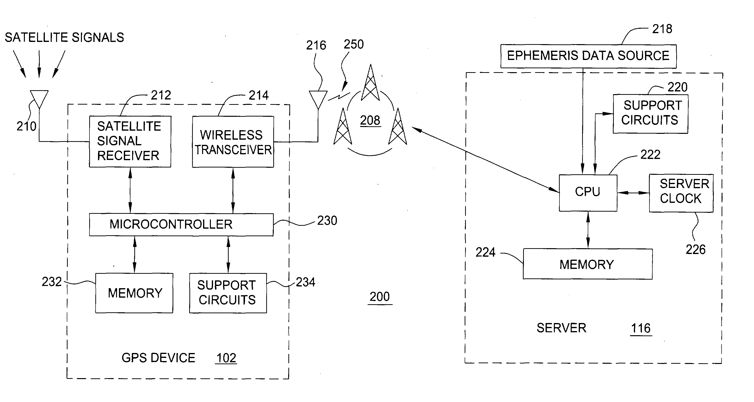
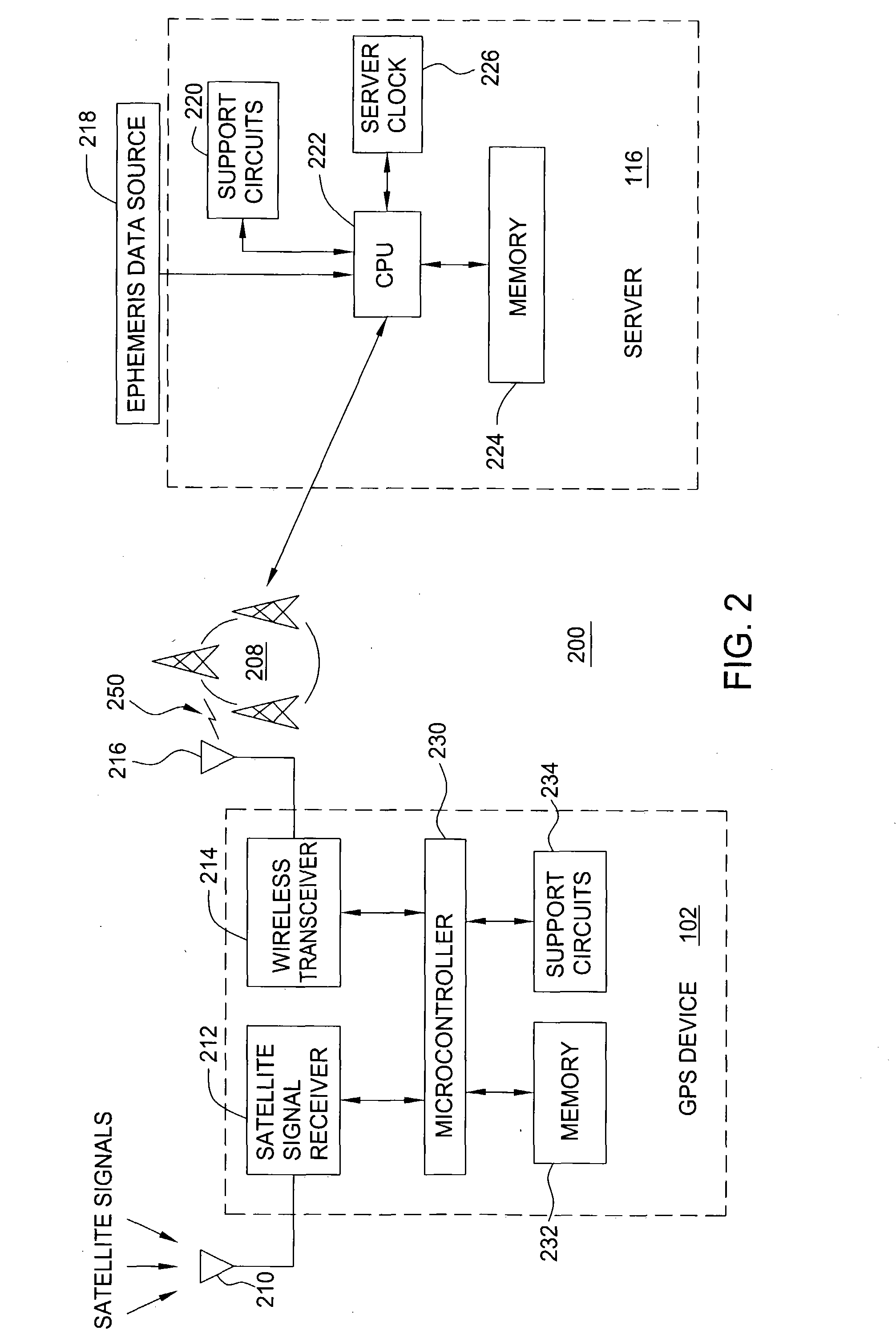
[0046] Returning to FIG. 3, in a second embodiment, a first fix of position is obtained using two satellites, given a-priori knowledge of approximate position, but no a-priori knowledge of the clock unknowns. At steps 302 and 304, pseudoranges and Doppler measurements are obtained from the GPS device to two satellites. At step 308, an approximate position is obtained as described above. The unknown velocity may be obtained either from an external measurement, or by assuming velocity equals zero. At step 310, the position of the GPS device is computed, as described algebraically below.

[0047] The absolute time-tag error (tS) may be obtained either from an external source, such as a wireless communication system if the system is synchronized to GPS time, or by decoding the Handover Word (HOW) from the satellite signals. The altitude parameter (z) may be obtained from the a-priori position information, or by using a terrain model as described above. This leaves four unknowns: x, y, tC a...

third embodiment

[0050] In a third embodiment, a first fix for position is obtained using two satellites, without a-priori knowledge of the clock unknowns and without a-priori knowledge of approximate position. In this embodiment, pseudoranges and Doppler measurements are obtained at step 302 and 304 for two satellites. No a-priori information is obtained at step 308. For example, the GPS device may not be able to receive a-priori information from a wireless communication system and may not have a-priori knowledge of approximate position. Thus, an initial position must be estimated. The estimate of initial position may be based on some knowledge of the general region (example, the country, or continent) in which the GPS device is operating. Then, one iteration of the mathematical model described above will produce a position that is a better estimate than the estimated initial position. This result is then used as a better a-priori position, and the process is repeated (using the same measurements, ...


PUM


Abstract

A method and apparatus for locating position of a satellite signal receiver is described. In one example, a Doppler offset for each of a plurality of satellite signals relative to the satellite signal receiver is determined at a first time. A position of the satellite signal receiver is then computed using the Doppler offset for each of the plurality of satellite signals. In another example, at least one pseudorange between the satellite signal receiver and a respective at least one satellite is determined. At least one Doppler offset for a respective at least one satellite signal relative to the satellite signal receiver is also determined. A position of the satellite signal receiver is computed using the at least one pseudorange and the at least one Doppler offset.

Description

CROSS-REFERENCE TO RELATED APPLICATIONS [0001] This application claims benefit of U.S. provisional patent application Ser. No. 60 / 399,647, filed Jul. 30, 2002, which is herein incorporated by reference.BACKGROUND OF THE INVENTION [0002] 1. Field of the Invention [0003] The present invention relates generally to the field of satellite positioning systems (SPS) and, more particularly, to processing of SPS signals. [0004] 2. Description of the Related Art [0005] Global positioning system (GPS) receivers normally determine their position by computing times of arrival of signals transmitted from a multiplicity of GPS satellites. These satellites transmit as part of their message, both satellite positioning data as well as data regarding clock timing, so-called ephemeris data. The process of searching for and acquiring GPS signals, reading the ephemeris data for a multiplicity of the satellites, and computing the location of the receiver from this data is time consuming, often requiring s...

Claims


Application Information

Patent Timeline
Patent Type & Authority Applications(United States)
IPC IPC(8): G01C21/00G01S19/23G01S1/00G01S5/00G01S5/12G01S5/14G01S19/25G01S19/33G01S19/42
CPCG01S5/0036G01S5/12G01S19/05G01S19/09G01S19/42G01S19/252G01S19/254G01S19/258G01S19/25
Inventor DIGGELEN, FRANK VAN
Owner AVAGO TECH WIRELESS IP SINGAPORE PTE
Learn More