
Wireless subsoil sensor network

a sensor network and subsoil technology, applied in the field of soil sensors, can solve the problems of limited fidelity and economics of models used in production agriculture, and achieve the effect of high fidelity crop and soil modeling

Inactive Publication Date: 2007-02-22
DEERE & CO
View PDF11 Cites 32 Cited by
  • Summary
  • Abstract
  • Description
  • Claims
  • Application Information

AI Technical Summary

Benefits of technology

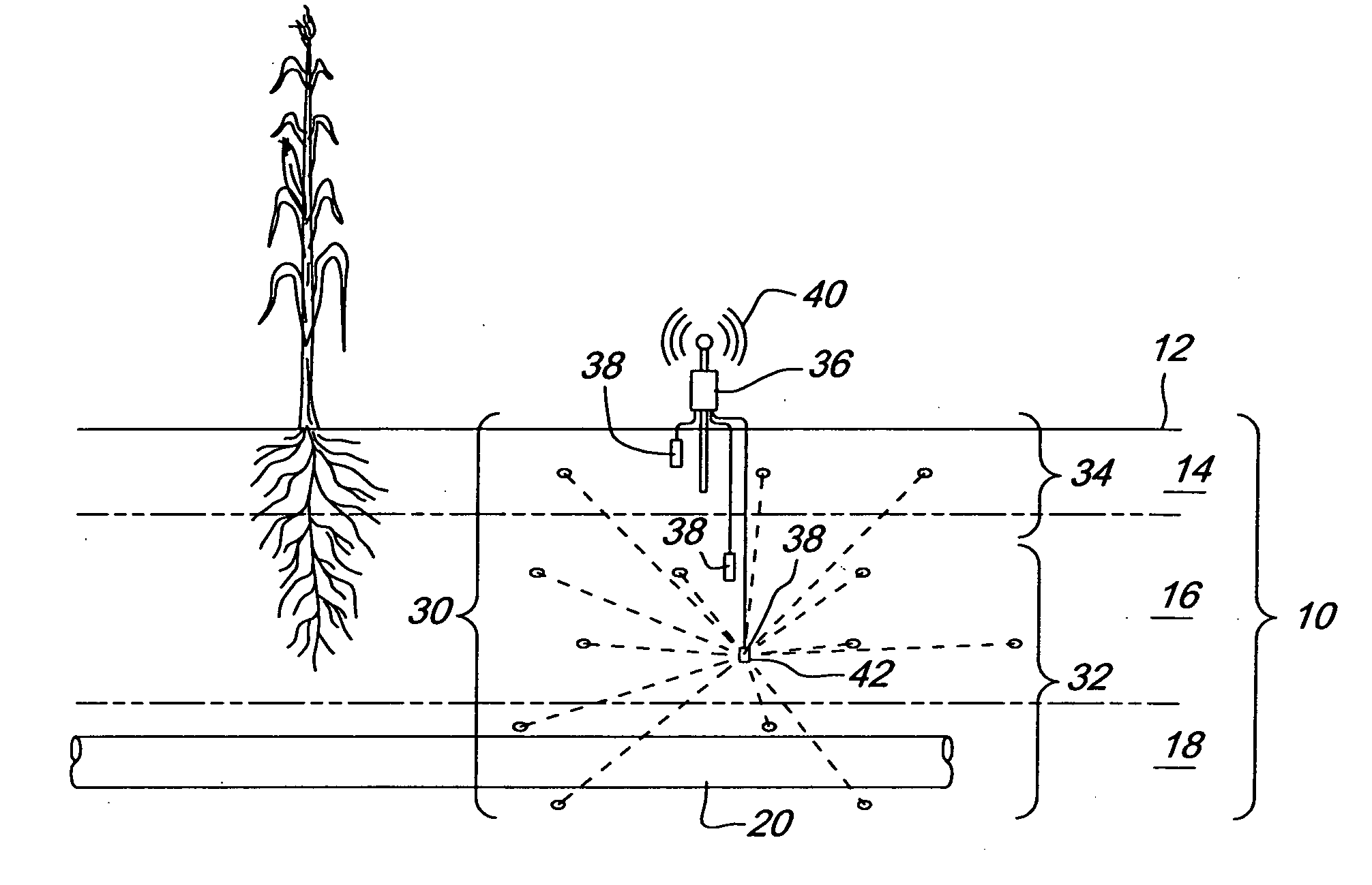
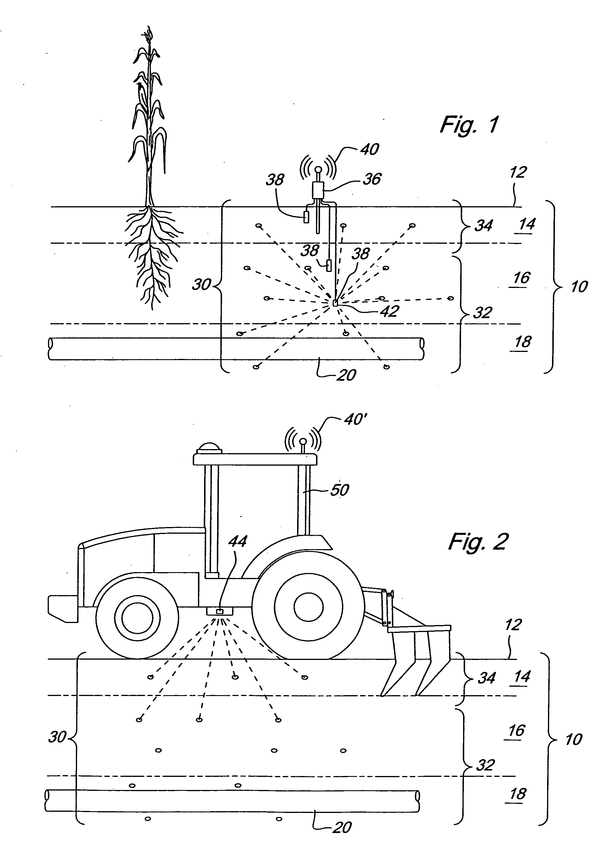
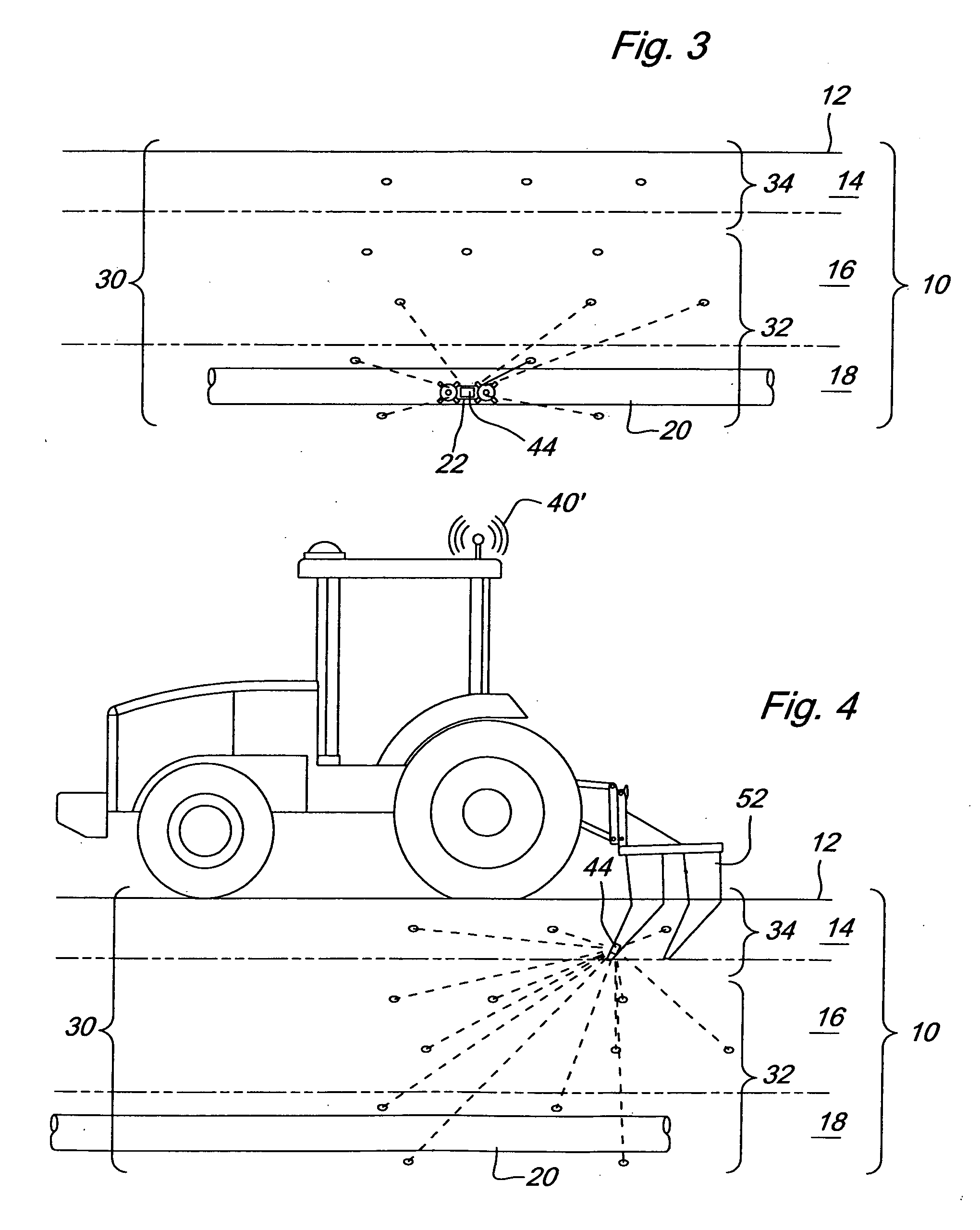
[0005] The present invention described herein is a network of heterogeneous sensors that may economically enable high fidelity crop and soil modeling. For description of this invention, the soil is split into four zones: surface, root zone (tilled), root zone (sub-tilled), and sub-root zone. A first class of long-live

Problems solved by technology

In the past, lack of economical sensing and processing means has limited the fidelity and economics of models for use in production agriculture.

Method used


Image

  • Wireless subsoil sensor network
  • Wireless subsoil sensor network
  • Wireless subsoil sensor network

Examples


Embodiment Construction

[0011] For description of this invention, the soil 10 is split into four zones: surface 12, root zone (tilled) 14, root zone (sub-tilled) 16, and sub-root zone 18. The boundaries of these zones will vary from year to year based on the crop grown and the tillage practice for that year. All four soil zones are critical for modeling soils and crops since mechanical forces, water, and nutrients are applied to them at various points and sometimes change because of the system inputs. Another subsurface factor is drainage tile 20 which may be placed into the lower two zones and is a major factor in what happens to water and nutrients at those levels.

[0012] To be useful for high fidelity modeling, soil data must come from sensors that are localized in space and time, have suitable precision and accuracy of the attributes they measure, and have data which can be collected at suitable temporal and spatial resolution. The sensor network 30 must do these things economically so the data can hav...


PUM


Abstract

A sensor network comprising one or more passive sensors dispersed within a soil at known coordinate locations and depths. A transceiver wirelessly communicates with the passive sensors to receive data indicating a condition within the soil, such as environmental condition or a biological presence. The wireless communication is performed on a radio frequency suitable for transmission through soil. The transceiver may be attached to a vehicle located above or below the surface of the soil, a device engaging the soil, or an active sensor located within the soil.

Description

FIELD OF THE INVENTION [0001] The present invention relates to soil sensors, and more specifically wirelessly communicating subsoil sensor networks. BACKGROUND OF THE INVENTION [0002] Water that falls as rain or is applied through irrigation to a field, and things that dissolve in it such as nitrogen fertilizers, can go to one of five places: evaporate (water) into the atmosphere; taken up and stored in a plant (ignored is any water that might be consumed by an animal from a puddle); stored in the soil; flow off the field or through a tile system to become surface water in a pond, stream, ditch, etc; seep down into a water table. [0003] Accurate modeling of the flow of water from its source to one of the above five fates is essential for crop, soil, and water management that uses models. Also important for high fidelity crop and soil modeling are factors that include, but are not limited to, soil temperature and nutrients. In the past, lack of economical sensing and processing means...

Claims


Application Information

Patent Timeline
IPC IPC(8): A01B63/00
CPCA01B79/005Y10T137/189
Inventor ANDERSON, NOEL WAYNEFAIVRE, STEPHEN MICHAELSTELFORD, MARK WILLIAM
Owner DEERE & CO
Learn More