
Apparatus, systems and methods for seabed data acquisition

a technology apparatus, applied in the field of underwater seabed data acquisition, can solve the problems of compromising the interpretation of time-lapse differences, affecting the accuracy of time-lapse surveys, and the relative slowness of seabed seismic sensor deployment, so as to reduce the errors of time-lapse surveys

Active Publication Date: 2008-06-19
WESTERNGECO LLC
View PDF17 Cites 184 Cited by
  • Summary
  • Abstract
  • Description
  • Claims
  • Application Information

AI Technical Summary

Benefits of technology

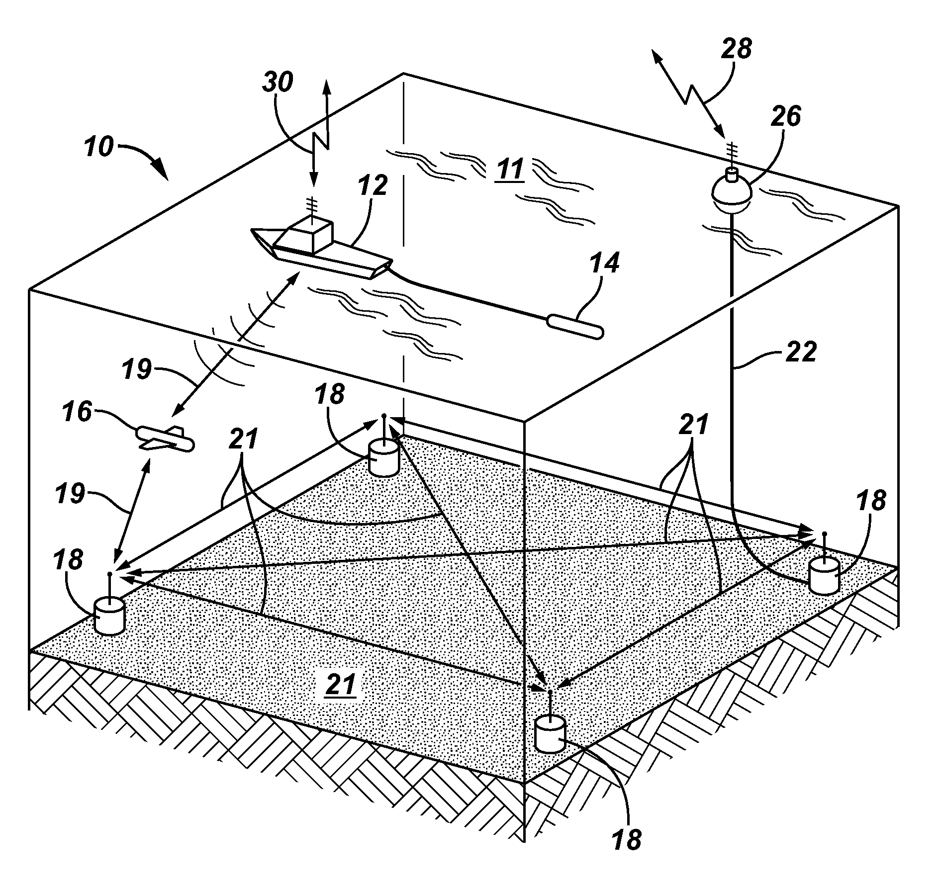
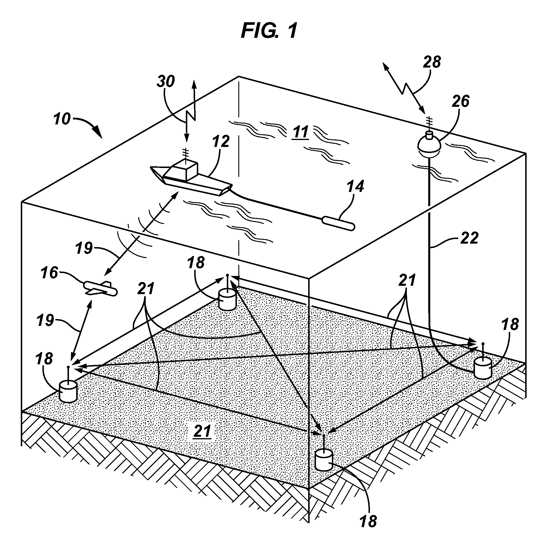
[0018]The inventive sensor units, and systems and methods employing the inventive sensor units, reduce or overcome problems using seabed cables and previously known seabed sensor units, are less expensive, more flexible in terms of data transfer, deployment, and retrieval, and use less power than previously known methods and systems. Apparatus, systems, and methods of the invention allow seabed data transfer to the surface and between sensor units, and may be used to collect marine seismic and / or EM data, for example 3-D and 4-D marine seismic and / or EM data, such as during exploration for sub-sea hydrocarbon-bearing reservoirs, or monitoring existing reservoirs. Electromagnetic signals may be used to transfer data to and / or from the sensor units, to transmit power, and / or to receive instructions to operate the sensor units.
[0041]Systems of the invention may comprise combinations of low-cost inertial navigation systems (on an ROV or AUV) with a homing device on one or more sensor units, greatly reducing errors in time-lapse surveys attributable to (attempted) replacing of seabed sensors in the places they were during a previous survey. Previous to the systems of the present invention, many known operational scenarios employed AUV / ROV's to place recording devices such as seabed sensor units. The navigational guidance available for AUV / ROV's is typically based on a combination of inertial electronics systems and acoustic ranging, either long baseline or short baseline methods. All methods suffer to some extent due to the refraction of the acoustic signal along the propagation path and drift of the inertial sensors. The degree of error resulting from acoustic positioning varies but rarely gives better than 5 meters accuracies in deep water, e.g., 1 km or more. In systems and methods of the invention, knowing the exact positioning of the inventive sensor units, and using the acoustic network for communications, the refraction during propagation effect may be corrected for despite daily and / or seasonal variation in the speed of sound in the water column. Systems of the invention may comprise one or more ROV / AUV's, surface vessels, tethers, and the like, and may coordinate surveys with seabed and / or towed seismic cables.

Problems solved by technology

However, deployment of seabed seismic sensor units is relative slow and units are quite costly, and for these reasons the placement of seismic sensor units on the seabed is usually sparse with several 100m between two sensor units in any direction.
This is mostly due to the problem of repositioning the seabed inventive sensor units in exactly the same location as for the monitor survey and ensuring a consistent coupling of the inventive sensor unit with the seafloor sediment.
Any changes in coupling at a later deployment or changes in position will be manifest in the seismic image and hence compromise the interpretation of the time-lapse differences.
The problem with this solution is that it is very costly, inflexible and in-situ repair of malfunctioning equipment is not possible without compromising the coupling integrity.
In theory, seabed seismic sensor units may also be used for time-lapse seabed seismic monitoring, but since the seismic sensor units, or at least portions thereof containing the data, must be retrieved after every survey, this approach is impractical for short time-lapses (typical 3 months between each survey).
This is not unachievable with today's technology, but the major draw back is that the soil parameters at its place of origin have likely changed since last installation and hence it will be close to impossible to repeat the same coupling of the sensor unit to the seabed as during the last lapse.
This will again introduce artifacts in the time-lapsed seismic image.
However, they suffer from several deficiencies—in particular with respect to power consumption.
This means that their batteries consume a large volume and weight of the sensor unit.
To date, this is only possible by costly permanently deployed seismic cables on the seabed.

Method used


Image

  • Apparatus, systems and methods for seabed data acquisition
  • Apparatus, systems and methods for seabed data acquisition
  • Apparatus, systems and methods for seabed data acquisition

Examples


Embodiment Construction

[0053]In the following description, numerous details are set forth to provide an understanding of the present invention. However, it will be understood by those skilled in the art that the present invention may be practiced without these details and that numerous variations or modifications from the described embodiments may be possible.

[0054]All phrases, derivations, collocations and multiword expressions used herein, in particular in the claims that follow, are expressly not limited to nouns and verbs. It is apparent that meanings are not just expressed by nouns and verbs or single words. Languages use a variety of ways to express content. The existence of inventive concepts and the ways in which these are expressed varies in language-cultures. For example, many lexicalized compounds in Germanic languages are often expressed as adjective-noun combinations, noun-preposition-noun combinations or derivations in Romanic languages. The possibility to include phrases, derivations and co...


PUM


Abstract

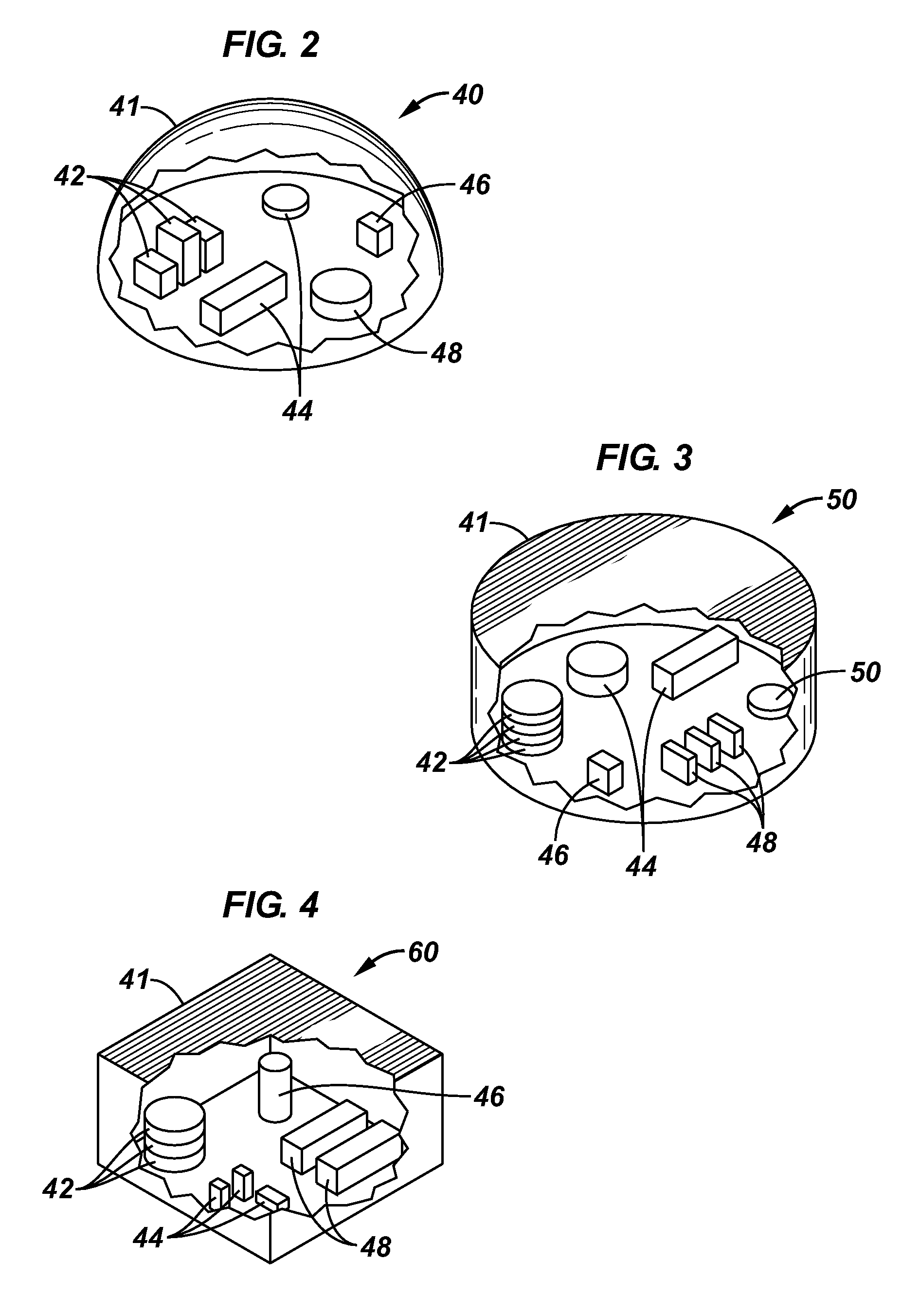
Seabed sensor units, systems including same, and methods for acquiring seabed data are described, one seabed sensor unit comprising a base, the base containing at least one sensor able to detect a seismic signal, electronics comprising a clock and one or more electronic components enabling the sensor to communicate seismic data to one or more memory modules, and a local autonomous power source. This abstract is provided to comply with the rules requiring an abstract, which will allow a searcher or other reader to quickly ascertain the subject matter of the technical disclosure. It is submitted with the understanding that it will not be used to interpret or limit the scope or meaning of the claims. 37 CFR 1.72(b).

Description

BACKGROUND OF THE INVENTION[0001]1. Field of Invention[0002]The present invention relates to the field of marine seabed data acquisition, which may be seismic or electromagnetic data. More specifically, the invention relates to apparatus and systems, and methods of using same for seabed seismic and / or electromagnetic data acquisition using, among other features, one or more autonomous seabed sensor units.[0003]2. Related Art[0004]Seabed seismic acquisition aims to capture the acoustic and elastic energy that has propagated through the subsurface. This energy may be generated by a surface source such as an airgun or airgun array, also known as a source array. The airgun array produces a pressure signal that propagates through the water column into the subsurface. Here acoustic and elastic waves are formed through interaction with the geologic structure in the subsurface. Acoustic waves are characterized by pressure changes and a particle displacement in the direction of which the aco...

Claims


Application Information

Patent Timeline
IPC IPC(8): H04B11/00
CPCG01V1/22G01V1/38H04B11/00G01V2210/1427G01V2200/12G01V3/12
Inventor COMBEE, LEENDERTGOUJON, NICOLASWELKER, KENNETH E.FRIVIK, SVEIN ARNE
Owner WESTERNGECO LLC
Learn More