
Method for Automatically Selecting Radionavigation Beacons

a radionavigation beacon and automatic selection technology, applied in direction finders, instruments, measurement devices, etc., can solve the problems of reducing the availability of the estimation of the 2d terrestrial position of the aircraft, prohibitive size of the initialization period, and modifying the selection pair of beacons, so as to reduce the drawback

Inactive Publication Date: 2008-10-16
THALES SA
View PDF2 Cites 11 Cited by
  • Summary
  • Abstract
  • Description
  • Claims
  • Application Information

AI Technical Summary

Benefits of technology

The invention aims to improve the selection of radionavigation beacons on aircraft by introducing a criterion for selecting a pair of beacons that can provide accurate position estimation over a longer flight duration. The method takes into account the accuracy of position estimation and the capacity of retaining a beacon selection. By using a maximum duration of membership criterion, the method reduces the need for frequent changes of selected beacons and ensures stability of the selection. The invention can lead to a reduction of modifications for selecting the beacon pair and is applicable to various aircraft flight configurations.

Problems solved by technology

But, the duration required in order to choose an optimal configuration comprising a number (greater than or equal to two and not fixed a priori) of beacons from among a number of eligible beacons which may exceed about forty is prohibitive.
However, the selection criterion that the method uses exhibits the drawback, when the selection method is implemented in a repeated manner, of producing a frequent change of one or more selected beacons, for example in the case of the aircraft overflying a terrestrial zone dense with beacons.
Now, a beacon modification requires a duration of initialization, that may be up to five seconds, which is related to a change of carrier frequency of the message emitted by the interrogator and this duration of initialization reduces the availability of the estimation of the 2D terrestrial position of the aircraft.
Additionally, modifying the pair of selected beacons is detrimental to the continuity of the position estimation of the aircraft over time since it disturbs the setting up of processing operations allowing estimation of the biases of the beacons.
But such a reduction in the beacon selection frequency based solely on the accuracy of the position estimation can make it necessary to fix a relatively low accuracy floor value and does not guarantee that the estimation accuracy value will be maintained over time.

Method used


Image

  • Method for Automatically Selecting Radionavigation Beacons
  • Method for Automatically Selecting Radionavigation Beacons
  • Method for Automatically Selecting Radionavigation Beacons

Examples


first embodiment

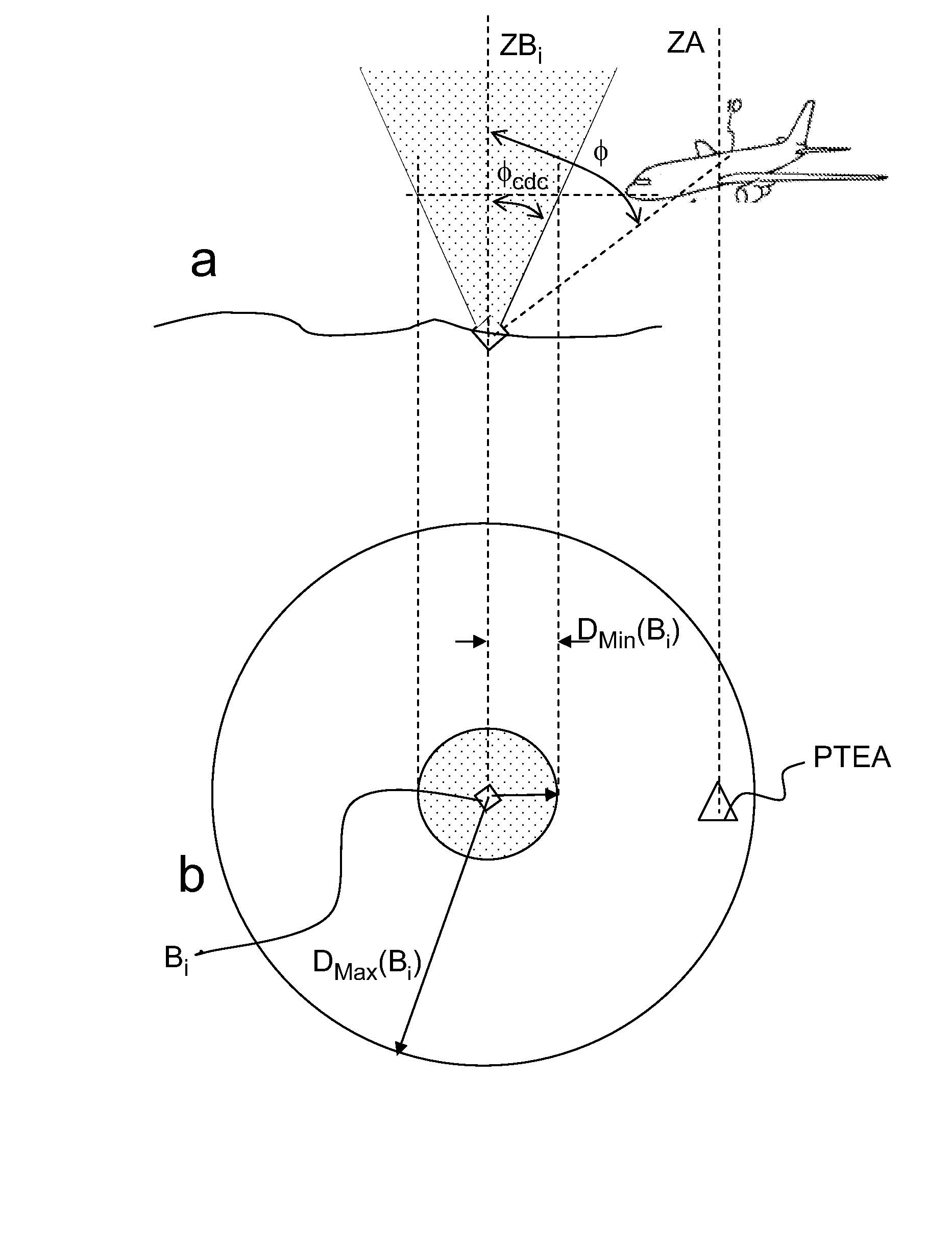
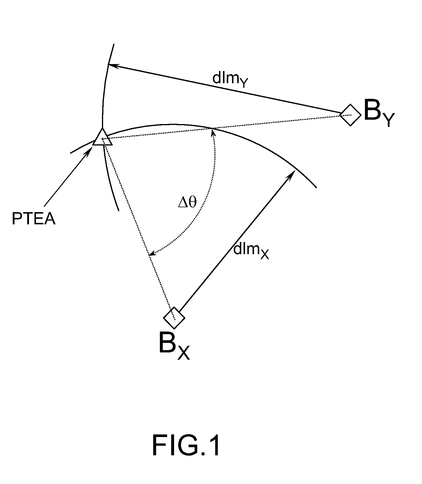
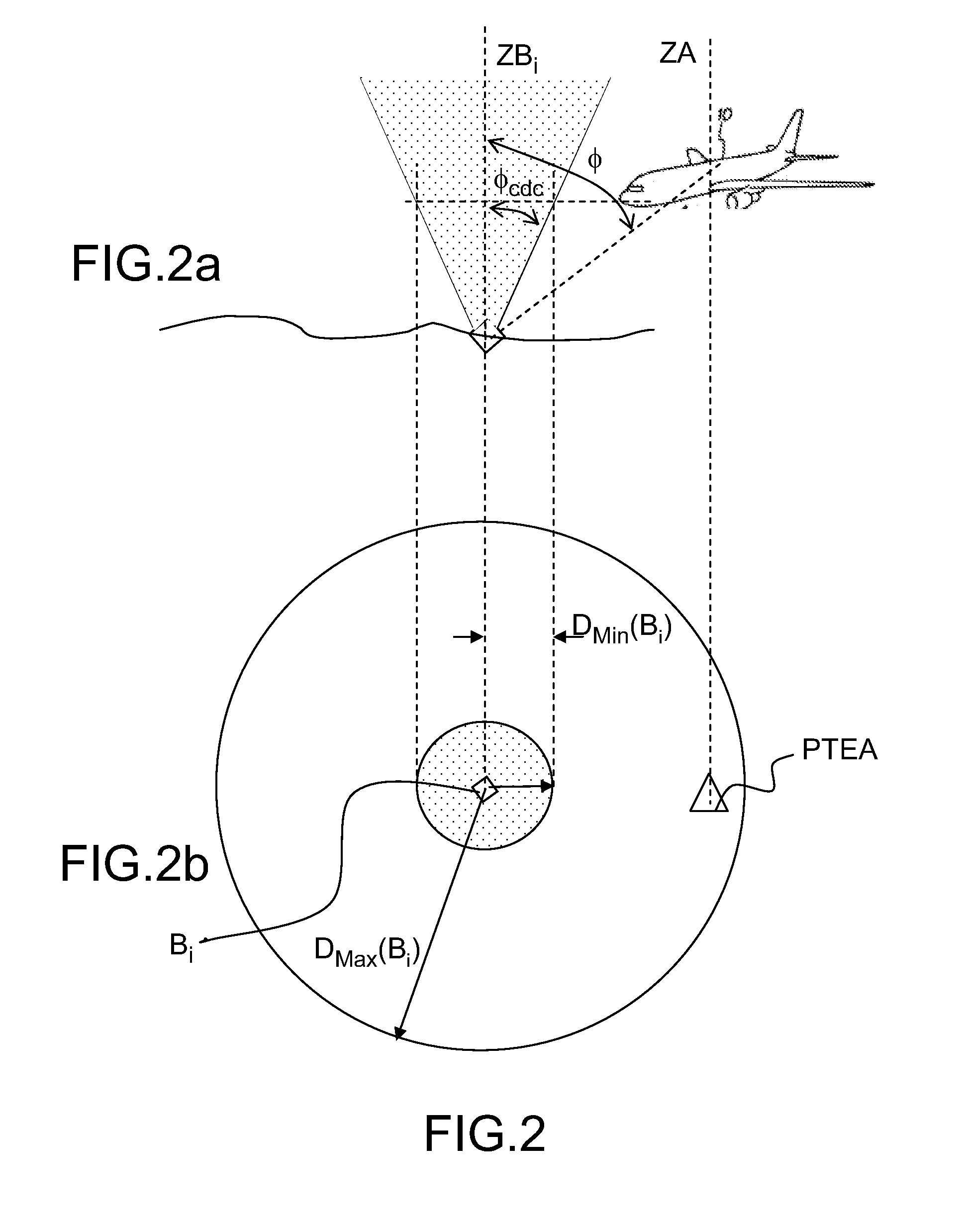
[0035]In the method for selecting beacons, it is possible to consider that the criterion for selecting a pair of beacons can be expressed as selecting a pair of beacons (BX, BY) with a view to maximizing the duration necessary for the aircraft to exit the employment zone ZX,Y(θ, t1), a speed of the aircraft being given. This criterion can also be expressed in distance terms, in this case one seeks to maximize the distance separating the 2D terrestrial position of the aircraft from the boundaries of the employment zone ZX,Y(θ, t1).

[0036]Accordingly, one seeks to express, at an instant t1, DX,Y(θ, t1) the shortest distance separating the 2D terrestrial position of the aircraft A(t1) taken at the instant t1 from the boundaries of the employment zone ZX,Y(θ, t1), θ being fixed. This search is done on the basis of the knowledge of A(t1) and of the 2D terrestrial positions of the beacons stored in the database onboard the aircraft, it is carried out independently of the searches done on t...

second embodiment

[0043]In the method for selecting beacons, the selection of the pair of beacons is carried out on the basis of assumptions on the 2D terrestrial position taken by the aircraft in the instants following t1. This embodiment leads to the evaluation, for each possible employment zone, defined by a pair of beacons from among the eligible beacons and a value of an angle θ, of the duration required for the 2D terrestrial position of the aircraft to exit the zone of employment of the relevant pair of selected beacons. Various assumptions about the predefined trajectory of the aircraft can be envisaged:

[0044]Advantageously, the predefined trajectory consists in prolonging the motion of the aircraft at the instant t1 by a uniform rectilinear motion.

[0045]Advantageously, the predefined trajectory is determined on the basis of data featuring in a flight plan onboard the aircraft.

[0046]The two embodiments of the method make it possible to evaluate, for each pair of beacons, the duration on compl...


PUM


Abstract

The field of the invention is that of navigation systems serving aboard an aircraft, to determine the position of the aircraft on the basis of measurements of distance separating the aircraft from radionavigation beacons delivered by equipment of the DME type (Distance Measuring Equipment). It relates to a method for selecting radionavigation beacons using an onboard navigation system aboard an aircraft from a list of eligible beacons at an instant t2, a position A(t1) taken by the aircraft in a reference frame tied to the Earth at an instant t1 prior to t2 being known, a projection of the position of the aircraft onto the 2D terrestrial globe according to the vertical to the aircraft being dubbed the 2D terrestrial position of the aircraft, the eligible beacons being arranged on the terrestrial surface at known positions which are stored in a database with which the aircraft is equipped, a domain of employment of an eligible beacon Bi defining a set of 2D terrestrial positions of the aircraft corresponding to positions of the aircraft for which a measurement of distance separating the aircraft and the beacon Bi is relevant, an employment zone ZX,Y(θ, t1) of a pair of eligible beacons (BX, BY) being defined by an intersection between the employment domains of the beacons BX and BY and a geometric locus that groups together 2D terrestrial positions of the aircraft for which an angle formed by axes connecting the 2D terrestrial position of the aircraft and the positions of the beacons BX and BY is greater than a predefined value θ, the employment zone ZX,Y(θ, t1) being delimited by a boundary. According to the invention, a step for formulating a criterion for selecting a pair of beacons (BX, By) from among the beacons forming part of the list of eligible beacons, and in that the selection criterion is based on a search for a maximum duration of membership, for instants subsequent to the instant t1, for which the 2D terrestrial position of the aircraft belongs to the zones of employment of all the pairs of beacons achievable from among the eligible beacons, on the basis of a given predictive trajectory of the aircraft.

Description

CROSS-REFERENCE TO RELATED APPLICATIONS[0001]The present Application is based on International Application No. PCT / EP2006 / 067556, filed on Oct. 18, 2006, which in turn corresponds to French Application No. 05 11256, filed on Nov. 4, 2005, and priority is hereby claimed under 35 USC §119 based on these applications. Each of these applications are hereby incorporated by reference in their entirety into the present application.FIELD OF THE INVENTION[0002]The field of the invention is that of navigation systems serving aboard an aircraft, to determine the position of the aircraft on the basis of measurements of distance separating the aircraft from radionavigation beacons delivered by equipment of the DME type (English acronym for Distance Measuring Equipment). It relates more particularly to a method of selecting a pair of radionavigation beacons from among a list of eligible beacons that is implemented in such a navigation system.DISCUSSION OF THE BACKGROUND[0003]It is recalled that d...

Claims


Application Information

Patent Timeline
Patent Type & Authority Applications(United States)
IPC IPC(8): G01S13/08G01S13/78
CPCG01S13/785
Inventor JACOTOT, GREGOIRE
Owner THALES SA
Learn More