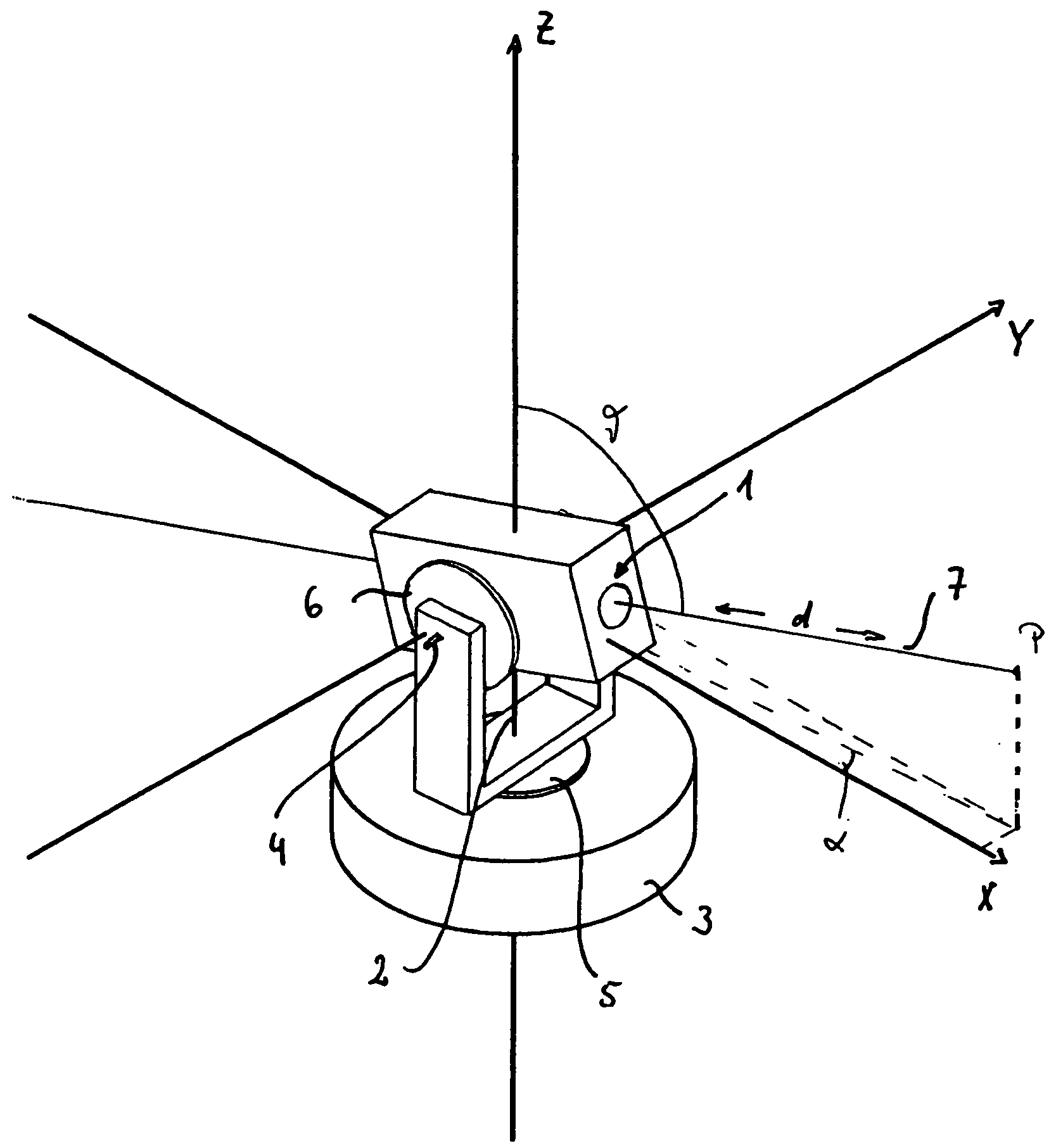
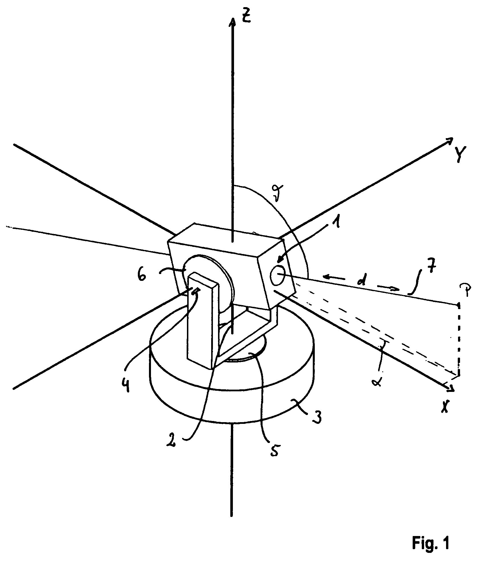
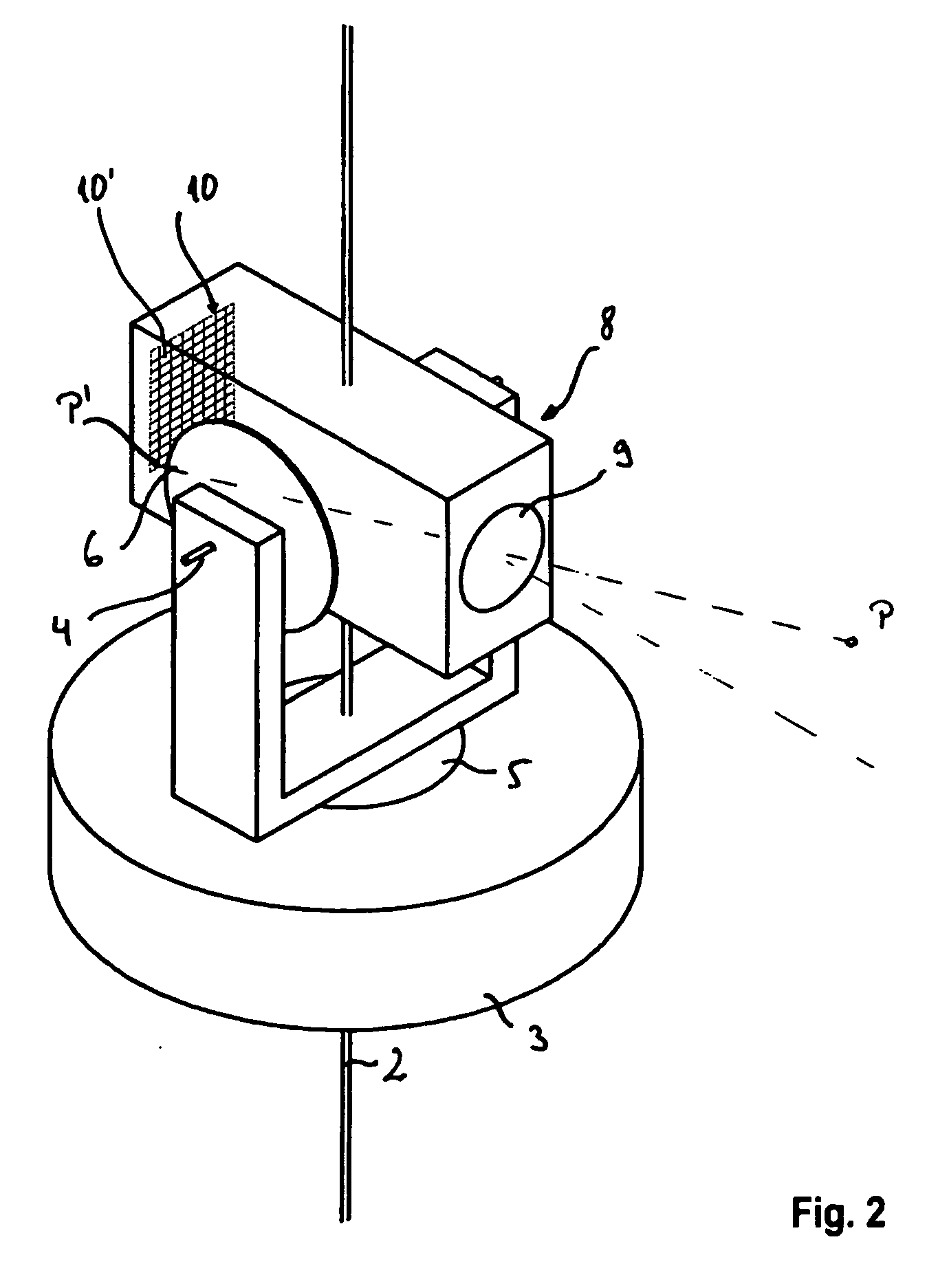
Surveying Instrument and Method of Providing Survey Data of a Target Region Using a Surveying Instrument

Active Publication Date: 2009-05-28
TRIMBLE JENA
View PDF28 Cites 128 Cited by
  • Summary
  • Abstract
  • Description
  • Claims
  • Application Information

AI Technical Summary

Benefits of technology

[0110]Generally, in the target region there may be moving objects that may disturb the surveying operation. Thus, in the method the step of acquiring the pixel data may comprise: acquiring preliminary pixel data corresponding to the same target region at subsequent times and calculating the pixel data from the preliminary pixel data corresponding to an identical target point at different times by averaging. In the processing unit and/or in the computer program the instructions may include a set of instructions such that the processor is responsive to the set of instructions to acquire preliminary pixel data corresponding to the same target region at subsequent times and calculate the pixel data from the preliminary pixel data corresponding to an identical target point at different times by averaging. The repeated capturing of images of the same scene and the averaging has the advantage that moving objects can be eliminated at least approximately from the image or the partial images without the use of sophisticated image processing algorithms for finding moving objects. Further, a higher precision of the pixel data used for transforming can be obtained.
[0111]Generally, the projected image data can be obtained by direct projection of the pixels of the two-dimensional image captured by the detector array to the projection surface. However, in the method the projected image may be represented by an arrangement of projected image pixels, each of the projected image pixels having associated visual data, and the step of transforming the pixel data may include: determining visual data for at least one projected image pixel from the visual information in the pixel data of at least one pixel of the set of pixels the at least on pixel having a location which is closest to the location of the projected image pixel of the image reversely projected to an image surface defined by the locations of the detector elements or the pixels of the image. In the processing unit and/or in the computer program the projected image may be represented by an arrangement of projected image pixels, each of the projected image pixels having associated visual data, and for transforming the pixel data the instructions may include a set of instructions to visual data for at least one projected image pixel from the visual information in the pixel data of at least one pixel of the set of pixels the at least on pixel having a location which is closest to the location of the projected image pixel of the image reversely projected to an image surface defined by the locations of the detector elements or the pixels of the image. This kind of projection corresponds to an indirect or reverse projection. Starting from given projected image pixel locations in the projected image a corresponding position is determined in the image plane, i.e. the plane of the detector array, the plane used for defining the pixels of the captured image or the camera model, which would be directly projected to the projected image pixel location on the projection surface. Using this indirect or reverse projection has the advantage that the determination of the visual data or visual information such as color and/or brightness and/or grayscale information, is faster than in a direct projection. Preferably, for the at least one projected image pixel the visual information is determined by determining a corresponding position in the image captured by the detector array and calculating the visual information by interpolation between the visual data of neighboring pixels. Preferably, bilinear interpolation

Problems solved by technology

Thus, surveying of a target region, in particular of give

Method used


Image

  • Surveying Instrument and Method of Providing Survey Data of a Target Region Using a Surveying Instrument
  • Surveying Instrument and Method of Providing Survey Data of a Target Region Using a Surveying Instrument
  • Surveying Instrument and Method of Providing Survey Data of a Target Region Using a Surveying Instrument

Examples


Example

[0159]A video-tacheometer 11 according to a first embodiment of the invention is shown in FIGS. 3 to 5 in a schematic and simplified manner.

[0160]An alidade 12 is arranged on a base element 13 of a tripod 14 serving as stand for the video-tacheometer 11. The alidade 12 is rotatable about a vertical axis 15, which is oriented vertical to the ground if the video-tacheometer 11 is correctly oriented with respect to ground. The alidade 12 carries a telescope unit 16, which comprises in a housing 17, a finder camera 18 having a wide field of view and a telecamera 19. The telescope unit 16 is rotatable about a tilting axis 20, which is orthogonal to the vertical axis 15 up to a tilting axis error. Thus, the tilting axis 20 rotates with rotation of one of the cameras 18 and 19 about the vertical axis 15. A control panel 21 is removably mounted to the alidade 12. The alidade 12 may be handled by means of a handle 86.

[0161]Rotation and tilting drives 22 and 23, respectively, are provided for...


PUM


Abstract

A surveying instrument (11) comprises a telescope unit having imaging optics and an array of optical detector elements, orientation sensors detecting an orientation of the telescope unit, rotation drives for rotating the telescope unit about a horizontal and a vertical axis, a controllable distance-measuring unit, and a processing unit. The processing unit comprises a memory storing instructions and calibration data for relating the location of each optical detector element to a sighting direction and a processor for: obtaining target region data; obtaining projection surface data (133) representing a projection surface (135), acquiring a set of pixel data representing a two-dimensional image of a target region, transforming the set of pixel data to a set of projected image data representing a projection of the image to the projection surface using the calibration data, and storing the projected image data as surveying data.

Description

[0001]This application claims the benefit of U.S. Provisional Patent Application No. 60 / 716,338, filed on Sep. 12, 2005, the entire contents of which are incorporated herein by reference.BACKGROUND OF THE INVENTION[0002]1. Field of the Invention[0003]The present invention relates to a method of providing survey data using a surveying instrument, means for performing the method and a corresponding surveying instrument.[0004]2. Brief Description of the Related Art[0005]Surveying often includes determination of angles or of positions of points, e.g. reflectors (triple reflectors) or targets in the terrain. Those angles or positions may be measured by surveying instruments such as theodolites or tacheometers.[0006]Positions in space can be defined by coordinates in a suitable coordinate system. For example, the position of a point may be defined by its Cartesian coordinates which are defined with respect to a Cartesian coordinate system having three axes which are orthogonal to each oth...

Claims


Application Information

Patent Timeline
IPC IPC(8): G01B21/16G01C3/08G02B23/00G06F15/00G01S17/89G06V10/24
CPCG01C15/00G01S5/163G06T3/4038G06K9/32G06T3/0062G01S17/89G06V10/24
Inventor KLUDAS, TORSTENSCHUNEMANN, AXELVOGEL, MICHAEL
Owner TRIMBLE JENA
Why Eureka
Try Eureka