

Local positioning systems and methods
a positioning system and nanoloc technology, applied in the field of local positioning systems and methods, can solve the problems of affecting the ranging accuracy, the accuracy of any local positioning system, and the error of a position sample within a positioning system employing the nanolocTM chip may be much greater than 1 or 2 meters
- Summary
- Abstract
- Description
- Claims
- Application Information
AI Technical Summary
Benefits of technology
Problems solved by technology
Method used
Image

Examples
Embodiment Construction
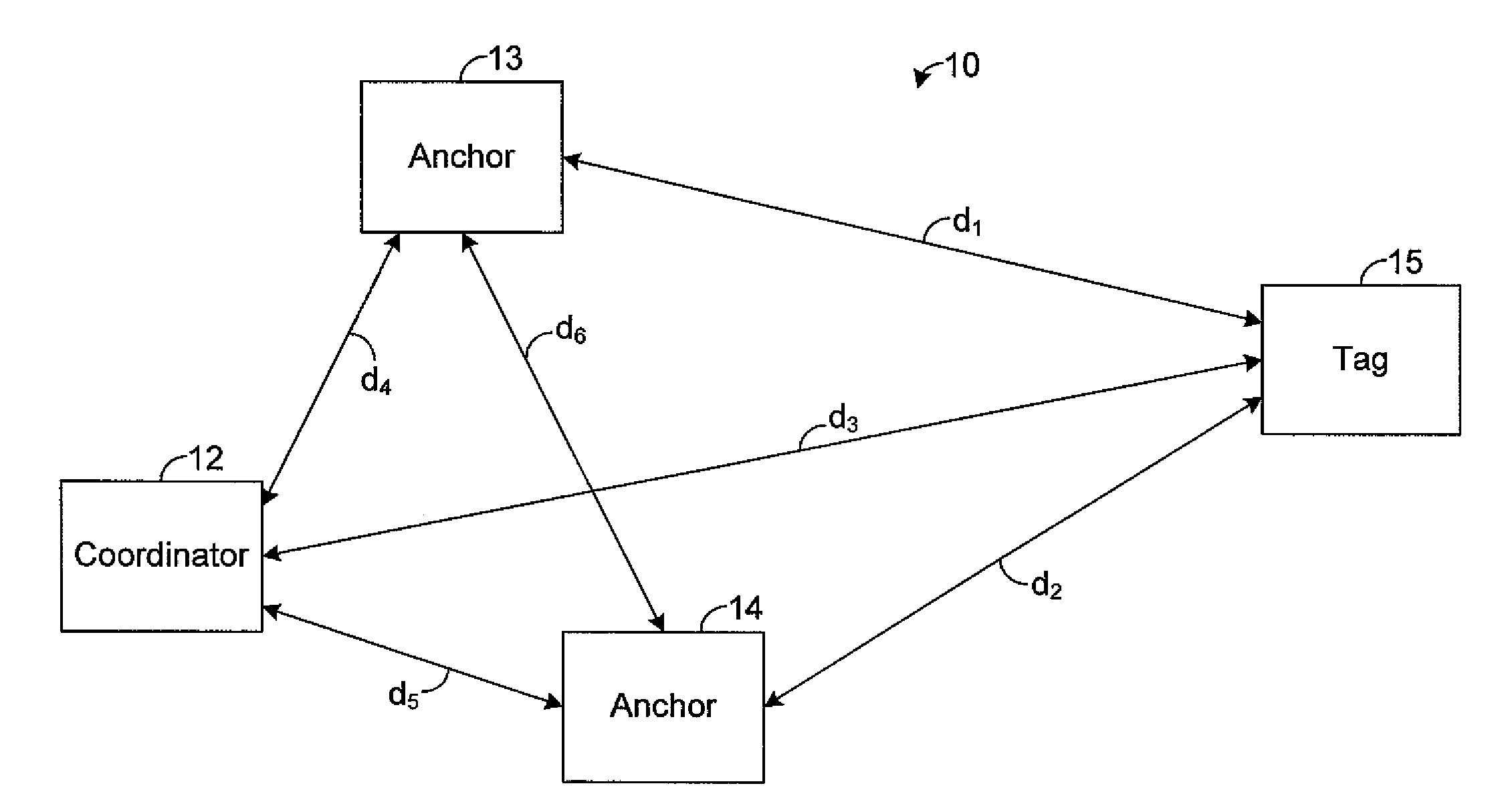
[0015]The present disclosure generally pertains to local positioning systems and methods for tracking objects and personnel. FIG. 1 depicts a local positioning system 10 in accordance with an exemplary embodiment of the present disclosure. The system 10 has a plurality of nodes 12-15. In one exemplary embodiment, as shown by FIG. 1, the system 10 has four nodes 12-15, but other numbers of nodes 12-15 are possible in other embodiments.
[0016]One of the nodes 12 is referred to herein as the “coordinator,” and two of the nodes 13, 14 are referred to herein as “anchors.” In one exemplary embodiment, the nodes 12-14 are stationary with respect to each other. For example, each of the nodes 12-14 may be mounted in the same building or vehicle. However, it is possible for the nodes 12-14 to move relative to each other provided that the relative positions of the nodes 12-14 can be determined.
[0017]One of the nodes 15 is referred to herein as the “tag.” The tag 15 is coupled to an object or pe...
PUM
 Abstract
Description
Claims
Application Information